Guided Tour of Monte Rosa in a small group
In summary
-
Sports
-
Duration6 days
-
LevelExpert
-
DestinationMonte Rosa Massif - France / Valais
-
AgeFrom 16 - 90 years
-
CO₂-Emissions34.26 kg CO2
-
Type of stayIn a group
-
Languages
 French
In a few words
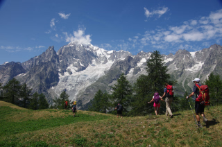
Embark on an iconic hike around Monte Rosa , in the heart of the majestic Italian and Swiss Alps , for an unforgettable journey .
From the picturesque alpine village of Saas-Fee , we proceed clockwise , crossing Switzerland and then Italy , before returning to our starting point. This lesser-known route around Monte Rosa follows the alpine heights as closely as possible, approaching imposing peaks , crossing airy passes , traversing snowfields and even glaciers .
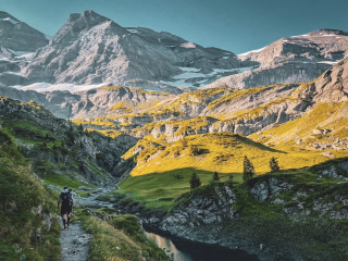
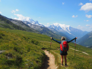
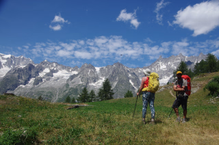
Throughout the hike, enjoy breathtaking views of the great peaks of the Alps : the Dom (4,545 m) , the Weisshorn (4,596 m) , and the Matterhorn (4,478 m) —panoramas that will remain unforgettable . This unspoiled and wild region is a true alpine paradise , with its steep, forested valleys , lush green meadows , and crown of snow-capped peaks .
We take good hiking trails throughout the circuit and enjoy comfortable accommodation in mountain huts or hotels , with the added bonus of a night in the famous alpine town of Zermatt .
The highlights
-
An iconic hike around Monte Rosa, an unsung gem of the Alps
-
Crossing picturesque Alpine villages between Switzerland and Italy
-
Crossing high mountain passes and walking on glaciers
Photos


Sport
Level
Hiking / Trekking
In figures
Trekking
- Average duration/day: 7h30
- Average daily elevation gain: 1117 m
- Average daily descent: 1139 m
- Maximum altitude: 2853 m
Management
French
This trip is led by a mountain guide who will provide you with the technical information necessary for a successful stay. They may need to modify the program to ensure safety based on mountain weather conditions or the physical condition of the participants.
He was chosen for his field experience, his specific knowledge of a geographical area and its associated culture, as well as for his passion for showcasing his region.
Program
-
Stalden Saas - Macugnaga
- Transportation Bus - 01h - 30km
- Activity Trekking
- Duration of the activity 7h30
- Positive elevation gain 730 m
- Negative elevation 1600 m
- Maximum altitude 2853 m
- Accommodation Refuge
- Breakfast not included
- Lunch included
- Dinner included
Meet at Stalden Saas train station. A short bus transfer takes us to the start of the hike, which begins around Lake Mattmark and then ascends to the Monte Moro pass on the Italian border. Upon reaching the pass, we are rewarded with a breathtaking view of Monte Rosa. After passing the Rifugio Citta di Malante, a steep descent, followed by a path through the forest, leads us to the village of Macugnaga and your accommodation for the night (the descent can be avoided by taking the cable car).Day 1 -
Macugnaga - Alagna Valesia
- Activity Trekking
- Duration of the activity 8h30
- Positive elevation gain 1500 m
- Negative elevation 1325 m
- Accommodation Refuge
- Breakfast included
- Lunch included
- Dinner included
The ascent to the Turlo Pass (2738 m) via the Quaraxxa Valley begins with a climb alongside a stream through granite rocks and then across glacial boulders and slabs. Finally, Monte Rosa gradually disappears, giving way to the Weissmies massif. From the pass, it's a long descent to the Rifugio Pastore, where we spend the night.Day 2 -
Alagna Valesia - Gressoney Valley
- Transportation Bus - 00h20 - 10km
- Activity Trekking
- Duration of the activity 8h
- Positive elevation gain 1800 m
- Negative elevation 605 m
- Breakfast included
- Lunch included
- Dinner included
Our day begins with a short shuttle transfer from Rifugio Pastore to Alagna. From there, we start our ascent through the charming hamlets and farming communities of the Otro Valley. Continuing our climb, we reach the first pass, the Passo Foric, which rises to 2,432 meters. Our route then takes us to the day's high point, the impressive Col d'Olen, which soars to an impressive 2,881 meters. After this exhilarating feat, we begin a relatively short descent to our overnight accommodation, the comfortable Rifugio Gabiet.Day 3 -
Gressoney Valley - Ayas Valley
- Activity Trekking
- Duration of the activity 7h
- Positive elevation gain 970 m
- Negative elevation 1200 m
- Accommodation Refuge
- Breakfast included
- Lunch included
- Dinner included
After yesterday's steep climb, we begin today's hike at a gentle pace. We set off on a pleasant trail that winds through lush forests and picturesque meadows, gradually leading us to the charming village of Gressoney Stafal. After a refreshing break, we begin the day's ascent, following a zigzag path that takes us to the Passo de Rothorn at 2,689 meters. Descending from this pass, we traverse a rocky landscape, marked by clear signs, before crossing peaceful alpine meadows. Our route includes another short climb over a wide pass, which finally leads us to the charming hamlet of Resy, perched above the Ayas Valley. Here, we find refuge for the night in a place full of charm and character.Day 4 -
Ayas Valley - Monte Rosa Glacier
- Activity Trekking
- Duration of the activity 7h30
- Positive elevation gain 1550 m
- Negative elevation 300 m
- Accommodation Refuge
- Breakfast included
- Lunch included
- Dinner included
As we trek towards the Teodulo refuge through the picturesque Orotx Valley, crossing the Cima Biancha pass at an altitude of 2,982 meters and passing several hidden lakes, the majestic pyramid of the Matterhorn takes center stage in this magnificent mountain setting. Upon arriving at this high-altitude refuge, perched precariously on a rocky outcrop amidst glaciers, we can look forward to an unforgettable night filled with breathtaking views and experiences.Day 5 -
Monte Rosa Glacier - Zermatt
- Activity Trekking
- Duration of the activity 6h
- Positive elevation gain 150 m
- Negative elevation 1800 m
- Breakfast included
- Lunch included
- Dinner not included
You cross the Teodulo Pass at 3,317 meters above sea level, where the landscape is blanketed in eternal snow. The views are breathtaking, with the Matterhorn once again taking center stage, complemented by the Alphubel, Dom, Obergabelhorn, Zinalrothorn, and Weisshorn, all on either side of the Mattertal valley. This part of the journey presents no technical challenges. The descent then continues by cable car to Schwarzsee, situated at 2,583 meters above sea level. Here, we leave the ice behind and traverse a glacial moraine towards the picturesque town of Zermatt. The excursion concludes in Zermatt.Day 6
Note
The program and walking times are given as a guide only and may vary depending on several factors (weather conditions, terrain, etc.). We may have to modify the itinerary due to organizational reasons (overbooked accommodations, splitting of groups, changes in terrain conditions, etc.), or at the guide's discretion (weather, group level, etc.).
These changes are always made in your best interest, for your safety and comfort. Transfer times may also vary depending on road conditions and traffic.
Accommodation
Access
Go to the starting point
Price details
The price includes
- Supervision by a state-certified mountain leader and a high-mountain guide on the crossing of the Téodule glacier
- Accommodation in a mountain refuge from day 1 to day 5
- Breakfasts from Day 2 to Day 6
- Lunch picnics from day 1 to day 6. Dinners from day 1 to day 5.
- The bus transfers and ski lifts included in the program
The price does not include
- Transportation to the meeting point and from the point of departure
- The possibility of paid showers in the mountain huts
- Anything not listed under the heading “Price includes”
- The transfer of the J6 between Zermatt and Saint Niklaus
- Entrance fees to sites, monuments, and museums
- Drinks
- Tips.
Options
- Flex fare and insurance
Practical information
Specific formalities
Specifics
Before your departure, check with the embassy or consulate regarding the entry and stay requirements for your destination country. You can also find this information on the France Diplomatie website ( https://www.diplomatie.gouv.fr/fr/dossiers-pays/ ).
In the case of flights with stopovers operated by different airlines, also check the entry requirements of the countries you are transiting through.
It is your responsibility to ensure you are in compliance, particularly regarding the validity of your identity documents (for example, some countries require your passport to be valid for at least six months after your return) , visa requirements, necessary vaccinations, and health recommendations. And don't forget to consider any customs restrictions and other potential requirements of your destination or transit country.
ℹ️ Information may change up to the departure date, remember to regularly check official websites.
Equipment
Equipment to bring
- For sleeping in mountain huts or guesthouses: a sleeping bag liner; blankets are provided in the huts and guesthouses.
- A small flashlight (with spare batteries)
- Telescopic walking poles (recommended)
- A 2L water bottle or CamelBak
- An Opinel-type pocket knife
- An individual plastic Tupperware container for lunch salads + cutlery and cup.
- Sunscreen cream (skin and lips) + after-sun
- Toilet paper + lighter (to burn it).
- Optional: camera, binoculars...
Clothing to bring
- A cap or a hat
- A pair of sunglasses
- A hat or a headband
- T-shirt (carline or merino type, quick-drying material)
- A warm shirt or a thin fleece
- A warm jacket (fleece type)
- A windproof jacket (like a K-Way or Gore-Tex)
- A closed rain cape with sleeves, without snaps, made of polyamide
- Lightweight canvas trousers
- Windproof trousers (like Kway or Gore-Tex)
- Shorts or capri pants
- Socks (100% wool: warm, absorbs and wicks away moisture, prevents foot overheating; synthetic fibers: very good resistance, absorbs and wicks away moisture, but be careful if 100% synthetic as it can cause foot overheating; cotton: absorbs moisture but doesn't wick it away well)
- Trekking boots compatible with crampons: they must possess three qualities: sturdiness, good foot and ankle support (high-top boots), and waterproofing. Choose boots with non-slip soles, cleats, and a relatively rigid structure. They must provide good traction on the terrain. Vibram soles have a long-standing reputation; opt for them if you have the choice.
- Mountaineering crampons that fit these boots (you will be crossing a glacier on the last day, and having these crampons in your backpack is essential). We recommend renting crampons if you don't have them and won't be using them later.
- A pair of long gaiters
- A pair of warm gloves
- Spare underwear
- A pair of lightweight canvas trousers and a spare pair of shorts
- Spare socks
- A pair of lightweight sandals for the refuge or a pair of sneakers
- A toiletry bag (earplugs recommended)
- A quick-drying bath towel