Tour of Mont Blanc at your own pace - in 6 days
In summary
-
Sports
-
Duration6 days
-
LevelAdvance
-
DestinationMont Blanc Massif - France / Chamonix-Mont-Blanc
-
AgeFrom 16 - 90 years
-
CO₂-Emissions27.64 kg CO2
-
Type of stayIndependent traveler
In a few words
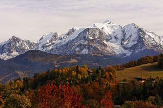
This 6-day trek offers a condensed yet intense version of the legendary Tour du Mont Blanc , one of the most beautiful treks in Europe. Circling the massif which rises to 4806 meters , it crosses the magnificent landscapes of France , Switzerland and Italy , combining high mountains , verdant alpine pastures and spectacular glaciers .
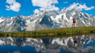
Without completing the entire route, this selection of stages allows you to experience the essence of the mountain range: the panoramic views of the Chamonix valley , the alpine atmosphere of the Val Ferret , the steep ridges of the Fenêtre d'Arpette , and the crossing of iconic mountain passes. Each day reveals a new facet of the massif: jagged peaks , wild valleys , mountain villages , offering a blend of physical exertion and constant wonder .
Accessible to experienced hikers , this trip offers a complete immersion in the world of Mont Blanc, with optimized logistics to fully enjoy the most beautiful sections of the route, in complete serenity.
The highlights
-
The Tour du Mont-Blanc, one of the most beautiful self-guided hiking trails in Europe
-
The spectacle and proximity of the great glaciers
-
Luggage transport (depending on the option chosen)
Photos


Sport
Level
Hiking / Trekking
The expert's opinion
This route is suitable for any advanced hiker. The stages may involve elevation gains or losses of up to 1500m, and you must be able to hike for six consecutive days, averaging between six and eight hours per day. Therefore, a level of physical fitness and endurance compatible with this trip is essential.
The trails are wide and well-marked. Early in the season, you may have to cross snowfields . Some descents can be a bit rocky, so choosing the right footwear is important, and we recommend using trekking poles . On a self-guided trip, you must be able to follow a route independently ; the roadbook and maps, containing a wealth of information, are there to help you navigate the terrain. On the Tour du Mont Blanc, the trail markers are in French.
In figures
Trekking
- Average duration/day: 7h
- Average distance/day: 22 km
- Average daily elevation gain: 1055 m
- Average daily descent: 1084 m
- Exposed Passages: Yes
Management
Your roadbook consists of:
- a full day/day description of the accommodation
- all the digital records of the various hikes offered
- information on the fauna, flora, and history of the various places you will encounter
- our advice
Program
-
Les Houches (1800 m) - Les Contamines Montjoie (1170 m)
- Activity Trekking
- Duration of the activity 7h
- Distance 22 km
- Positive elevation gain 410 m
- Negative elevation 1000 m
- Accommodation Refuge
- Breakfast not included
- Lunch not included
- Dinner included
Meet early at 8:20 am in Les Houches at the Bellevue cable car station, then depart from the top of the cable car. From the summit, enjoy panoramic views of the Mont Blanc massif, the Aiguilles Rouges, the Fiz mountain range, and the Aravis range. The hike begins along a balcony trail at 1800m and leads you to the foot of the Bionnassay glacier before descending to Les Contamines-Montjoie. (If taking the variant via the Col du Tricot: elevation gain = 760m, elevation loss = 1360m)Day 1 -
Contamines Montjoie (1170 m) - Col du Bonhomme (2329 m) - Vallée des Glaciers
- Activity Trekking
- Duration of the activity 8h
- Distance 24 km
- Positive elevation gain 1550 m
- Negative elevation 900 m
- Accommodation Refuge
- Breakfast included
- Lunch not included
- Dinner included
You leave your accommodation and head towards Notre Dame de la Gorge, a landmark of Baroque Romanticism. A long climb takes us to the Col du Bonhomme (2329m). This pass has been traversed for centuries by shepherds and their flocks, armies and soldiers, pilgrims, peddlers, and hikers on the Tour du Mont Blanc. The view then opens up to the Beaufortain region at our feet. We make our way towards the Crête des Gittes ridge to descend into the alpine pastures amidst Tarine and Abondance cows. The milk from these cows provides us with a variety of cheeses, notably Beaufort, which you will undoubtedly taste during the week.
Day 2 -
Valley of the Glaciers - Col de la Seigne (2516 m) - Val Veny (Courmayeur)
- Transportation Minibus - 00h30 - 8km
- Activity Trekking
- Duration of the activity 6h30
- Distance 20 km
- Positive elevation gain 1350 m
- Negative elevation 1410 m
- Accommodation Refuge
- Breakfast included
- Lunch not included
- Dinner included
A private morning transfer will allow you to begin your day in the heart of the City of Glaciers. Today you cross your first border between France and Italy, at the Col de la Seigne (2516m): frequented since antiquity, it is marked by a large cairn and lies on the watershed between the Mediterranean and the Adriatic! The view is breathtaking: a panorama of snow-capped peaks stands out against the Italian side of Mont Blanc. You enter the Val Veny and the Aosta Valley unfolds before you.Day 3 -
Val Veny - La Fouly
- Transportation Bus - 00h40 - 12km
- Activity Trekking
- Duration of the activity 6h30
- Distance 18 km
- Positive elevation gain 900 m
- Negative elevation 740 m
- Accommodation Refuge
- Breakfast included
- Lunch not included
- Dinner included
Today, you continue your ascent towards the Italian Val Ferret to reach the Grand Col Ferret, which marks the border between Italy and Switzerland. You hike while admiring the Pré de Bar Glacier and Mont Dolent, the summit that forms the border between the three countries. You descend towards the village of Ferret to spend the night. Maximum altitude: 2537m
Day 4 -
La Fouly - Champex - Trient - Montroc
- Transportation Bus - 00h45 - 15km
- Activity Trekking
- Duration of the activity 6h30
- Distance 22 km
- Positive elevation gain 1000 m
- Negative elevation 1000 m
- Accommodation Refuge
- Breakfast included
- Lunch not included
- Dinner included
You'll take an early bus to Orsières to reach the charming village of Champex, nestled beside a beautiful mountain lake. Your day begins with a climb to the Bovine alpine pastures. From there, the view encompasses the Rhône Valley on the Swiss side and the Grand Combins massif to the southeast. You'll descend through a magnificent forest leading to the authentic village of Trient. An alternative route via the Fenêtre d'Arpette is possible depending on weather conditions and your fitness level. Elevation gain: approx. 850m, Elevation loss: approx. 900m, Maximum altitude: 2005m. A shuttle will be waiting for you at 4 pm at the Col de la Forclaz to take you to Argentière (Montroc).Day 5 -
Montroc - Lac Blanc - Chamonix
- Activity Trekking
- Duration of the activity 8h30
- Distance 21 km
- Positive elevation gain 1120 m
- Negative elevation 1450 m
- Exposed passages Yes
- Breakfast included
- Lunch not included
- Dinner not included
For this final day, we'll explore the Aiguilles Rouges mountain range and nature reserve, which face Mont Blanc. We'll hike up to the Chéserys lakes and then to Lac Blanc, where the panoramic views are breathtaking. We'll descend via a balcony trail through La Flégère and Le Brévent to Chamonix (with the option of taking the cable cars back down to the valley). The tour ends in Chamonix. (If you parked your car in Les Houches, bus number 1 will take you back to the Bellevue cable car station (approximately every 30 minutes).
Day 6
Accommodation
Access
Go to the starting point
- Take the train from Saint Gervais les bains to Le Fayet, then transfer to the Saint Gervais - Martigny line, stopping at Les Houches station. Then it's approximately a 20-minute walk to the Bellevue cable car departure point.
- It is possible to go to Chamonix by train and take bus No. 1 to reach Les Houches - Bellevue stop.
If you are coming by car: please park before going to the meeting point.
The Prarion car park is now subject to a fee starting this summer, as are all car parks in Chamonix. Consequently , all car parks fill up very quickly. There are also very few parking spaces in Les Houches (a handful in the Bellevue car park).
If you are coming by car, allow plenty of time if you want to find free parking.
Price details
The price includes
- A personalized welcome on Day 1 in Les Houches by a member of our team
- Dormitory accommodation in guesthouses/refuges
- Breakfasts from Day 2 to Day 6
- Dinners from Day 1 to Day 5
- The digital travel journal for a group of 2 to 8 people.
The price does not include
- Transportation to the starting point of the stay
- Local transfers (shuttles, local buses, cable cars)
- Lunches
- Drinks and personal expenses
- Travel using public transport and ski lift fees.
Options
- Luggage transfer - Group of 2 to 3 people : CHF182.96 / person
- Luggage transfer - Group of 4 to 5 people : CHF164.66 / person
- Luggage transfer - Group of 6 to 8 people : CHF146.37 / person
- Flex fare and insurance
Practical information
Specific formalities
Specifics
Before your departure, check with the embassy or consulate regarding the entry and stay requirements for your destination country. You can also find this information on the France Diplomatie website ( https://www.diplomatie.gouv.fr/fr/dossiers-pays/ ).
In the case of flights with stopovers operated by different airlines, also check the entry requirements of the countries you are transiting through.
It is your responsibility to ensure you are in compliance, particularly regarding the validity of your identity documents (for example, some countries require your passport to be valid for at least six months after your return) , visa requirements, necessary vaccinations, and health recommendations. And don't forget to consider any customs restrictions and other potential requirements of your destination or transit country.
ℹ️ Information may change up to the departure date, remember to regularly check official websites.
Equipment
Equipment to bring
- A waterproof plastic pouch with your personal documents: passport or identity card, driving licence, vaccination record, European health insurance card, travel insurance/assistance leaflet, currency, credit card, personal papers (emergency numbers).
- Medium-sized plastic box with cutlery and plastic cup if you wish to prepare some meals.
- Plastic bags to ensure the watertightness of your belongings, cameras and clothes.
- Earplugs, always useful!
- A notepad and pen, a good book, a deck of cards...
- Walking poles (optional): they are a valuable aid to save your knees on the descent (up to 30% of your weight + that of your bag are supported by the poles) and to support your effort on the ascent (the arms help in addition to the legs).
- Gaiters (highly recommended, especially at the beginning of the season when there is still snow on some trails).
- A survival blanket.
- Mobile phone.
- A small flashlight (with spare batteries)
- Telescopic walking poles (recommended)
- A water bottle with at least one liter of water / an extra thermos is also good for having hot tea during the break (0.75L)
- A knife, a spoon, and a fork
- An individual plastic container if you are making salads for lunch.
- Sunscreen cream (skin and lips) + after-sun lotion,
- Toilet paper + lighter (to burn it).
- Optional: camera, binoculars...
Clothing to bring
- A cap or a hat,
- A pair of sunglasses,
- A hat or a headband,
- T-shirt (carline type, quick-drying material)
- A warm shirt or fleece jacket,
- A warm jacket (fleece or down type),
- A windproof jacket (like a Kway or Gore-Tex),
- A closed rain cape with sleeves, without snaps, made of polyamide.
- Lightweight canvas trousers
- Windproof trousers (like Kway or Gore-Tex),
- Shorts, capri pants
- Socks (100% wool: warm, absorbs and wicks away moisture, prevents foot overheating; synthetic fibers: very good resistance, absorbs and wicks away moisture, but be careful if 100% synthetic as it can cause foot overheating; cotton: absorbs moisture but doesn't wick it away well)
- Trekking shoes: they are a hiker's best friend! They must combine three qualities: sturdiness, good support for the foot and ankle (high tops) and waterproofing.
- A pair of long gaiters,
- A pair of warm gloves,
- Spare underwear,
- A pair of lightweight canvas trousers and a spare pair of shorts,
- Spare socks
- A pair of lightweight sandals for the refuge or a pair of sneakers.
- A toiletry bag (earplugs recommended),
- A bath towel,
- For sleeping in mountain huts or guesthouses: a light sleeping bag sheet, blankets are provided in mountain huts and guesthouses.
- A nightgown
They traveled with us