Tour of Mont Blanc, northern half-turn, in 5 days
In summary
-
Sports
-
Duration5 days
-
LevelConfirmed
-
DestinationMont Blanc Massif - France / Chamonix-Mont-Blanc
-
AgeFrom 16 - 90 years
-
CO₂-Emissions57.84 kg CO2
-
Type of stayIn a group
-
Languages
 French
 English
In a few words
Experience the intensity of the Tour du Mont-Blanc through a legendary route condensed into five days . This northern loop has been specifically designed for hikers with limited time but an unlimited thirst for adventure.
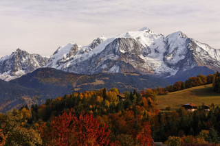
Your adventure begins on the sun-drenched slopes of Courmayeur , the starting point for a spectacular trek through Italy, Switzerland, and France. You'll hike through the heart of the Val Ferret , between hanging glaciers, golden alpine pastures, and crystal-clear lakes, before reaching the renowned Chamonix Valley . Each stage reveals breathtaking panoramas of the glaciers and the preserved architecture of the high-altitude villages.
For total immersion without constraints, enjoy optimal comfort: your luggage will be transported by taxi, allowing you to hike light. You will stay in local hotels and welcoming mountain huts , selected for their authenticity, where your hosts will prepare your picnic lunches each morning. This circuit can also be combined with the southern loop to complete the full circuit. The most majestic of the Alpine massifs awaits you for an unforgettable experience.
The highlights
-
A legendary itinerary in a short format: 5 days to discover three countries
-
Light baggage guaranteed: your luggage travels by taxi, you walk freely
-
A turnkey trip: accommodation, transfers and organized picnics to enjoy
Photos


Sport
Level
Hiking / Trekking
The expert's opinion
- The northern turnaround is a moderately difficult hike
- The elevation gain is between 700m and 900m, equivalent to an average of 5 to 7 hours of walking per day.
- Mountain trails are generally well-maintained, with occasional off-trail sections.
- Being in good physical condition and engaging in regular sporting activity
- Have experience with day hiking
In figures
Hiking
- Average distance/day: 14 km
- Average daily elevation gain: 940 m
- Average daily descent: 790 m
Management
French
English
Qualified professionals with a passion for the mountains, they will guide you safely . Expert and attentive, they share their knowledge of nature, adapt the pace to your group, and ensure your comfort.
Objective : To provide you with a unique experience, combining the discovery of landscapes, local anecdotes and total disconnection.
Conditions of participation :
- Maximum 7 to 12 participants for optimal supervision.
- Registration is possible from the age of 16 , accompanied by a parent.
These standards guarantee a quality stay .
Program
-
Val Ferret, Italy
- Transportation Minibus - 00h45 - 23km
- Activity Hiking
- Distance 12 km
- Positive elevation gain 1100 m
- Negative elevation 350 m
- Accommodation Refuge
- Breakfast not included
- Lunch included
- Dinner included
The adventure begins from the very first hours. A short transfer drops you off at the hamlet of Villair Supérieur , and already, the mountain takes you by the hand.
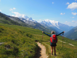
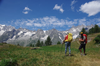
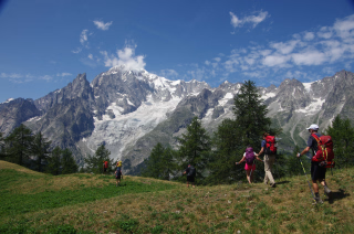
The trail climbs gently up to the Bertone refuge , perched like a belvedere overlooking the world. Up there, the scenery takes your breath away before you've even had a chance to catch your breath: before you rise the legendary peaks of the Mont Blanc massif: the Aiguille Noire, the Aiguille de Triolet, the Grandes Jorasses in all their wild and vertical majesty. A panorama that few hikers forget.
Then the path descends onto a high balcony, suspended between sky and valley, gently guiding you into the heart of the Italian Val Ferret . Here, time seems to slow down. The pastures stretch out, the streams sing, and the altitude gives each step a special flavor.
The night is spent at the Bonatti refuge, a stop in itself. Nestled in the heart of the valley, this legendary refuge bears the name of a legendary mountaineer. The food is good, the sleep is restful, and you share with other hikers that silent camaraderie that only the mountains can create.
This first day sets the tone: demanding, generous, unforgettable. The rest of the tour follows suit.
Day 1 -
Val Ferret Switzerland
- Activity Hiking
- Distance 19 km
- Positive elevation gain 900 m
- Negative elevation 1300 m
- Accommodation Cottage
- Breakfast included
- Lunch included
- Dinner included
This second day is the day of the great crossings. The one we talk about in the evening at the refuge, our eyes still shining.
From Arnuva , the trail climbs steadily towards the Grand Col Ferret , at 2,490 meters altitude. Each turn reveals a little more of the sky, a little less of the valley. Meadows give way to scree slopes, the air becomes crisper, purer. And then, suddenly, the pass. An invisible line in the landscape, yet decisive: you have just left Italy and entered Switzerland.
On the other side, the light is different. The Swiss alpine pastures welcome you with their characteristic serenity. In the distance, the snow-capped peaks of Mont Dolent and Mont Avignon , along with their glaciers, gleam in the sunlight like mirrors set upon the mountain. The silence is almost perfect. You walk, you look, you breathe.
The descent to La Fouly is long and beautiful, with a generous elevation change and abundant panoramic views. The village, nestled at the bottom of the valley, welcomes you with open arms in the late afternoon. Overnight stay in local accommodation, in this corner of Switzerland untouched by mass tourism.
This is the most demanding day of the circuit and often the favorite. The one that makes you feel like you're really doing something big...
Day 2 -
Trient Valley
- Transportation Minibus - 00h30 - 19km
- Activity Hiking
- Distance 16 km
- Positive elevation gain 800 m
- Negative elevation 900 m
- Accommodation Hostel
- Breakfast included
- Lunch included
- Dinner included
This morning, a transfer takes you to Champex-Lac , an alpine jewel set like a postcard amidst the larches.
From there, the day opens onto landscapes of rare grandeur, which remind us that the Alps are not just about peaks.
As you walk towards the Bovine alpine pasture , your gaze wanders towards the Rhône Valley, stretching into the distance with its terraced vineyards, sleepy villages, and golden reflections. Higher up, the towering peaks of the Bernese Oberland close the horizon with their austere whiteness. And to your left, the Combins massif imposes its vertiginous, massive, and majestic silhouette.
It's this kind of day that makes you reconcile with everything. With time, with slowness, with the idea that the journey is sometimes worth more than the destination.
The descent leads you to the Col de la Forclaz , a historic pass between the Rhône Valley and the Trient Valley, frequented for centuries by smugglers, pilgrims, and mountaineers. A few more steps, and you arrive in Trient : an intimate and authentic mountain village, where the inn smells of warm soup and wood.
A day of transition, certainly, but a magnificent one.
Day 3 -
Trélechamps
- Activity Hiking
- Distance 13 km
- Positive elevation gain 898 m
- Negative elevation 900 m
- Accommodation Hostel
- Breakfast included
- Lunch included
- Dinner included
Today, you return to France. And France welcomes you as it should: with Mont Blanc in front of you.
The trail gradually climbs towards the Col des Posettes , at 1,997 m, the natural border between Switzerland and Haute-Savoie .
As you approach the pass, the silhouette of Mont Blanc is revealed, first shy, then overwhelming, and finally absolutely majestic. The Aiguilles Rouges , ablaze in the high-altitude light, frame this spectacle like a painting too beautiful to be true.
And yet, it's very real. You are standing there, looking down at the roof of Europe .
The descent that follows is a reward. The path hugs the ridges in a fantastic setting, a blend of rock and vegetation, open sky and dense forest. At every turn, a new perspective unfolds on the Chamonix valley , stretching out below in all its immensity.
The stage ends at the listed hamlet of Trélechamps: a timeless, unspoiled place where the stone houses seem to have grown naturally among the fir trees. A peaceful night before the grand finale.
Day 4 -
Chamonix Valley
- Activity Hiking
- Distance 10 km
- Positive elevation gain 1000 m
- Negative elevation 500 m
- Breakfast included
- Lunch included
- Dinner not included
The last day is often the most beautiful. As if the mountain wanted to let you leave with an image impossible to forget.
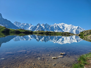
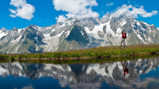
From Trélechamps , the Grand Balcon Sud trail gently leads you to one of the most photographed and moving spots in the entire Alps: Lac Blanc . At 2,352 meters altitude, this small mountain lake reflects the Mont Blanc massif with uncanny precision. The Bossons Glacier, the Grandes Jorasses, the Aiguille Verte : everything appears there, inverted in the still water, like a dream image.
This is where you share the last picnic of the trip. Sitting by the water, facing the highest peak in Europe, with five days of hiking under your belt and a head full of memories. A suspended moment, one you don't really leave.
The descent is via La Flégère , then the gondolas whisk you back down to the village of Les Praz with a big smile. Chamonix is just a few minutes away, lively, festive, and worthy of the finish line you deserve.
The Demi Tour du Mont Blanc Nord ends here. But something, you can already feel it, has begun.
Day 5
Note
The route may be adapted at any time by the instructor, depending on the weather or the technical and physical level of the participants.
Accommodation
Access
The return to Chamonix is scheduled for late afternoon at the end of the trip. The return time is approximate : if you have a train or plane to catch, please allow extra time.
Go to the starting point
By train 🚆
- Paris → TGV to Saint-Gervais-les-Bains-Le Fayet (5h), then TER Mont-Blanc Train (1h05).
- Lyon/Geneva → TER towards Saint-Gervais , then Mont-Blanc Train.
By plane + bus ✈️🚌
- Geneva Airport (GVA) → Direct shuttle (1 hour 15 minutes) or Taxi
By car 🚗
- Paris → A6/A40 (~6h)
- Lyon → A40 (~2h30)
- Geneva → A40 (~1 hour)
Paid parking in Chamonix :
- Grépon parking lot (city centre, near cable car).
- Saint-Michel parking lot (city centre, near shops).
- Mont-Blanc car park (covered, central).
Price details
The price includes
- The trip will be supervised by a state-certified mountain guide.
- Half-board accommodation in a mountain refuge or small hotel in a quadruple room & dormitory
- Picnics from Day 1 to Day 5
- The ski lifts planned in the program
- The transfers planned in the program
- Transport of only one piece of luggage during your stay: soft bag, no hard suitcase (max 15 kg, in case of excess weight, your luggage will not be taken care of by our service provider)
The price does not include
- Transportation to the meeting point
- Drinks and personal expenses
- Ski lifts or taxi transfers in case of personal inability to complete the planned stage
- Anything not mentioned under "Price includes"
Options
- Flex fare and insurance
Practical information
Specific formalities
Specifics
During the hike, you must have the following documents in your possession:
• Valid identity card or passport.
• European Health Insurance Card (to be ordered directly from your AMELI account, under the "Procedures" section)
• Your travel insurance leaflet received upon registration (if you purchased this insurance through our offices) or your personal insurance (contract number + telephone number).
Equipment
Equipment to bring
⚠️ Importance of choice : Your equipment directly influences the success of your stay.
Weight = key criterion : Find the right compromise between weight and comfort .
👟 High-top hiking boots :
- Suitable for trekking: good ankle support .
- New? → Wear them first to break them in .
- Blisters? → Talcum powder on dry feet + shoes in the morning.
🎒 Backpack :
- Volume 30L (allow space for picnic) + a compact and sturdy travel bag, Max 15 kg, in case of excess weight, your luggage will not be taken care of by our service provider.
- Rain tip : Protect your belongings with a plastic bag (like a garbage bag) inside the bag.
Bag weight :
- Optimize each item : "Will I use it every day?"
- Tips :
- Pack it down as much as possible.
- Smaller bag = better balance → reduced feeling of weight.
Others :
- Telescopic poles
- Minimum 2L water bottle
- Pocket knife and spork-type fork
- Flashlight or headlamp
Clothing to bring
🔹 Weather conditions :
Conditions can be changeable → Opt for thin, layerable garments rather than one thick garment.
Stay dry in all circumstances.
Preferred textiles :
- Avoid cotton (heavy, cold, slow to dry).
- Prefer :
- Synthetic technical textiles.
- 1 merino wool textile (warm, quick-drying, odorless).
Clothing & Accessories :
- Breathable T-shirts (long and short sleeves)
- Lightweight fleece-type jacket
- Warm down-type jacket
- Gore-tex type waterproof jacket
- Rain cape
- Hiking pants
- Gore-tex type waterproof trousers
- Shorts
- Hiking socks
- Hat or cap
- Cap
- Pair of gloves
- Change of clothes at your convenience
- Sunglasses (minimum category 3), sunscreen, lip balm
- Optional : camera, binoculars, etc.
- Bag sheet
- Toiletries bag, earplugs and toilet paper
- Limited personal pharmacy (Compeed-type second-skin plasters, medications for common ailments: diarrhea, constipation, sore throat, headache, pain, allergies)
- A little laundry soap
⚠️ Note : The guide has a first aid kit .