Tour of Mont Blanc in 6 days, fast walking version
In summary
-
Sports
-
Duration6 days
-
LevelExpert
-
DestinationMont Blanc Massif - France / Chamonix-Mont-Blanc
-
AgeFrom 16 - 90 years
-
CO₂-Emissions76.71 kg CO2
-
Type of stayIn a group
-
Languages
 French
 English
In a few words
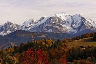
Experience the intensity of a legendary trek with this "Fast Walking" version of the Tour du Mont Blanc . This condensed 6-day format takes on the challenge of the full 10-day route, without compromise. Here, there are no ski lifts or transfers: every kilometer is earned solely through the strength of your legs , from the first step to the last.
This demanding circuit links Chamonix to its starting point through France , Italy and Switzerland . Designed for athletic hikers who enjoy fast walking , it offers challenging daily stages, with up to 2,000 meters of elevation gain.
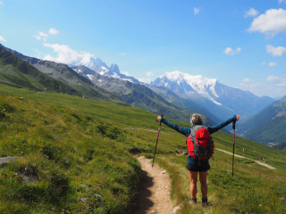
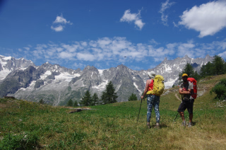
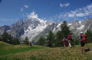
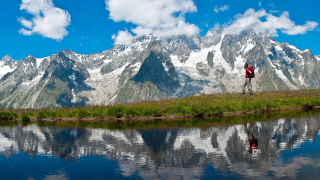
The effort is rewarded with breathtaking and ever-changing panoramas: from the golden alpine pastures of the Beaufortain to the hanging glaciers of the Val Veny, and on to the vertiginous balconies of the Val Ferret. To optimize your performance and enjoyment, you 'll travel light thanks to luggage transport provided by taxi. Each evening, the comfort of a mountain hut or hotel allows you to recover before setting off again to conquer the mountain range. Complete this loop with the pride of having conquered the most famous trails in the Alps in record time .
The highlights
-
Complete tour, 100% on foot from Chamonix to Chamonix, without transport along the route
-
A complete route for experienced hikers: 20 km and 2000m of elevation gain per stage
-
The complete package with complete peace of mind: luggage transported by taxi
Photos


Sport
Level
Hiking / Trekking
The expert's opinion
The complete Tour du Mont Blanc in 6 days is a challenging hike. With an elevation gain ranging from 900 to 2500 meters, averaging 6 to 8 hours of walking per day, this route requires excellent physical fitness. Mountain trails are generally well-maintained, although the route may occasionally include off-trail sections. Prior experience with fast-paced, multi-day hikes is essential.
In figures
Hiking
- Average distance/day: 28 km
- Average daily elevation gain: 1627 m
- Average daily descent: 1567 m
Management
French
English
Qualified professionals with a passion for the mountains, they will guide you safely . Expert and attentive, they share their knowledge of nature, adapt the pace to your group, and ensure your comfort.
Objective : To provide you with a unique experience, combining the discovery of landscapes, local anecdotes and total disconnection.
Conditions of participation :
- Maximum 6 to 8 participants for optimal supervision.
- Registration is possible from the age of 16 , accompanied by a parent.
These standards guarantee a quality stay .
Program
-
Chamonix - Les Contamines
- Activity Hiking
- Distance 26 km
- Positive elevation gain 1500 m
- Negative elevation 1400 m
- Accommodation 2-star hotel
- Breakfast not included
- Lunch included
- Dinner included
It all begins in front of the church in Chamonix . This starting point in the heart of the town is significant; it's the historic starting point of the Tour du Mont Blanc, where generations of hikers have taken one last look at the church steeple before setting off on their adventure. Today, it's your turn.
The first steps follow the Arve, this nervous river born from the glaciers, which accompanies your steps to Les Houches .
The village marks the end of the familiar valley and the beginning of the climb: the Col de Voza awaits you at 1,653 meters. The ascent is steep, legs warm up, and a rhythm is found. It is here that the group settles into a pace, conversations become lighter, and the mountain begins to work its magic.
From the pass, the descent into the Val Montjoie is a revelation. This unspoiled valley, dotted with hamlets of wooden chalets and babbling fountains, seems to keep the modern world at bay. Here, one walks differently, more attentively, more presently. Alpine pastures unfold, villages appear one after another, and Les Contamines emerges in the late afternoon like a well-deserved reward.
26 kilometers, 1,500 meters of positive elevation gain: the first day sets the tone.
This full Tour doesn't do things by halves, and that's exactly what you came for. Tonight, your legs are full of energy and your smile is wide. Tomorrow, the real climb begins.
Day 1 -
Les Contamines - Les Mottets
- Activity Hiking
- Distance 21 km
- Positive elevation gain 1460 m
- Negative elevation 900 m
- Accommodation Hostel
- Breakfast included
- Lunch included
- Dinner included
This morning, you're walking in the footsteps of the Romans. From Notre-Dame-de-la-Gorge , a Baroque sanctuary nestled at the bottom of the valley, the ancient Roman road climbs steadily towards the heights. There's something breathtaking about the idea that this path carved into the rock has existed for centuries, long before the Tour du Mont Blanc was even conceived.
The climb to the Col du Bonhomme (2,329m) is long, sustained, and magnificent. The landscape gradually unfolds: forests give way to alpine pastures, pastures to scree slopes, and the air becomes thinner and purer. But the effort doesn't end there; this is what distinguishes this full version from the others. The traverse to the Col de la Croix du Bonhomme takes you into the wildest, most rugged, and most striking section of the Tour.
Up there, the silence is almost absolute. The world stretches out at your feet in every direction, a breathtaking panorama that rewards every meter of effort.
The descent into the Chapieux valley is a gradual return to life, to greenery...
Day 2 -
Les Mottets - Courmayeur
- Activity Hiking
- Distance 30 km
- Positive elevation gain 1700 m
- Negative elevation 1800 m
- Accommodation 2-star hotel
- Breakfast included
- Lunch included
- Dinner included
Today, you're crossing a border, and not just any border. The Col de la Seigne , at 2,516 meters, is one of the most historically and emotionally charged passes on the entire route. On one side, the familiar slopes of Savoy; on the other, the Italian side of Mont Blanc, which suddenly reveals itself as more rugged, more dramatic, almost intimidating. The south face of the massif doesn't have the same gentleness as the French side; it commands respect.
The descent into the Val Veny is like stepping into another world. Glaciers plunge directly into the valley, and the moraines tell the slow, powerful story of the ice. Walking here gives you a unique feeling, that of standing at the foot of something far greater than yourself.
Lake Combal, at 2,000 meters, marks the beginning of the most spectacular section of the day. The ascent towards the Arp Vieille alpine pastures takes you along an exceptional panoramic trail, facing some of the most legendary peaks in the history of mountaineering: the Noire de Peuterey, the Dent du Géant, and the Grandes Jorasses. Names that evoke dreams, silhouettes that awe.
The long descent towards Courmayeur is a gentle transition between two worlds. The medieval village welcomes you with its cobbled streets, lively terraces and Italian way of life.
Tonight, Courmayeur is yours.
Day 3 -
Courmayeur - La Fouly
- Activity Hiking
- Distance 30 km
- Positive elevation gain 1900 m
- Negative elevation 1500 m
- Accommodation 2-star hotel
- Breakfast included
- Lunch included
- Dinner included
Just like yesterday, we're on a long 30-kilometer stage. This time, 1,900 meters of elevation gain await us. These figures, which might seem daunting, become, once on the trail, a source of pride with every kilometer covered, because this day is also one of the most beautiful , the most rewarding, the most complete of the circuit.
It begins in the forest. The larches of Courmayeur envelop you in their golden light and resinous scent as you climb towards the Bertone Refuge . Then the trail drops onto an exceptional balcony, suspended above the Italian Val Ferret , with the imposing Mont Blanc massif constantly in view. It's one of those sections where you involuntarily slow down, not because your legs are giving out, but because your eyes don't want to miss a thing.
The Bonatti Refuge , halfway along the route, is a stop steeped in symbolism. Named in homage to the legendary mountaineer Walter Bonatti, it embodies the spirit of the mountains in its most authentic form. A well-deserved rest, a breathtaking view, and the road continues.
The Grand Col Ferret, at 2,537 meters, takes you into Switzerland amidst a magnificent high-mountain landscape. The descent that follows is long and rolling, traversing vibrant green alpine pastures to the village of La Fouly , nestled at the end of the Swiss Val Ferret . Tonight, you've completed another demanding stage of the Tour, and that calls for a celebration!
Day 4 -
La Fouly - Col de la Forclaz
- Activity Hiking
- Distance 28 km
- Positive elevation gain 1200 m
- Negative elevation 1300 m
- Accommodation 2-star hotel
- Breakfast included
- Lunch included
- Dinner included
After the intense efforts of the previous days, this stage offers a different, more varied, more contemplative, but equally rewarding pace. It begins with a traverse of the Swiss Val Ferret from end to end, dotted with small hamlets boasting well-preserved architecture where time seems to have stood still. This is a hidden Switzerland, far removed from the postcards, authentic and captivating.
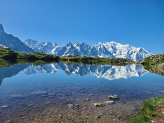
The village of Issert marks the beginning of the ascent to Champex-Lac , a jewel nestled in the mountains: a mountain lake with emerald reflections, surrounded by forests and chalets, inviting you to pause and contemplate. A stop you won't forget and that you'll leave with regret.
But the best is yet to come. The steep and challenging climb to the Bovine alpine pastures rewards you with one of the most breathtaking panoramas of the entire route. Here, your gaze extends far beyond the Mont Blanc massif: the Rhône Valley stretches out in all its breadth, vineyards trace geometric lines across the hillsides, and the peaks of the Bernese Oberland close the horizon to the north. It's an unexpected view, making it all the more precious.
The long descent to the Col de la Forclaz and then the village of Trient beautifully concludes a 28-kilometer day. The penultimate night. Tomorrow, it's back to Chamonix.
Day 5 -
Col de la Forclaz - Chamonix
- Activity Hiking
- Distance 28 km
- Positive elevation gain 2000 m
- Negative elevation 2500 m
- Breakfast included
- Lunch included
- Dinner not included
The final day. The one we dread from the very first, and which always arrives too quickly. But what a way to finish. This last stage is the most demanding of all on paper: 28 kilometers, 2,000 meters of elevation gain, 2,500 meters of descent. A finale worthy of a full Tour, befitting the week you've just experienced.
The departure from the Col de la Forclaz marks your last hour in Switzerland. The Catogne alpine pastures lead you uphill in an almost solemn morning silence, as if the mountain itself knew it was the last day and wanted to offer you the very best for the end.
The Posettes alpine pastures , at 2,000 meters, signal your return to France. And suddenly, the Chamonix valley unfolds before you in all its grandeur, the Mont Blanc range unmistakably yours, familiar and majestic. You've circled it for six whole days, seen every slope, every glacier, every pass. Now you see it head-on, and something in your gaze has changed.
The final descent along the balcony overlooking the massif is a gift. Each step brings you closer to Chamonix , and the church, your starting point six days ago, finally appears below. Completing this entire Tour du Mont Blanc, entirely on foot, without any transport, is a victory you carry in your legs and in your heart forever.
Day 6
Note
The route may be adapted at any time by the instructor, depending on the weather or the technical and physical level of the participants.
Accommodation
Access
The return to Chamonix is scheduled for late afternoon at the end of the trip. The return time is approximate : if you have a train or plane to catch, please allow extra time.
Go to the starting point
By train 🚆
- Paris → TGV to Saint-Gervais-les-Bains-Le Fayet (5h), then TER Mont-Blanc Train (1h05).
- Lyon/Geneva → TER towards Saint-Gervais , then Mont-Blanc Train.
By plane + bus ✈️🚌
- Geneva Airport (GVA) → Direct shuttle (1 hour 15 minutes) or Taxi
By car 🚗
- Paris → A6/A40 (~6h)
- Lyon → A40 (~2h30)
- Geneva → A40 (~1 hour)
Paid parking in Chamonix :
- Grépon parking lot (city centre, near cable car).
- Saint-Michel parking lot (city centre, near shops).
- Mont-Blanc car park (covered, central).
Price details
The price includes
- The trip will be supervised by a state-certified mountain guide.
- Accommodation in hotels and guesthouses/hostels, in shared double/twin rooms
- Full board from picnic lunch on Day 1 to picnic lunch on Day 6
- Transport of only one piece of luggage during your stay: soft bag, no hard suitcase (max 15 kg, in case of excess weight, your luggage will not be taken care of by our service provider)
The price does not include
- Transportation to the meeting point
- Drinks and personal expenses
- Ski lifts or taxi transfers in case of personal inability to complete the planned stage
- Anything not mentioned under "Price includes"
Options
- Flex fare and insurance
Practical information
Specific formalities
Specifics
During the hike, you must have the following documents in your possession:
• Valid identity card or passport.
• European Health Insurance Card (to be ordered directly from your AMELI account, under the "Procedures" section)
• Your travel insurance leaflet received upon registration (if you purchased this insurance through our offices) or your personal insurance (contract number + telephone number).
Equipment
Equipment to bring
⚠️ Importance of choice : Your equipment directly influences the success of your stay.
Weight = key criterion : Find the right compromise between weight and comfort .
👟 High-top hiking boots :
- Suitable for trekking: good ankle support .
- New? → Wear them first to break them in .
- Blisters? → Talcum powder on dry feet + shoes in the morning.
🎒 Backpack :
- Volume 40L (allow space for a picnic).
- Rain tip : Protect your belongings with a plastic bag (like a garbage bag) inside the bag.
Bag weight :
- Optimize each item : "Will I use it every day?"
- Tips :
- Pack it down as much as possible.
- Smaller bag = better balance → reduced feeling of weight.
Others :
- Telescopic poles
- Minimum 2L water bottle
- Pocket knife and spork-type fork
- Flashlight or headlamp
Clothing to bring
🔹 Weather conditions :
Conditions can be changeable → Opt for thin, layerable garments rather than one thick garment.
Stay dry in all circumstances.
Preferred textiles :
- Avoid cotton (heavy, cold, slow to dry).
- Prefer :
- Synthetic technical textiles.
- 1 merino wool textile (warm, quick-drying, odorless).
Clothing & Accessories :
- Breathable T-shirts (long and short sleeves)
- Lightweight fleece-type jacket
- Warm down-type jacket
- Gore-tex type waterproof jacket
- Rain cape
- Hiking pants
- Gore-tex type waterproof trousers
- Shorts
- Hiking socks
- Hat or cap
- Cap
- Pair of gloves
- Change of clothes at your convenience
- Sunglasses (minimum category 3), sunscreen, lip balm
- Optional : camera, binoculars, etc.
- Bag sheet
- Toiletries bag, earplugs and toilet paper
- Limited personal pharmacy (Compeed-type second-skin plasters, medications for common ailments: diarrhea, constipation, sore throat, headache, pain, allergies)
- A little laundry soap
⚠️ Note : The guide has a first aid kit .
They traveled with us