Tour of Mont Blanc at your own pace
In summary
-
Sports
-
Duration10 days
-
LevelConfirmed
-
DestinationChamonix-Mont-Blanc / Mont Blanc Massif - France
-
AgeFrom 16 - 90 years
-
CO₂-Emissions73.73 kg CO2
-
Type of stayIndependent traveler
In a few words
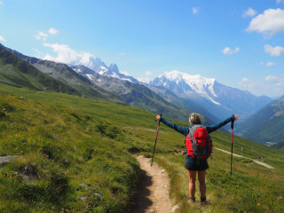
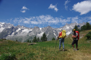
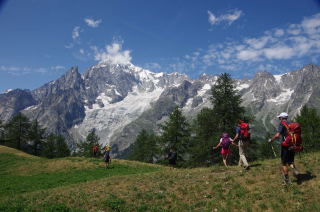
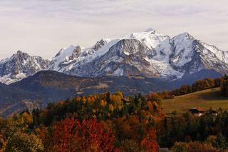
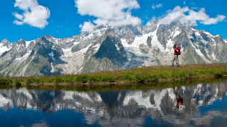
This is "the" classic, the most legendary of hikes. The Tour du Mont Blanc unfolds in a magnificent setting, a stone's throw from glaciers, through three countries with distinct cultures and landscapes. We offer this hike without carrying your own gear, allowing you to explore independently, without a guide. This grand "circle around Mont Blanc" begins in the Val Montjoie, an example of controlled tourism development, and the Vallée des Glaciers, where pastoralism remains very much alive. The Col de la Seigne marks the entry into Italy, facing the spectacular Brenva face of Mont Blanc, which plunges dramatically towards the Val Veni and Courmayeur. After ascending the Italian Val Ferret, at the foot of the Grandes Jorasses, you reach the tranquility of the Swiss Val Ferret. We finish with the balcony of the Aiguilles Rouges and the Chamonix valley, whose landscapes, though well-known, never fail to impress.
Luggage is transported from stage to stage by a support vehicle, allowing you to fully enjoy the pleasures of discovery and explore the most interesting variations of the route. If you choose the room option, you can stay in small dormitories for 2 to 4 people in the mountain huts.
The highlights
-
An essential route for any hiker's life
-
The discovery of three Alpine countries with different cultures
-
An app that guides you along your journey
Photos


Sport
Level
Hiking / Trekking
The expert's opinion
Sports walkers
Hiking :
Average elevation gain: 880 m Maximum elevation gain: 1080 m
Average length: 16 km Maximum length: 19 km
Average time: 5 hours 45 minutes Maximum: 6 hours 15 minutes
It is sometimes possible to shorten certain stages by using buses (at your own expense) or by using the vehicle that transports our luggage (approximately €30 to €50 per journey, at your own expense).
Warning! At the beginning of the season (until early July), due to late snowfall, conditions can be more difficult for crossing some mountain passes and snowfields. Only choose this period if you have mountain experience.
It should also be noted that the shuttles to shorten certain stages only operate in July and August.
Orientation: Upon request, we can send you the GPS tracks of the route.
We also provide a smartphone application that provides guidance and positions you in real time even without a network connection (thanks to your phone's GPS – see the "hiking guide" section).
Level 1 : A little attention and some map reading skills are required.
You must be able to follow a route using an FFRP guidebook and clues found on the ground. You must only use marked trails.
This route is undertaken without a guide and at your own risk. We provide you with all the information you need (it's too long…).
In figures
Hiking
- Average duration/day: 6h
- Average distance/day: 17 km
- Average daily elevation gain: 862 m
- Average daily descent: 942 m
- Exposed Passages: Yes
Management
To complete your hiking file, we provide you with a free digital route planner.
This is an application to download on your phone which will tell you at each intersection which direction to follow and will provide you with practical information, as well as details on the natural or cultural heritage.
You will also be able to know your position on the course in real time.
With the voice function, the phone can stay in your pocket or bag.
To benefit from this service, simply let us know when making your reservation.
Program
-
Chamonix - Bionnassay
- Activity Hiking
- Duration of the activity 5h30
- Distance 15 km
- Positive elevation gain 630 m
- Negative elevation 1160 m
- Accommodation Refuge
- Breakfast not included
- Lunch not included
- Dinner included
Meet at Chamonix SNCF train station at 9:30 a.m. sharp . Dress in hiking gear , with your backpack ready, water in your bottle, and your hiking boots on. You will be met at the station by the taxi company that will transport your luggage. Your luggage will then be loaded into the vehicle. With a daypack containing your essentials, you will set off for the Petit Balcon Sud. Facing Mont Blanc and its famous peaks, which you will learn to identify, you will reach Les Houches to take the Bellevue cable car. You can use public transport in the Chamonix valley, either train or shuttle (at your own expense), to get from Les Houches. A mountainside path leads you to the terminus of the Bionnassay Glacier .
Night in Bionnassay, above the valley of Contamines Montjoie.
Day 1 -
Bionnassay - Les Contamines
- Activity Hiking
- Duration of the activity 6h15
- Distance 18 km
- Positive elevation gain 970 m
- Negative elevation 830 m
- Accommodation Refuge
- Breakfast included
- Lunch not included
- Dinner included
After a gentle start, you climb through forests and clearings for a traverse along the mountainside above the Gruvaz Gorges . You then pass from the V-shaped valley carved by the stream to the U-shaped glacial valley of the Miage Alpine Pastures (1559 m). It's a true little paradise at the foot of the Dômes de Miage. A burst of energy is needed to reach the peaceful Plateau du Truc (1740 m) before descending to Les Contamines-Montjoie . You then ascend the Val Montjoie via Notre Dame de la Gorge , a splendid 17th-century Baroque church.
Via the ancient passage, wrongly called the Roman Road , you cross over the Bon Nant torrent which roars below to reach the " Roman Bridge" , then to the Chalet du Nant Borrant ( Accommodation only possible in 8-person dormitories ).
You are in the Contamines Montjoie Nature Reserve. Vehicles can only enter before 7 a.m. or after 7 p.m.
You will not be able to collect your luggage until around 7:30 pm.
Day 2 -
Les Contamines – Les Chapieux
- Activity Hiking
- Duration of the activity 5h30
- Distance 12 km
- Positive elevation gain 1020 m
- Negative elevation 930 m
- Accommodation Refuge
- Breakfast included
- Lunch not included
- Dinner included
An alpine stage with the ascent of two mountain passes is on the agenda for today. You begin by discovering the tranquility of the Balme pastures before reaching the Col du Bonhomme (2329 m), gateway to the Beaufortain region. The hardest part is over, as a gentle uphill traverse leads you to the Col de la Croix du Bonhomme (2479 m). The route then descends into the alpine pastures of the Vallée des Glaciers to reach the village of Les Chapieux , the end of your stage.
You can stay in Ville des Glaciers by crossing the Col des Fours (2665 m), the highest point of your hike (+200 m, +1 hour). This will shorten your stage the next day.
You can also be accommodated in Bourg St Maurice after using the shuttle (+ €6 to be paid on site, operates from mid-June to mid-September ).
Day 3 -
Les Chapieux – Val Veny
- Activity Hiking
- Duration of the activity 6h
- Distance 19 km
- Positive elevation gain 1080 m
- Negative elevation 990 m
- Accommodation Refuge
- Breakfast included
- Lunch not included
- Dinner included
The Col de la Seigne (2516 m) This marks the entrance to the Aosta Valley and Italy. Mont Blanc appears before you in its wildest aspect. You descend the Val Veni to the enormous moraine of the Miage Glacier, which blocks the entire valley. A short detour leads to Lake Miage , nestled between the moraine and the glacier. Following the valley floor, you discover the prestigious and legendary routes of Mont Blanc: the Brouillard, Innominata, and Peuterey ridges.
Night at the Monte Bianco Refuge. A shuttle between Les Chapieux and Ville des Glaciers allows you to shorten this stage by one hour, but it only runs in July-August.
Day 4 -
Val Veny – Val Ferret
- Activity Hiking
- Duration of the activity 5h45
- Distance 17 km
- Positive elevation gain 880 m
- Negative elevation 880 m
- Accommodation Refuge
- Breakfast included
- Lunch not included
- Dinner included
After visiting the Chapel of Our Lady of Healing, you descend to Courmayeur (which you can also reach by bus in July and August) to perhaps enjoy a cappuccino. In fine weather, the warm climb through scattered larch trees is rewarded at Pré de la Saxe (2000 m), a splendid viewpoint overlooking the Dent du Géant and the Grandes Jorasses. A siesta is highly recommended.
You then descend to the Italian Val Ferret and reach Lavachey (room option) for the night.
If you have chosen the dormitory option, you will stop at the Elena refuge , at the end of the Val Ferret, after a short (inexpensive) bus transfer, at your own expense.
Day 5 -
Val Ferret – La Fouly
- Activity Hiking
- Duration of the activity 6h
- Distance 17 km
- Positive elevation gain 920 m
- Negative elevation 860 m
- Accommodation Refuge
- Breakfast included
- Lunch not included
- Dinner included
You begin the day with a leisurely ascent of the Italian Val Ferret and the discovery of the Pré de Bar Glacier , a genuine demonstration glacier featured in many geography books. Then it's time to tackle the real climb to reach the Grand Col Ferret (2537 m), gateway to the Swiss Val Ferret.
You are facing Mont Dolent, which is very symbolic, since it is at its summit that the three borders, Italian, Swiss and French, meet.
Night in Ferret (1700 m) or La Fouly (1600 m).
Day 6 -
La Fouly - Champex
- Activity Hiking
- Duration of the activity 5h15
- Distance 19 km
- Positive elevation gain 630 m
- Negative elevation 700 m
- Accommodation Refuge
- Breakfast included
- Lunch not included
- Dinner included
This long, leisurely stage allows us to savor the gentle charm of the Swiss Valais. You descend the Swiss Val Ferret through the delightful villages of La Fouly, Praz de Fort, Les Arlaches, and Issert. The Valais architecture is admirably preserved: houses, barns, and raccards (wooden granaries on stilts) line the path. In this meticulously maintained landscape, you climb back up through the forest to the Champex health resort (1473 m). After following the shores of the lake, an ideal spot for a nap, all that remains is to reach the entrance of the Val d'Arpette to spend the night.
Depending on accommodation availability, you may also be accommodated in the Champex valley.
Day 7 -
Champex – Forclaz or Trient
- Activity Hiking
- Duration of the activity 4h45
- Distance 13 km
- Positive elevation gain 760 m
- Negative elevation 860 m
- Accommodation Refuge
- Breakfast included
- Lunch not included
- Dinner included
After a slight descent, you begin the climb, initially gentle then becoming steeper, which leads you to the Bovine Alpine pastures (1987 m). This is a balcony suspended above the Rhône Valley, an immersion in wide open spaces and horizons, from which you can see Martigny, the Valais region, and the Dents Blanches mountains. The ascent ends at Collet Portalo (2049 m), before descending through larch forests to reach the Col de la Forclaz (1526 m).
You can also stay in Trient (1297 m, + 30 min) or in Martigny (541 m, descent on foot + 2 h 00, ascent the next day by bus + 10 CHF to be paid on site).
Day 8 -
Forclaz or Trient – The Tour
- Activity Hiking
- Duration of the activity 6h15
- Distance 17 km
- Positive elevation gain 900 m
- Negative elevation 1050 m
- Accommodation Refuge
- Breakfast included
- Lunch not included
- Dinner included
After following the Bisse de Trient (a water supply channel carved into the rock), you climb the path leading to the Bergeries des Grands (2113 m), above the Trient Glacier. A balcony trail takes you to the Col de Balme (2191 m) where you cross back into France and the Chamonix Valley. Mont Blanc appears there, visible from the side you discovered nine days earlier.
The descent offers stunning views of the Glacier du Tour and the Aiguille Verte. Overnight stay in the village of Le Tour , at the foot of the glacier. If you have chosen the comfort option, you will be accommodated in Argentière (+ 30 minutes).
Day 9 -
The Tour - Chamonix
- Transportation Car - 20h - 12km
- Activity Hiking
- Duration of the activity 6h15
- Distance 15 km
- Positive elevation gain 830 m
- Negative elevation 1160 m
- Exposed passages Yes
- Breakfast included
- Lunch not included
- Dinner not included
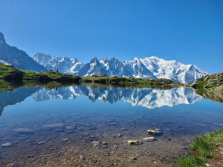
You climb the ladders of the Aiguillette d'Argentière to reach the Balcon des Aiguilles Rouges . You then reach one of the Lacs des Chéséry (2133 m) for your last nap away from the crowds at Lac Blanc. You finish the hike in a magnificent setting, facing the Aiguille Verte and the Drus.
Arrival is scheduled for around 5:00 PM at Chamonix train station, where you will find your luggage.
Day 10
Note
The times were calculated based on a pace of 300 meters of elevation gain per hour uphill, 500 meters of elevation gain per hour downhill, and 4 km per hour on flat terrain, in order to allow for a comparison of the different hikes on the same basis. They only include actual walking time; all meal breaks, rest stops, or periods of quiet contemplation must be added.
The TMB is so popular that accommodations fill up quickly. We may need to modify your itinerary if your planned accommodations are unavailable during your travel dates. Alternative accommodations may be of a different category and incur an additional cost. Some may require the use of a shuttle, the cost of which is moderate and will be your responsibility. They may also lengthen or shorten some stages of the journey!
Note : Depending on your chosen comfort level, the various accommodation options are often several kilometers apart at certain stages. The stage lengths mentioned in this technical sheet are based on typical locations along the Tour du Mont Blanc and are therefore only indicative. Once you have the complete itinerary, you will have all the information needed to recalculate the actual lengths and durations.
Accommodation
Access
Go to the starting point
Price details
The price includes
- Organization costs.
- Food and accommodation on a half-board basis.
- The provision of a complete hiking file.
- The provision of the FFRP guidebook for the Tour du Mont-Blanc.
- The provision of a description indicating the most interesting variants
- The ascent via the Bellevue cable car
The price does not include
- Luggage transport by taxi at each stage.
- Lunchtime meals.
- Wine during meals.
- Drinks and personal expenses.
- Any shower tokens.
- Personal equipment.
- Possible buses in the Aosta Valley in Italy (inexpensive).
- The journeys to and from the reception location.
- The different types of insurance: Cancellation and/or Search and rescue costs - Assistance - Repatriation - Interruption of stay.
- Everything that is not listed under "The price includes".
Options
- Price does not include luggage transport : CHF-457.40 / person
- Additional night in a dormitory in Chamonix : CHF36.59 / person
- Additional night in a room in Chamonix : CHF100.63 / person
- Price does not include luggage transport : CHF-274.44 / person
- Price does not include luggage transport : CHF-247.00 / person
- Price does not include luggage transport : CHF-228.70 / person
- Price does not include luggage transport : CHF-201.26 / person
- Flex fare and insurance
Practical information
Specific formalities
Specifics
Before your departure, check with the embassy or consulate regarding the entry and stay requirements for your destination country. You can also find this information on the France Diplomatie website ( https://www.diplomatie.gouv.fr/fr/dossiers-pays/ ).
In the case of flights with stopovers operated by different airlines, also check the entry requirements of the countries you are transiting through.
It is your responsibility to ensure you are in compliance, particularly regarding the validity of your identity documents (for example, some countries require your passport to be valid for at least six months after your return) , visa requirements, necessary vaccinations, and health recommendations. And don't forget to consider any customs restrictions and other potential requirements of your destination or transit country.
ℹ️ Information may change up to the departure date, remember to regularly check official websites.
Equipment
Equipment provided on site
- N / A
Equipment to bring
Equipment :
- 1 backpack of 35/40 litres with a flexible frame, equipped with a waist belt.
- A large plastic bag to protect the inside of the backpack.
- 1 pair of excellent quality sunglasses with side protection.
- a water bottle (1.5 liters minimum).
- 1 Opinel-type pocket knife.
- 1 small pouch (preferably waterproof) to put your money, identity card, health insurance card and assistance contract in.
- Toilet paper + a bin bag.
- Sunscreen + lip balm.
- Airtight plastic container (minimum capacity 0.5 litre) + cup + cutlery.
- 1 survival blanket.
- Camera, binoculars (optional).
- A pair of poles is recommended.
For the evening at the accommodation:
- Your pocket-sized hand sanitizer and disinfectant wipes.
- Your masks in sufficient quantity.
- A sleeping bag.
- 1 swimsuit (optional).
- 1 pair of comfortable trousers.
- 1 pair of lightweight casual shoes.
- Toiletries (prioritize the essentials, small sizes, samples and travel kits).
- 1 quick-drying bath towel.
- Earplugs or ear cushions (optional).
- 1 headlamp or flashlight.
Clothing to bring
Clothes :
The principles:
For the upper body, the 3-layer principle allows you to manage almost all situations:
- a long-sleeved undershirt made of breathable material (hollow fiber).
- a warm fleece fur jacket.
- a waterproof and breathable windproof jacket of the gore-tex type.
When hiking in calm, sunny weather, a base layer may be sufficient. In rain, snow, or wind, simply add a waterproof jacket. In very cold weather or during breaks, a fleece jacket is an essential addition.
Choose quick-drying clothes , so avoid cotton. Opt for wool (merino wool underwear is comfortable and doesn't develop unpleasant odors), silk, and synthetic fibers that will keep you dry and warm for as long as possible.
Remember to dress warmly before you get cold , but especially to remove layers before you get too hot . Sweat is a hiker's enemy, as it dampens clothing that quickly becomes icy during breaks. Therefore, it's very rare to undertake a climb wearing a fleece jacket.
The ideal list : (to be adapted according to the hike and the season)
- 1 sun hat or cap.
- 1 scarf or neck warmer.
- Short-sleeved T-shirts preferably made of breathable material (1 for 2 to 3 days of walking).
- 1 long-sleeved undershirt in breathable material or a shirt.
- 1 fleece fur jacket.
- 1 windproof, waterproof and breathable Gore-Tex type jacket with hood.
- 1 rain cape or a sleeping bag cover if you own the jacket above.
- 1 loose trekking pants.
- 1 pair of shorts or bermudas.
- Hiking socks (1 pair for 2 to 3 days of hiking). Opt for wool or specific hiking socks. Be careful with cotton as it can cause blisters.
- 1 pair of high-top hiking boots with good ankle support and waterproof soles (Vibram type). Remember to test new shoes and those that haven't been used for a long time beforehand.
- Underwear.
- At the beginning and end of the season (June and September), it may be useful to also have gaiters, gloves and a hat.