The GR20 South with family and at your own pace
In summary
-
Sports
-
Duration7 days
-
LevelConfirmed
-
DestinationAjaccio / South Corsica
-
AgeFrom 14 - 67 years
-
CO₂-Emissions63.23 kg CO2
-
Type of stayIndependent traveler
In a few words
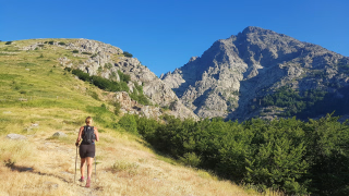
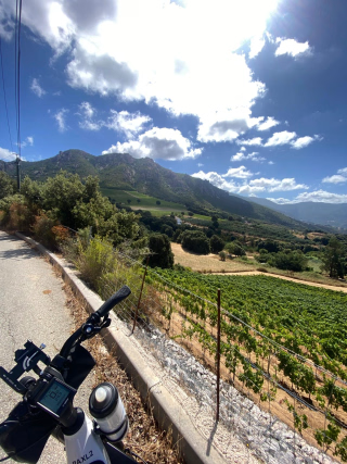
Set off to discover the southern part of the GR20 , a legendary route that combines sporting challenges and spectacular landscapes . Between the Bavella needles and the Vizzavona forest, this trek crosses a mosaic of reliefs: panoramic ridges, laricio pine forests, high altitude plateaus and wild valleys typical of the Corsican mountains .
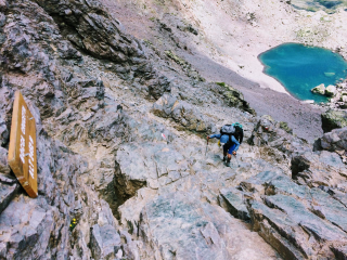
Less rocky and slightly gentler than the northern section, this part of the GR20 is nonetheless a demanding hike , ideal for walkers in excellent physical condition . Each stage reveals a new facet of the island: panoramic views of the peaks, high-altitude passages, and unspoiled mountain environments.
The experience is made easier by the meals provided in the mountain huts and the transport of luggage between stages , allowing you to fully enjoy the route while preserving the authentic spirit of the great Corsican crossing.
Accessible to teenagers aged 14 and up , this trek is a fantastic adventure to share, allowing you to discover one of Europe's most legendary trails . A unique immersion in the heart of unspoiled nature , where each day of walking offers its share of emotions and unforgettable panoramas.
The highlights
-
The Alpine Variant of Bavella
-
Forests, mountain ridges, and the sea as a backdrop
-
A clear and detailed road book
Photos


Sport
Level
Hiking / Trekking
The expert's opinion
Tackling the GR20 as a family is a real challenge, but also an unforgettable collective adventure . Renowned for being one of the most demanding treks in Europe, this route requires mutual support, motivation, and teamwork so that everyone progresses at the same pace on the Corsican mountain trails.
Beyond performance, the essential element is the desire to share a powerful family project : leaving behind the daily grind, embracing simpler comforts, and fully immersing oneself in a timeless experience . When children feel involved in this adventure, they often find the energy and determination needed to meet the challenge.
This trek is recommended for children aged 14 and over , provided the whole family has good experience with mountain hiking . The stages average 700 meters of elevation gain per day , on varied and sometimes technical terrain , requiring sure footing and experience walking for several consecutive days.
To best prepare for this legendary crossing, it is advisable to follow a program of regular hikes during the three months preceding departure , in order to strengthen endurance and approach the GR20 in the best conditions.
In figures
Hiking
- Average duration/day: 5h30
- Average daily elevation gain: 572 m
- Average daily descent: 725 m
- Exposed Passages: Yes
Management
Program
-
Arrival in Corsica - Transfer to Bavella
- Transportation Bus - 02h30 - 80km
- Accommodation Cottage
- Breakfast not included
- Lunch not included
- Dinner included
You will be met in the early afternoon at the Ajaccio bus station and transferred to Bavella , in the heart of one of the iconic sites of the Corsican mountains. Once there, you will have time to settle in and explore the surroundings at your leisure before beginning your trek.
This initial approach allows you to enjoy the unique atmosphere of the Bavella site , nestled between rocky outcrops and mountain landscapes. It's also an opportunity to prepare for the rest of your stay before taking your first steps on the famous GR20 .
At the end of the day, settling in and overnight stay in Bavella .
Day 1 -
Alpine variant of the Aiguilles de Bavella
- Activity Hiking
- Duration of the activity 5h
- Positive elevation gain 80 m
- Negative elevation 410 m
- Exposed passages Yes
- Accommodation Refuge
- Breakfast included
- Lunch included
- Dinner included
The adventure truly begins today with your first kilometers on the GR20 . From Bavella , you take the alpine variant , a more exposed route that allows you to cross the famous Aiguilles de Bavella .
The trail winds through a dramatic, rocky landscape, passing through forests and offering panoramic views of the southern Corsican mountains. While some sections require careful attention, this stage provides an immediate immersion into the wild atmosphere of the massif.
You continue your journey through the mountain to the Asinao refuge , nestled in a preserved natural setting.
Settling in and overnight stay at the Asinao refuge .
Day 2 -
Ascent of Alcudina and Cuscionu plateau
- Activity Hiking
- Duration of the activity 5h30
- Positive elevation gain 710 m
- Negative elevation 900 m
- Accommodation Refuge
- Breakfast included
- Lunch included
- Dinner included
The day begins early with the ascent of Alcudina (2134m) , the highest point in southern Corsica. Setting off in the cool of the morning, you progress up the slopes of this summit, which offers a beautiful view of the surrounding landscape.
After this climb, the route gradually changes in atmosphere. You cross the vast high-altitude meadows of the Cuscionu plateau , an open space where the terrain becomes gentler and the landscapes more rounded. This part of the stage allows you to progress at a steady pace while enjoying the peaceful atmosphere of this high plateau.
The walk continues to the Bassetta sheepfolds , located in a natural setting typical of the Corsican mountains.
Accommodation and overnight stay at the Bassetta sheepfolds .
Access to the support bag.
Day 3 -
The Ridge of Statues
- Activity Hiking
- Duration of the activity 4h30
- Positive elevation gain 630 m
- Negative elevation 210 m
- Accommodation Bivouac / Tent
- Breakfast included
- Lunch included
- Dinner included
You gain altitude to reach the spectacular Statues Ridge . The path follows the crest of the ridge , offering an airy progression amidst granite blocks sculpted by the wind .
As you walk, the rock formations unfold, creating a unique mineral landscape. On a clear day, the Tyrrhenian Sea appears in the background, contrasting with the wild terrain of the Alta Rocca.
You continue your progress along this iconic ridge line of the GR20 to the Usciolu refuge .
Settling in for the evening and overnight in a tent at the Usciolu refuge .
Day 4 -
Ridges of the GR20 and Punta Cappella
- Activity Hiking
- Duration of the activity 7h
- Positive elevation gain 790 m
- Negative elevation 1240 m
- Exposed passages Yes
- Accommodation Refuge
- Breakfast included
- Lunch included
- Dinner included
You continue your northward journey along a typical GR20 ridge route . The route often remains exposed and follows the watershed between the Taravu valley and the eastern plain .
The hike alternates between rocky sections and more open areas, with regular views of the central Corsican landscape. Along the way, you climb Punta Cappella (2041m) , a summit that marks one of the highest points of the stage.
After this high-altitude crossing, the trail gradually begins its descent towards the Verde refuge , nestled on the edge of the forest.
Accommodation and overnight stay at the Verde refuge .
Access to the support bag.
Day 5 -
Forests and plateau of Renosu
- Activity Hiking
- Duration of the activity 6h
- Positive elevation gain 1000 m
- Negative elevation 700 m
- Accommodation Cottage
- Breakfast included
- Lunch included
- Dinner included
After the steep ridges traversed the previous day, the atmosphere changes markedly. The path enters a forest track , offering a gentler progression through the undergrowth of pines and beeches.
During the stage, you have the option of taking a marked variant to reach the famous Pozzi del Renosu . This out-and-back hike leads to a vast high plateau , known for its wet meadows dotted with small pozzines, a characteristic landscape and often considered a must-see in the area.
Back on the main route, you continue your walk to the Capanelle gîte , located in the heart of the forest.
Accommodation and overnight stay at the Capanelle gîte .
Access to the support bag.
Day 6 -
Palente Pass and Vizzavona Forest
- Transportation TER / Metro / Tram - 01h15 - 40km
- Activity Hiking
- Duration of the activity 5h
- Positive elevation gain 220 m
- Negative elevation 890 m
- Breakfast included
- Lunch included
- Dinner not included
The day begins on an old mule track that gradually climbs towards the Palmente pass (1640m) . As you gain altitude, the landscape gradually opens up and reveals a wide panorama of the eastern coast , with the Diana and Urbinu lakes below.
After this high-altitude crossing, the trail begins its descent towards Vizzavona . You then progress through the Vizzavona beech forest , a dense and cool forest that contrasts with the more mineral terrain traversed in the previous days.
Upon arrival, return transfer by train to Ajaccio , marking the end of your journey on the GR20 .
Day 7
Note
Departure is only possible on Saturdays from May 30th to September 19th inclusive to benefit from luggage transfer.
Accommodation
Access
Go to the starting point
From the airport
- Taxi : approximately 15 to 20 minutes (approximately €20 to €30 depending on traffic)
- Urban bus (Muvistrada network) : a shuttle connects the airport to the city center and the Ajaccio train station
- Then a 10-15 minute walk or a few minutes by taxi to reach the bus station.
From the port to the bus station
- On foot : approximately 10 minutes
- Taxi : approximately 5 minutes
Price details
The price includes
- Accommodation in guesthouses and mountain huts (with one night in a tent)
- Full board from dinner on Day 1 to lunch on Day 7
- The route log and GPS app
- Luggage transfer to each accommodation with road access (on the evenings of Day 1, Day 3, Day 5 and Day 6)
- The outward transfer from Ajaccio to Bavella by coach
- Return transfer from Vizzavona to Ajaccio by train
The price does not include
- Drinks and personal expenses
- Transportation to the meeting point
- Day 1 picnic
- Race provisions
- The framework
- Anything not listed under "Price includes"
Options
- Flex fare and insurance
Practical information
Specific formalities
Specifics
Before your departure, check with the embassy or consulate regarding the entry and stay requirements for your destination country. You can also find this information on the France Diplomatie website ( https://www.diplomatie.gouv.fr/fr/dossiers-pays/ ).
In the case of flights with stopovers operated by different airlines, also check the entry requirements of the countries you are transiting through.
It is your responsibility to ensure you are in compliance, particularly regarding the validity of your identity documents (for example, some countries require your passport to be valid for at least six months after your return) , visa requirements, necessary vaccinations, and health recommendations. And don't forget to consider any customs restrictions and other potential requirements of your destination or transit country.
ℹ️ Information may change up to the departure date, remember to regularly check official websites.
Equipment
Equipment to bring
- The backpack: Your backpack should be able to hold your sleeping bag and personal belongings for two days (three days for the Original), which is approximately 40/50 liters. Choose a backpack with a hip belt (allowing the weight of the pack to rest on your hips), padded shoulder straps, and a chest strap.
You should always carry in your backpack a warm garment, a rain garment, a water bottle, a first aid kit and your personal belongings, not forgetting part of the picnic.
In addition to the bag cover (sometimes integrated into the backpack), a 70-litre garbage bag and two freezer bags are essential to effectively protect your belongings from the rain.
- Sleeping: A good quality sleeping bag (comfort temperature: +5°) that is compact and lightweight is essential for this trip involving nights in a guesthouse, mountain refuge or tent.
- The picnic: - 1 individual airtight container of approximately 0.5 liters, such as a "Tupperware" type container, to hold a mixed salad, cutlery (knife, fork) and a cup.
- Small equipment
- Water bottle or hydration pack (approximately two liters): we strongly advise you to bring a filter bottle, a filter straw, or a filter adapter.
- A pair of telescopic poles
Sunglasses, sunscreen, and a hat
- Toilet paper
- A small toiletry bag, with a towel (made of lighter microfiber)
- A headlamp with new batteries
-A pair of sneakers or sandals for the evening
- The support bag: This is your "support" bag. You'll find it at your accommodations each evening, provided there's road access. It's a duffel bag or sports bag. Besides your spare clothes, it contains any extras you'll be glad to have on hand each evening. No items should be attached to the outside of the bag. It will be transported by our support team to accommodations accessible by road. Please limit your equipment and only pack what's essential. We recommend one support bag per person (not one bag for two): "lightening your load" is common during the trip; you should still have room to store your sleeping bag when it's not needed for that particular day. For added security, we advise you to put a padlock on your support bag.
Clothing to bring
- The clothes
- A windproof, waterproof and breathable GORE-TEX type jacket
- Protection against rain (rain cape or waterproof and breathable jacket)
- A fleece jacket or light down jacket
- Trousers, shorts, t-shirt(s) (avoid cotton and favour breathable materials).
- Change of clothes
- A swimsuit and a microfiber towel (lighter)
- Thin gloves and a light hat.
- Footwear: Choose hiking boots with good ankle support and lug soles that are flexible. Footwear is one of the most important pieces of equipment for your hike. Above all, it must be comfortable, lightweight, waterproof, and breathable. Good ankle support is essential. Don't set off in brand-new boots. Wear them at least two or three times beforehand on hikes. Similarly, make sure your "old boots" won't fall apart on the first climb.