The Chamonix-Zermatt crossing at your own pace
In summary
-
Sports
-
Duration9 days
-
LevelExpert
-
DestinationChamonix-Mont-Blanc / Mont Blanc Massif - France
-
AgeFrom 15 - 90 years
-
CO₂-Emissions65.72 kg CO2
-
Type of stayIndependent traveler
In a few words
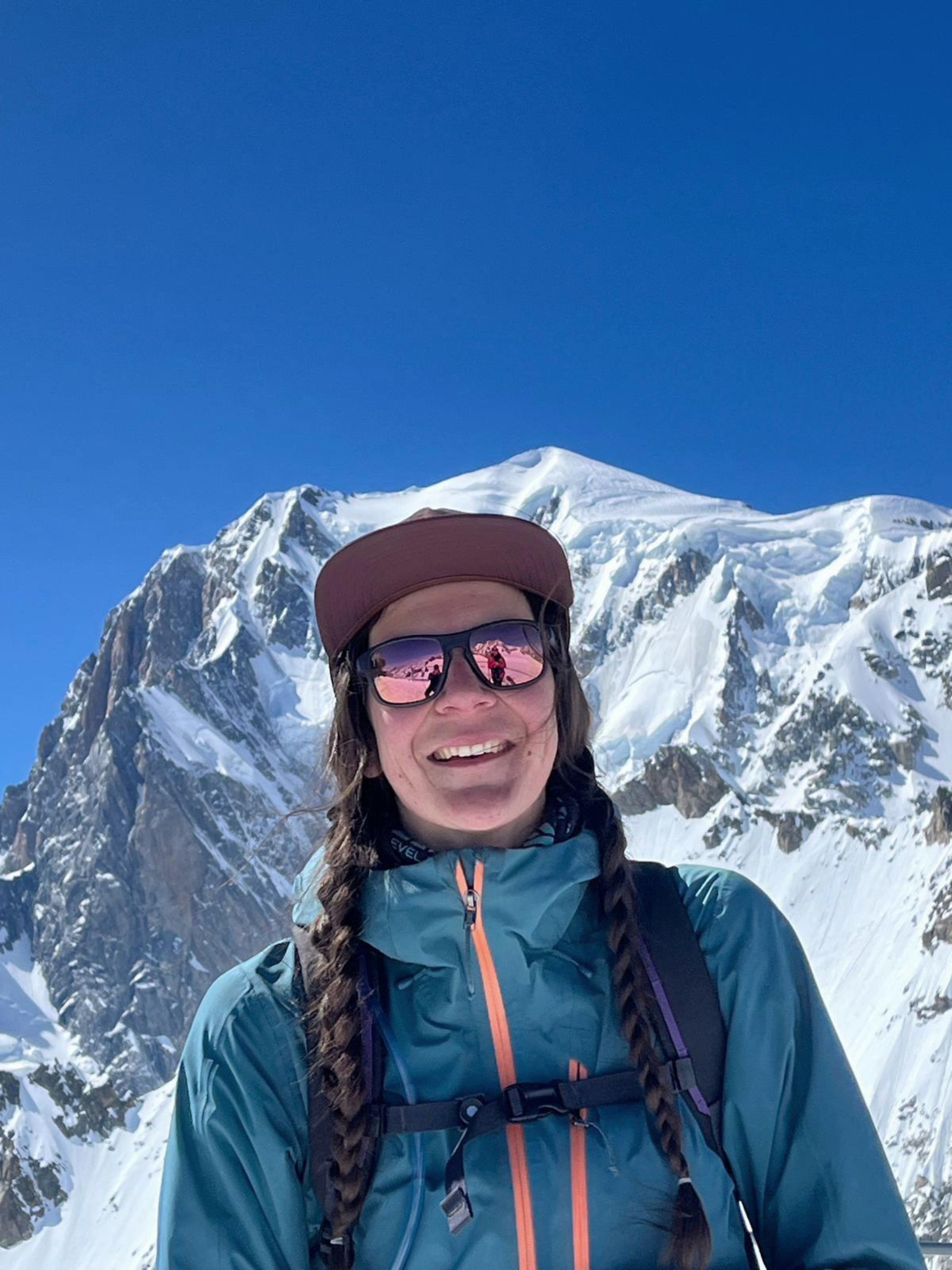
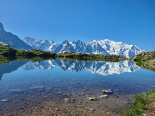
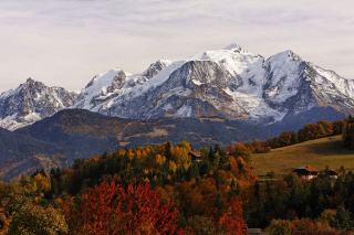
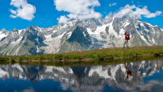
Connect two legendary mountaineering capitals with an exceptional long-distance hike . This walking route links Chamonix Mont-Blanc in France to Zermatt in Switzerland, offering total immersion in the heart of the most beautiful alpine landscapes.
Far from the glacial route reserved for mountaineers, this trail version follows paths exclusively through mid-mountain terrain, at altitudes ranging from 2,000 to 3,000 meters . You will travel safely across varied terrain accessible to hikers, without ever setting foot on glaciers.
Throughout your journey, you will traverse a succession of authentic valleys and cross numerous renowned mountain passes . The route is dotted with charming villages, shady forests , rushing streams, and sparkling high-altitude lakes , all dominated by majestic peaks and glaciers . It's the perfect opportunity to contemplate the grandeur of the Alpine giants from a unique and unspoiled perspective.
The highlights
-
Discover the High Alpine Route via the trails
-
Completely self-sufficient with a route book and GPX tracks
-
Overnight stays in authentic mountain refuges
Photos


Sport
Level
Hiking / Trekking
The expert's opinion
The route, distances and altitudes may vary slightly for many reasons beyond our control, including weather and terrain conditions.
In figures
Hiking
- Average duration/day: 6h30
- Average distance/day: 15 km
- Average daily elevation gain: 1156 m
- Average daily descent: 1089 m
- Exposed Passages: Yes
Management
We provide a printed roadbook, a PDF roadbook, and GPX tracks. We are also available via WhatsApp throughout your stay to assist you. A pre-trip briefing is also possible at our office in Les Houches.
Program
-
Montroc – Trélechamp – Trient
- Activity Hiking
- Duration of the activity 6h
- Distance 11 km
- Positive elevation gain 1000 m
- Negative elevation 1200 m
- Accommodation Hostel
- Breakfast not included
- Lunch not included
- Dinner included
The Posettes Aiguillette ridge is particularly beautiful and offers panoramic views. The Mont Blanc massif, its main peaks, and the Chamonix valley provide a breathtaking panorama! The Posettes and Balme alpine pastures are the last remaining working pastures near Chamonix. The Franco-Swiss border is crossed via a mountainside path through the Catogne pastures. The village of Trient is our destination.
Day 1 -
Trient – Champex (via the Cattle Pastures)
- Activity Hiking
- Duration of the activity 6h
- Distance 15 km
- Positive elevation gain 850 m
- Negative elevation 1000 m
- Accommodation Hostel
- Breakfast included
- Lunch not included
- Dinner included
The day begins with a climb to the Col de La Forclaz. The trail then enters a beautiful larch forest and reaches the Bovine alpine pastures, which overlook the upper Rhône Valley, upstream from Lake Geneva in the Swiss Valais. The Dents du Midi massif and the foothills of the Bernese Alps can also be admired. Further east, the Pennine Alps (Valais) welcome us with a prominent feature: the Grand Combin massif. The "Bovine road" is used by herders to guide their cattle through the mountains. The trail now descends towards Plan de l'Au and finally Champex-le-Lac.
Day 2 -
Champex – Mille's Hut
- Activity Hiking
- Duration of the activity 7h
- Distance 13 km
- Positive elevation gain 1700 m
- Negative elevation 700 m
- Accommodation Refuge
- Breakfast included
- Lunch not included
- Dinner included
From Champex-Lac, a pleasant descent through forests, hillsides, and small hamlets leads to the bottom of the Val d'Entremont and the village of Orsières, nestled at the foot of the Great St. Bernard Pass. Here are the Valais Alps! A long climb up the western slope of the Val d'Entremont is necessary to reach the ridges of Mont Brûlé, offering a final view of the peaks to the northeast of the Mont Blanc range. The trail then leads to the Mille hut, perched at an altitude of 2,473 meters.
Day 3 -
Mille Hut – Louvie Hut
- Activity Hiking
- Duration of the activity 7h
- Distance 18 km
- Positive elevation gain 1200 m
- Negative elevation 1400 m
- Accommodation Refuge
- Breakfast included
- Lunch not included
- Dinner included
This is a long but easy stage. The scenery is breathtaking, from the Cabane de Mille overlooking the Val d'Entremont to the Cabane de Louvie overlooking the Val de Bagnes. The trail initially traverses to the Cabane de Brunet, then descends into the Val de Bagnes. From the village of Fionnay, the trail climbs again towards the Cabane de Louvie and its magnificent lake, which reflects the immense Corbassière Glacier.
Day 4 -
Louvie Hut – Prafleuri Hut
- Activity Hiking
- Duration of the activity 6h
- Distance 14 km
- Positive elevation gain 1050 m
- Negative elevation 1150 m
- Exposed passages Yes
- Accommodation Refuge
- Breakfast included
- Lunch not included
- Dinner included
The Grand Désert, situated between two mountain passes (the Col de Louvie at 2921m and the Col de Prafleuri at 2939m), is a vast plateau composed of moraines and roche moutonnées left behind by glaciers before retreating back to their summits. The landscape is starkly mineral, dotted with lakes, cairns, and trail markers to guide your crossing. From the Col de Prafleuri, the trail descends to the refuge of the same name, where you will spend the night.
Day 5 -
Cabane de Prafleuri – Evolène (via Col de la Meina)
- Activity Hiking
- Duration of the activity 7h
- Distance 19 km
- Positive elevation gain 1050 m
- Negative elevation 1560 m
- Accommodation Cottage
- Breakfast included
- Lunch not included
- Dinner not included
Our route avoids the Riedmatten Pass and the Pas de Chèvre Pass. Both are technical and exposed. They can pose a significant challenge for those unsure of their footing on unstable scree and/or afraid of climbing high vertical ladders.
Our trail leaves the Grande Dixence dam and descends into the Val d'Hérémence to the locality known as "Môtot," at an elevation of 1905m. The trail crosses the Merdéré stream and much later reaches the Novèlé alpine pastures (2082m). Crossing the Col de la Meina (2702m) allows us to descend into the Val d'Hérens. The descent from the pass leads to the charming hamlet of La Meina. From here, a chairlift provides easy access to Lana.
Day 6 -
Evolène / La Sage – Zinal (Via Col de Thorens and Lac de Moiry)
- Activity Hiking
- Duration of the activity 6h
- Distance 11 km
- Positive elevation gain 1200 m
- Negative elevation 700 m
- Accommodation 2-star hotel
- Breakfast included
- Lunch not included
- Dinner included
Starting from La Sage in the Val d'Hérence, head towards Zinal! You'll first pass through the Col de Torrent. Here you'll have a breathtaking view of the Moiry dam with its stunning colors. Then you'll descend to the lake, crossing the Thorens alpine pastures. From the dam, the local shuttle service will take you from Moiry to Zinal where you'll spend the night.
Day 7 -
Zinal – Gruben (via Col de la Forcletta)
- Activity Hiking
- Duration of the activity 7h
- Distance 17 km
- Positive elevation gain 1250 m
- Negative elevation 1090 m
- Accommodation Rural hotel
- Breakfast included
- Lunch not included
- Dinner included
The climb to the Col de La Forcletta is long and varied. A steep path through the forest leads to a pleasant, long balcony overlooking the Val de Zinal, then to a welcoming alpine pasture on the final steep section. A descent into the Turtmanntal (Val Turtmann) feels like stepping back in time. Inaccessible in winter, this is the wildest valley in the Valais. In the distance, you'll see the Augstbordpass, the mountain pass you'll cross the next day, as well as the Turtmann Glacier, flanked by the Bishorn on one side and the Weisshorn on the other.
Day 8 -
Gruben – St Niklaus – Zermatt
- Activity Hiking
- Duration of the activity 6h
- Distance 13 km
- Positive elevation gain 1100 m
- Negative elevation 1000 m
- Breakfast included
- Lunch not included
- Dinner not included
The climb to the Augstbordpass (2892m) is long: forest, alpine pastures, grassy slopes, pebbles, and rocks… It's the last challenge of our trek. Crossing the pass offers a spectacular view. Here lies the Zermatt Valley and the Mischabel massif. The descent winds through the valley below the pass to the junction at 2095m. The trail continues to the right, along the rather steep flank of the Twära mountain, towards the perched hamlet of Jungu (1954m). Here, a small cable car takes you down to St. Niklaus. A connecting train then takes you to Täsch, and another to our final destination, Zermatt.
Day 9
Accommodation
Access
As this is a self-guided trip, you manage your days at your own pace, without fixed departure or return times. However, we recommend starting your Day 1 hike fairly early in the morning to fully enjoy your first stage in complete peace of mind.
Go to the starting point
To return to Chamonix from Zermatt (4:15 to 4:30 am):
- Zermatt --> Visp (Viège): Take the red rack railway Matterhorn Gotthard Bahn ( 1h10 ).
- Visp --> Martigny: Take the SBB train through the Rhône Valley ( 45 min ).
- Martigny --> Chamonix: Board the famous Mont-Blanc Express . This panoramic train climbs through the Trient Valley, crosses the French border at Vallorcine and drops you off right in the centre of Chamonix ( 1h30 ).
Booking: You can buy a single combined ticket on the SBB (SBB) website or app.
Price details
The price includes
- Accommodation in dormitories in mountain huts and 1 night in a private room
- 8 breakfasts and 7 dinners (dinner not included at La Sage on day 6)
- A travel log + GPS tracks and map
- Pre-tour assistance via email/phone
- Assistance from our on-site team
The price does not include
- Transportation to the place of stay
- Transfers during the stay if necessary and transfers to/from Chamonix.
- Dinner on Day 6 at La Sage
- Lunches, snacks, drinks and personal expenses
- Personal hiking equipment
- Anything not mentioned under "Price includes"
Options
- Flex fare and insurance
Practical information
Specific formalities
Specifics
Before your departure, check with the embassy or consulate regarding the entry and stay requirements for your destination country. You can also find this information on the France Diplomatie website ( https://www.diplomatie.gouv.fr/fr/dossiers-pays/ ).
In the case of flights with stopovers operated by different airlines, also check the entry requirements of the countries you are transiting through.
It is your responsibility to ensure you are in compliance, particularly regarding the validity of your identity documents (for example, some countries require your passport to be valid for at least six months after your return) , visa requirements, necessary vaccinations, and health recommendations. And don't forget to consider any customs restrictions and other potential requirements of your destination or transit country.
ℹ️ Information may change up to the departure date, remember to regularly check official websites.
DON'T FORGET
Passport or identity card
Insurance covering search, rescue or repatriation costs (bring your insurance policy number and emergency phone number with you)
Equipment
Equipment to bring
- BACKPACK - Recommended size: 35 liters minimum
Keep in mind that 500g + 500g + ... quickly adds up to extra kilos. Only take what you need, as you'll have to carry everything you pack. Your bag shouldn't weigh more than 8 to 10kg. Opt for a backpack with a hip belt to help distribute the weight and relieve strain on your posture and back. A bag with a chest strap will be a real plus in terms of comfort and stability.
TIPS: Remember to distribute the weight evenly inside your pack and adjust it properly so that your hips bear the load rather than your shoulders. This tip may seem insignificant at first, but it proves essential on multi-day hikes.
- HIKING SHOES
A pair of high-top, waterproof hiking boots. This is the most important piece of equipment. Comfortable shoes can make all the difference, while unsuitable shoes can hinder your progress or even force you to give up. There are many different models of hiking boots available. Choose shoes that offer ankle support and adequate waterproofing. Nothing is more unpleasant than walking for hours in shoes soaked by rain or even morning dew.
TIP: Go trekking with shoes that you have already tried beforehand and are sure you won't get blisters in.
OTHERS :
- Telescopic walking poles (recommended option)
- Lip balm
- Ultra-light shower kit (toothbrush, toothpaste, shower gel/shampoo or soap: also useful for washing clothes)
- Synthetic bath towel
- Phone and charger
- International plug adapter
- Rechargeable power bank
- Handwashing liquid for washing clothes
- Silk sheet (mandatory in dormitory)
In the mountains, the weather can change quickly. The clear blue morning sky can rapidly become overcast, especially if aided by a high-altitude wind bringing masses of humid air. Warm temperatures can also saturate the atmosphere with humidity, creating conditions conducive to thunderstorms. Winter conditions, such as frost, are also possible.
Early morning conditions or the presence of snow above 1800m. Finally, one might also fear a rainy day and see our boldness rewarded with an unexpected burst of sunshine and a completely clear sky a few hours later...
Keep this in mind:
When heading to the mountains, you must always consider the possibility of heat, rain, and cold. Your backpack should always contain the essentials to prepare for these three scenarios: this is the essential core kit.
Weight/efficiency dilemma:
Water bottles, picnic lunches, snacks, cameras, binoculars... these are all additional items to consider. A backpack fills up quickly, so it's essential to optimize the weight-to-performance ratio of the clothing and equipment you carry. For a multi-day hike with support and the transfer of drop packs, minimizing the weight of your daily pack is much easier. Without this support, packs are larger, so you'll need to consider hand-washing your clothes to reduce the number of items you need as much as possible.
Clothing to bring
CLOTHES :
- First layer with short sleeves (synthetic)
- First layer with long sleeves (synthetic)
- 2nd layer (e.g., fleece) or thin down jacket
- 3 pairs of hiking socks (synthetic or Merino wool)
- Shorts
- Hiking pants
- Long technical underwear
- Waterproof and breathable jacket
- Rain cape / poncho
BAG BUNK:
- A pair of lightweight gloves
- Cap or beanie
- Sunglasses
- Water bottle (1.5L)
- Small first aid kit (paracetamol, blister prevention/treatment, plasters, etc. Don't forget to bring your personal prescription if you have one).
- Cash (euros and Swiss francs: most shelters do not accept credit cards)
- Sunscreen
- Pocket fork and knife
- Headlamp
- Survival blanket
- Garbage bag for your waste