Routes of Compostela (G65: from Geneva to Le Puy-en-Velay)
In summary
-
Sports
-
Duration19 days
-
LevelConfirmed
-
DestinationMassif Central / Swiss
-
AgeFrom 16 - 90 years
-
CO₂-Emissions185.82 kg CO2
-
Type of stayIndependent traveler
In a few words
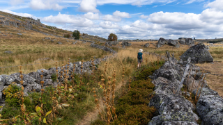
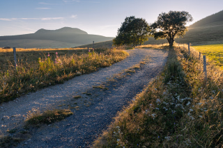
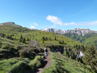
Following in the footsteps of German and Swiss pilgrims, you'll take the Jakobsweg , or the Via Gebennensis , leaving the shores of Lake Geneva in Geneva and heading into France. You'll skirt Mont Salève and pass through the Col du Mont Sion . The Pays de Seyssel , shaped by the Rhône River, marks the entrance to Savoy, with its Chautagne vineyards. The terrain becomes more mountainous at Mont Tournier , before descending to Saint-Genix-sur-Guiers . The second week takes you across the Dauphiné plain, passing through the Voironnais and Bièvre-Valloire regions, where cereal-growing valleys and wooded hills alternate. This part of Isère, far from major urban centers, offers charming villages (with houses built of rammed earth or pebbles) and a peaceful countryside. During the third week, you cross the Pilat Natural Park , then the wild plateaus of Meygal , before reaching Le Puy-en-Velay , starting point of the Via Podiensis , one of the major French routes to Santiago de Compostela.
The highlights
-
A varied and interesting hiking trail away from the crowds
-
The departure from the shores of Lake Geneva and the visit to Geneva
-
Arriving at Le Puy-en-Velay, one of the four main French routes to Santiago de Compostela
Photos


Sport
Level
Hiking / Trekking
The expert's opinion
Average elevation gain: 390 m Maximum elevation gain: 800 m
Average length: 21 km Maximum: 24 km (or 34 km)
Average time: 5 hours 15 minutes Maximum: 7 hours
Orientation :
Level 1 : A little attention and some map reading skills are required.
You must be able to follow a route using an FFRP guidebook and clues found on the ground. You must only use marked trails.
In figures
Hiking
- Average duration/day: 5h
- Average distance/day: 21 km
- Average daily elevation gain: 427 m
- Average daily descent: 404 m
Management
Program
-
St Julien en Genevois - Geneva - St Julien en Genevois
- Activity Hiking
- Duration of the activity 3h
- Distance 13 km
- Positive elevation gain 130 m
- Negative elevation 80 m
- Accommodation 2-star hotel
- Breakfast not included
- Lunch not included
- Dinner not included
The meeting point is in Saint Julien en Genevois, France, not far from the border (for luggage transport reasons at the Swiss border). After a transfer by bus (regular line, approximately €3 at your own expense), you will reach the starting point of the hike (bring your ID card or passport) on the banks of the Rhône in Geneva. After exploring the city and Lake Geneva, it's time to begin the Camino. We recommend visiting St. Peter's Cathedral and its towers (beautiful views of Geneva and the surrounding area). After leaving the city, you will join the GR65, which you will then follow (perhaps all the way to the Roncevaux Pass on the Spanish border). You will return to your accommodation in Saint Julien en Genevois. Dinner is not included. You will find many restaurants in Saint Julien en Genevois.
Day 1 -
St Julien en Genevois - Mont Sion (785 m)
- Activity Hiking
- Duration of the activity 4h15
- Distance 16 km
- Positive elevation gain 475 m
- Negative elevation 200 m
- Accommodation 2-star hotel
- Breakfast included
- Lunch not included
- Dinner included
Today's route follows the base of Mont Salève, passes the Roman milestone at Neydens, then the Chartreuse de Pomier, and crosses the Col du Mont Sion. The hike offers beautiful views of Lake Geneva and the nearby Jura Mountains. You will spend the night at Mont Sion or in a neighboring village.
Day 2 -
Mont Sion - Frangy (320m)
- Activity Hiking
- Duration of the activity 5h30
- Distance 21 km
- Positive elevation gain 385 m
- Negative elevation 840 m
- Accommodation Bed and Breakfast
- Breakfast included
- Lunch not included
- Dinner included
This stage takes you through a lovely rural landscape of rolling hills westward to Les Contamines-Sarzin (marker and bas-relief of St. James). You'll enjoy a view of the gorges above the Barbannaz Waterfall before reaching Frangy, a stopover town. Accommodation is available in Chaumont (3 km, 45 minutes).
Day 3 -
Frangy – Pont du Fier (260 m)
- Activity Hiking
- Duration of the activity 4h45
- Distance 19 km
- Positive elevation gain 345 m
- Negative elevation 410 m
- Accommodation 2-star hotel
- Breakfast included
- Lunch not included
- Dinner included
Heading south through the agricultural valleys of Desingy, the path crosses the heights of Seyssel (a possible alternative route), passes through charming villages, and descends towards the Rhône at Pont du Fier, gateway to Savoy and its Chautagne vineyards. This stage is ecumenical, as it follows the "In the Footsteps of the Huguenots" route between the Drôme and Switzerland. Accommodation is available in Seyssel (the following day: +3 km, +45 min) or in Motz (+2 km, +30 min).
Day 4 -
Pont du Fier – Chanaz (230 m)
- Activity Hiking
- Duration of the activity 4h30
- Distance 18 km
- Positive elevation gain 110 m
- Negative elevation 130 m
- Accommodation 2-star hotel
- Breakfast included
- Lunch not included
- Dinner included
That day, you'll have time to stroll along the GR 65. Your route takes you past the Pont de la Loi and joins the GR 9 (Jura - Mediterranean) for a short stretch. Your journey then leads you to Chanaz, a village bisected by the Canal de Savières between the Rhône and Lake Bourget (a lovely boat trip is possible). The village's architecture and the canal's proximity will charm you at the end of your day.
Day 5 -
Chanaz - Yenne (240 m)
- Activity Hiking
- Duration of the activity 5h
- Distance 17 km
- Positive elevation gain 450 m
- Negative elevation 460 m
- Accommodation Bed and Breakfast
- Breakfast included
- Lunch not included
- Dinner included
From Chanaz to the summit of Butte Saint Romain , the route leaves the banks of the Rhône to gain altitude and cross the vineyards of Jongieux , at the foot of the Mont du Chat range. A short descent brings you back to the Rhône alluvial plain and leads you to Yenne (worth seeing: the 12th-century church).
Day 6 -
Yenne – Saint Genix sur Guiers (223 m)
- Activity Hiking
- Duration of the activity 6h30
- Distance 24 km
- Positive elevation gain 790 m
- Negative elevation 790 m
- Accommodation Bed and Breakfast
- Breakfast included
- Lunch not included
- Dinner included
After this medieval section, the terrain becomes mountainous. The path overlooks the Chartreuse de Pierre Chatel and climbs along a balcony overlooking the Rhône. It reaches Mont Tournier (877 m) before gradually descending to the plateau of St Maurice de Rotherens (650 m). The descent continues to the Truison river and then climbs back up to the Chapelle de Pigneux , which overlooks the village of Saint Genix sur Guiers, the land of the red praline brioche.
Day 7 -
St Genix sur Guiers – Saint Ondras (570 m)
- Activity Hiking
- Duration of the activity 5h30
- Distance 19 km
- Positive elevation gain 460 m
- Negative elevation 180 m
- Accommodation Bed and Breakfast
- Breakfast included
- Lunch not included
- Dinner included
You leave the mountains of Savoy behind and enter Isère. You discover the first Dauphiné-style houses built of rammed earth. The Way of St. James follows the Guiers River and then hops from hill to hill in this rolling landscape that leads you to Charancieu (393 m), then to Valencogne (where you'll find a triptych of St. James in the church). Accommodation is available in Charancieu or Saint-Ondras .
Day 8 -
Saint Ondras - Le Grand Lemps (470m)
- Activity Hiking
- Duration of the activity 6h
- Distance 24 km
- Positive elevation gain 545 m
- Negative elevation 545 m
- Accommodation Bed and Breakfast
- Breakfast included
- Lunch not included
- Dinner included
This day welcomes you to the Bièvre-Valloire region. Your route passes near Lake Paladru. (At the level of Le Pin), crosses the former Chartreuse de Sylve Bénite (a Carthusian monastery founded around 1116) and, after the climb to Le Soulier (702 m), emerges at La Ferme de Futeau , surrounded by nature. A final steep descent leads you to Le Grand Lemps. There is no longer any accommodation in Le Grand Lemps; you will be staying at La Côte St André , a taxi or the accommodation provider will pick you up and take you back to Grand Lemps the next day.
Day 9 -
Le Grand Lemps - La Côte St André (394 m)
- Activity Hiking
- Duration of the activity 3h30
- Distance 15 km
- Positive elevation gain 200 m
- Negative elevation 280 m
- Accommodation Bed and Breakfast
- Breakfast included
- Lunch not included
- Dinner not included
The stage has very little elevation gain. The Way of St. James remains gentle at the foot of Mont Avallon. You'll pass no fewer than three castles overlooking the valley, and it's the castle of Louis XI that welcomes you to La Côte St André . Hector Berlioz was born there, and the town honors him with an autumn festival. Dinner is not included .
Day 10 -
La Côte St André - Revel Tourdan (394m)
- Activity Hiking
- Duration of the activity 5h15
- Distance 22 km
- Positive elevation gain 250 m
- Negative elevation 235 m
- Accommodation Bed and Breakfast
- Breakfast included
- Lunch not included
- Dinner included
After this musical town, the GR65 long-distance hiking trail invites you to pick up your walking stick again towards Balbins-Ornacieux. Behind Mont Cardon, a bocage landscape (canals, mills, a pond) leads you to Faramans, then to Pommier de Beaurepaire where the orientation table shows you the route you have already traveled and your next destination. A shaded walk through the Bois Favan forest takes you to Revel Tourdan. There is no longer any accommodation available in Revel Tourdan; you will be staying in Chapelle de Surieu, and a transfer will be arranged by the accommodation provider.
Day 11 -
Revel Tourdan - La Chapelle de Surieu (312m)
- Activity Hiking
- Duration of the activity 5h
- Distance 19 km
- Positive elevation gain 290 m
- Negative elevation 430 m
- Accommodation Bed and Breakfast
- Breakfast included
- Lunch not included
- Dinner included
It is on the hillside, through fields and beautiful chestnut groves that you pass the villages of Moissieu sur Dolon (site of the former Hospice of the Knights of St John of Jerusalem), Bellegarde Poussieu (Chapel of Our Lady of La Salette 18th century) and reach your accommodation in La Chapelle de Surieu , 1.5 km from the GR65.
Day 12 -
The Chapel of Surieu – Condrieu (149 m)
- Activity Hiking
- Duration of the activity 5h30
- Distance 22 km
- Positive elevation gain 250 m
- Negative elevation 330 m
- Accommodation Bed and Breakfast
- Breakfast included
- Lunch not included
- Dinner included
After passing through St. Romain de Surieu (249 m) and its magnificent Carmelite monastery, the Carrefour du Grand Chêne welcomes you to the Bois de Limone forest before you reach Assieu. With the Pilat Mountains on the horizon, you then cross the orchards of Auberive and Clonas-sur-Varèze to emerge into the Rhône plain. You reach the river that separates the Isère and Loire departments at Les Roches de Condrieu, or simply Condrieu, located on either bank of the Rhône. You discover the vineyards of the Condrieu appellation at the foot of the Pilat Mountains.
Day 13 -
Condrieu - Bourg Argental (530m)
- Activity Hiking
- Duration of the activity 8h
- Distance 34 km
- Positive elevation gain 890 m
- Negative elevation 520 m
- Accommodation Bed and Breakfast
- Breakfast included
- Lunch not included
- Dinner included
Condrieu - Bourg Argental (530 m)
After following the Rhône River along the Via Rhona, the route leaves the Rhône Valley and immediately climbs. The passage near the Calvary Chapel offers a beautiful view of the river's meanders. The route then winds through the apple orchards of Bessey and St. Appolinard. The final climb leads to the day's highest point at the Croix de Sainte Blandine (690 m), before descending to St. Julien Molin Molette . After a scenic climb, the route descends to Bourg Argental (530 m). Be sure to see the 12th-century Church of St. Andrew, whose portal is a listed historical monument.
Elevation gain: +890 m, -520 m Length: 32 km Time: 8 hours
To break up this long leg, it's possible to add an extra day by stopping in Roisey or the surrounding area. The itinerary would then be as follows:
Condrieu - Roisey: 14 km, Roisey - Bourg Argental: 20 km
Day 14 -
Bourg Argental - Les Sétoux (1125m)
- Activity Hiking
- Duration of the activity 5h45
- Distance 20 km
- Positive elevation gain 830 m
- Negative elevation 350 m
- Accommodation Bed and Breakfast
- Breakfast included
- Lunch not included
- Dinner included
After leaving the village, head towards the heights of St Sauveur en Rue, following an old railway line, before climbing to the Col du Tracol (1062 m), on the watershed between the Mediterranean and the Atlantic. Then, reach the perched hamlet of Les Sétoux . Accommodation is available in Lhermet (+2 km and -200 m).
Day 15 -
Les Sétoux - Montfaucon (918 m)
- Activity Hiking
- Duration of the activity 5h15
- Distance 18 km
- Positive elevation gain 440 m
- Negative elevation 350 m
- Accommodation Bed and Breakfast
- Breakfast included
- Lunch not included
- Dinner included
After two more challenging stages and a 1000-meter ascent over two days, you'll now be traversing the gentler plateaus of the Massif Central. The route passes through the farming hamlets of Lhermet and Coirolles before entering the undergrowth of the Viallou forest. You'll arrive in Montfaucon via the charming hamlet of Les Chomats.
Day 16 -
Montfaucon - St Jeures (1050 m)
- Activity Hiking
- Duration of the activity 5h30
- Distance 20 km
- Positive elevation gain 490 m
- Negative elevation 350 m
- Accommodation Bed and Breakfast
- Breakfast included
- Lunch not included
- Dinner included
No villages to cross on this first part of the stage, traversing the granite plateau of Montfaucon, but the route passes by numerous isolated farms. We cross Tence, heading towards St Jeures, a small town where we stop for the night. Accommodation is available in Tence (-8 km, -2 hours).
Day 17 -
St Jeures - St Julien Chapteuil (821 m)
- Activity Hiking
- Duration of the activity 5h30
- Distance 21 km
- Positive elevation gain 530 m
- Negative elevation 730 m
- Accommodation 2-star hotel
- Breakfast included
- Lunch not included
- Dinner included
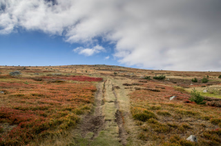
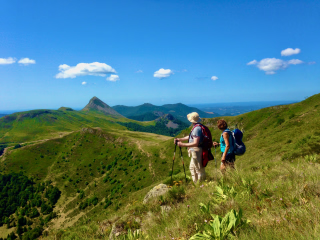
It's time to head towards the highest point of this hike, Raffy, at 1276 meters . The route then offers beautiful views of the volcanic peaks of the Pays du Meygal. After the village of Queyrières nestled beneath its rocky outcrop, and Monedeyres with its "fake" church, the path reaches St Julien Chapteuil and its beautiful church of St Julien with its distinctive bell gable.
Day 18 -
St Julien Chapteuil - Le Puy en Velay (640 m)
- Activity Hiking
- Duration of the activity 4h30
- Distance 20 km
- Positive elevation gain 250 m
- Negative elevation 450 m
- Breakfast included
- Lunch not included
- Dinner not included
We finish this "Le Puy route" with a stage linking St Germain Laprade and its magnificent church, then Brives Charensac before immersing ourselves in this beautiful and large city of Le Puy en Velay with, at its center, the historic quarter and the cathedral, classified as a World Heritage Site by UNESCO.
The stay ended in the afternoon.
Day 19
Note
The times were calculated based on a pace of 300 meters of elevation gain per hour uphill, 500 meters of elevation loss per hour downhill, and 4 km per hour on flat terrain, in order to allow for a comparison of the different hikes on the same basis. They only include actual walking time; all meal breaks, rest stops, or periods of quiet contemplation must be added.
We may need to modify your itinerary if the planned accommodations are unavailable during your travel dates. The alternative accommodations offered will be of a similar category and their location will have minimal impact on your route. Rest assured, these changes are always made in your best interest, for your safety and comfort!
Accommodation
Accommodation options include 2-star hotels, 1-star hotels, bed and breakfasts, hostels, and rooms in private homes, such as artists' houses. In some cases, the shower and toilet may be located on the landing or upstairs. Rooms are not available before 4:00 PM, out of respect for the rest period of the hosts, who are on call early mornings and late evenings. Contact details for the accommodations will be provided with your hiking pack. Please note that dogs are not allowed. The basic package for this self-guided hike includes a double room (for two people) with half-board, including dinner, overnight stay, and breakfast. Dinner on days 1 and 10 is not included, but several restaurants are available in the corresponding towns along the route. A supplement will be charged for a single room. If you require a triple room, please be aware that few accommodations offer this option. The third bed, when available, may be an extra bed, a cot, or a sofa bed. For stages where this is not possible, a supplement per night for a single room will be charged.
In the event of unavailability of accommodation, we may need to arrange two consecutive nights in the same accommodation with a transfer, or change the accommodation category. This will not affect the content of the hike but may incur an additional charge, for which your agreement will be required. Any changes will be detailed in your booking confirmation.
Access
Go to the starting point
Saint Julien en Genvois SNCF train station :
Located on the Bellegarde - St Gervais Les Bains line.
Avoid traveling on weekends or public holidays as SNCF services are much more difficult on these days. SNCF stations near the route: If you would like a personalized itinerary: Seyssel station, Vions station (2 km from Chanaz), Chambéry station (25 km from Yenne, many buses), Pont de Beauvoisin station (10 km from St Genix sur Guiers), Les Abrets station, Virieu station (7 km from Valencogne), Grand Lemps station and St Clair les Roches station.
Bus access : St Julien en Genevois train station and by car access: St Julien en Genevois (France) is accessible via the A40 motorway between Bellegarde and Geneva (10 km).
Access by car : St Julien en Genevois (France) is accessible via the A40 motorway between Bellegarde and Geneva (10 km).
Price details
The price includes
- Organization fees
- Food and accommodation on a half-board basis (except dinners on Days 01, 09 and 10)
- The provision of a complete hiking file
- The provision of the FFRP guidebook
The price does not include
- Luggage transport
- The “solo supplement” if you are travelling alone
- Lunch (except for full board)
- Dinners on Days 1, 9 and 10
- Wine during meals
- Drinks and personal expenses
- All options not included in the price include
- Individual equipment
- Possible visits
- The bus ticket between St Julien en Genevois and Geneva
- Shuttles or taxis to retrieve your car or to shorten certain steps
- The journeys to and from the reception location.
- The different types of insurance: Cancellation and/or Search and Rescue Costs - Assistance - Repatriation - Trip Interruption
- Luggage transport at each stage
- Anything not listed under "Price includes"
Options
- Single room : CHF539.73 / person
- Luggage transfer for 1 person : CHF1’033.72 / person
- Luggage transfer for 2 people : CHF585.47 / person
- Luggage transfer for 3 people : CHF347.62 / person
- Luggage transfer for 4 people : CHF256.14 / person
- Return transfer : CHF548.88 / reservation
- Additional night in Roisey in a single room : CHF118.92 / person
- Additional night in Roisey in a double room : CHF91.48 / person
- Extra night before your stay in Saint-Julien-en-Genevois - Single room : CHF109.78 / person
- Extra night before your stay in Saint-Julien-en-Genevois - Double room : CHF77.76 / person
- Additional night after your stay in Le Puy-en-Velay - Single room : CHF91.48 / person
- Extra night after your stay in Le Puy-en-Velay - Double room : CHF64.04 / person
- I'm coming by train : CHF0.00 / person
- Flex fare and insurance
Practical information
Specific formalities
Specifics
Before your departure, check with the embassy or consulate regarding the entry and stay requirements for your destination country. You can also find this information on the France Diplomatie website ( https://www.diplomatie.gouv.fr/fr/dossiers-pays/ ).
In the case of flights with stopovers operated by different airlines, also check the entry requirements of the countries you are transiting through.
It is your responsibility to ensure that you are in compliance, particularly regarding the validity of your identity documents (
For example, some countries require your passport to be valid for at least six months after your return date. Consider visa requirements, necessary vaccinations, and health recommendations. And don't forget to take into account any customs restrictions and other potential requirements of your destination or transit country.
ℹ️ Information may change up to the departure date, remember to regularly check official websites.
⚠️ For this trip, you must also bring your health insurance card (Carte Vitale). Unlike in France, emergency services are very expensive in Switzerland. Check that you have search and rescue coverage with a sufficiently high limit. In particular, bank card insurance covers repatriation assistance, but basic bank card insurance (and some premium bank cards) does not include search and rescue coverage. Health insurance card (Carte Vitale). European Health Insurance Card (EHIC).
Equipment
Equipment to bring
- 1 backpack of 35/40 litres with a flexible frame, equipped with a waist belt
- A large plastic bag to protect the inside of the backpack
- 1 pair of excellent quality sunglasses with side protection
- A water bottle (1.5 liters minimum)
- 1 Opinel-type pocket knife
- 1 small pouch (preferably waterproof) to hold your money, ID card, health insurance card and assistance contract
- Toilet paper + a lighter to burn it
- Sunscreen + lip balm
- Airtight plastic container (minimum capacity 0.5 liters) + cup + cutlery
- 1 survival blanket
- Camera, binoculars (optional)
- A pair of poles is recommended.
- 1 quick-drying bath towel
- Earplugs or earplugs (optional)
- 1 headlamp or flashlight
Clothing to bring
The 3-layer principle : breathable base layer, warm fleece jacket, waterproof jacket (Gore-Tex type).
Recommended materials : merino wool, synthetic fibers (quick drying, without cotton).
Thermal regulation : Cover up before getting cold, uncover before getting hot (avoid sweating).
Extras (depending on the season) : gaiters, gloves, hat (May-June, Sept.-Oct.).
The ideal list : (to be adapted according to the hike and the season)
- 1 sun hat or cap.
- 1 scarf or neck warmer.
- Short-sleeved T-shirts in breathable material preferred (1 for 2 to 3 days of walking).
- 1 long-sleeved undershirt in breathable material or a shirt.
- 1 fleece fur jacket.
- 1 windproof, waterproof and breathable Gore-Tex type jacket with hood.
- 1 rain cape or a bivvy bag if you own the jacket above.
- 1 pair of loose-fitting trekking trousers.
- 1 pair of shorts or bermudas.
- Hiking socks (1 pair for 2 to 3 days of hiking). Opt for wool or hiking-specific socks. Be careful with cotton as it can cause blisters.
- 1 pair of high-top hiking boots with good ankle support and waterproof soles (Vibram type). Remember to test new shoes and those that haven't been used for a long time beforehand.
- Underwear.
- At the beginning and end of the season (May - June and September - October), it may be useful to also have gaiters, gloves and a hat.