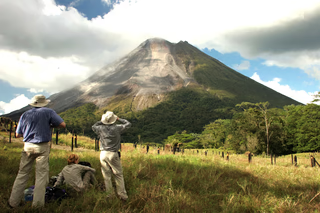
High-altitude trek between Chile and Bolivia, volcanoes and salt flats
In summary
-
Sports
-
Duration22 days
-
LevelIntermediate
-
DestinationAmerica / Chile
-
AgeFrom 14 - 80 years
-
CO₂-Emissions1135.46 kg CO2
-
Type of stayIndependent traveler
-
Languages
 French
In a few words
Embark on a grand Andean loop from Santiago to Santiago , discovering the spectacular landscapes of the Chilean and Bolivian Altiplano . This ambitious journey combines high altitude , vast mineral landscapes, and iconic climbs, all within one of the most breathtaking settings in South America.
The route begins in the Atacama Desert , a true acclimatization zone, where you ascend from 2,000 to 4,000 meters in altitude before crossing the Bolivian border. The legendary Sud Lipez region marks a magnificent start, culminating in the ascent of the Licancabur volcano , a majestic challenge overlooking high-altitude lagoons.
The journey continues through the heart of colorful lagoons , then across the endless expanses of the Salar de Uyuni and Salar de Coipasa , among the largest salt flats in the world. Further north, Sajama National Park offers a new high-altitude landscape before the return to Chile.
From the Andean highlands, a spectacular descent towards the Pacific Ocean concludes this journey, amidst volcanoes, salt flats, and exceptional panoramas. A challenging and immersive trip to the heart of the mythical Andes .
The highlights
-
High-altitude stay. Discover the wonders of the Atacama Desert, including the Tatio geysers
-
Climbing Licancabur volcano / Llama caravan / Cycling on the Uyuni salt flats
-
Trekking in Sajama Park and around Chungara Lake
Photos


Sport
Level
Hiking / Trekking
In figures
Hiking
- Average duration/day: 2h30
- Average distance/day: 5 km
- Average daily elevation gain: 142 m
- Average daily descent: 109 m
Mountaineering
- Average duration/day: 6h
- Average distance/day: 3 km
- Average daily elevation gain: 1205 m
- Average daily descent: 1205 m
- Maximum altitude: 6008 m
MOUNTAIN BIKING
- Average duration/day: 5h
- Average distance/day: 25 km
- Predominant type of terrain : White path
Trekking
- Average duration/day: 4h30
- Average distance/day: 7 km
- Average daily elevation gain: 517 m
- Average daily descent: 517 m
Management
French
All our guides are certified and have been trained in leading groups at altitude for many years.
Program
-
Arrival in Santiago, Chile
- Transportation Bus - 00h30 - 30km
- Accommodation 3-star hotel
- Breakfast included
- Lunch not included
- Dinner not included
Your French-speaking guide will pick you up at Santiago airport and take you to your hotel.
Welcome to Chile!
Day 1 -
Santiago - Calama - San Pedro de Atacama
- Transportation Bus - 01h30 - 130km
- Accommodation 3-star hotel
- Breakfast included
- Lunch not included
- Dinner not included
Your driver will pick you up from your hotel and take you to Santiago airport .
Domestic flight from Santiago to Calama (approximately 2 hours, schedule to be confirmed).
Arrival at Calama airport and transport by private vehicle to the oasis of San Pedro de Atacama in the heart of the desert.
Day 2 -
San Pedro de Atacama - Valley of the Rainbow - Valley of the Moon
- Transportation Bus - 01h - 60km
- Activity Hiking
- Accommodation 3-star hotel
- Breakfast included
- Lunch not included
- Dinner not included
Let's embark on a half-day geology excursion to discover the Rainbow Valley , which, as its name suggests, displays colors born deep within the earth. Northwest of San Pedro, in the Domeyko mountain range , in the Matancilla Valley, you'll find colorful stones, each with its own story. You'll hike through this Wild West landscape, amidst colorful mountains and herds of llamas grazing freely throughout the area.
You're off for a half-day trip to see the Valley of the Moon , located a ten-minute drive from San Pedro de Atacama, which offers breathtaking landscapes. Sculpted by the wind and the few rains of recent millennia, the landscapes of this valley are unique and fascinating.
Short walks on the park's trails. The hike crosses a barren canyon, which nevertheless receives rainwater almost every year during the summer. Throughout the walk, you can admire thick salt deposits and landscapes with reddish hues. At the end of the hike, there's a brief visit to the most popular dune in the Valley of the Moon.
Day 3 -
San Pedro de Atacama - Salar de Aguas Calientes/Piedras Rojas - Miscanti & Miñiques Lagoons
- Transportation Bus - 03h - 220km
- Activity Hiking
- Accommodation 3-star hotel
- Breakfast included
- Lunch included
- Dinner not included
Departure early in the morning for a day across the high plateaus of Atacama , always avoiding the crowds as much as possible to be able to make the most of each place.
On the program: landscapes with spectacular color combinations, rare geological formations, generated by the whims of all the volcanoes that have inhabited this area, lagoons with color variations, a phenomenon explained by its ecosystem and water density, but also some animals, including vicuñas and pink flamingos.
During this exploration, we cross the Tropic of Capricorn on the Inca Trail. We visit Tuyajto Lagoon and the Salar de Talar, also known as Piedras Rojas (the Red Stones), where we can enjoy a well-maintained trail that leads to the lake's edge. Then we head to Miscanti and Miñiques Lagoons .
Return to your hotel in the afternoon.
Day 4 -
San Pedro de Atacama - Tatio Geysers
- Transportation Bus - 03h30 - 160km
- Activity Hiking
- Accommodation 3-star hotel
- Breakfast included
- Lunch not included
- Dinner not included
Early morning departure for the Tatio Geysers .
Located more than four thousand meters above sea level in the Andean altiplano, the Tatio Geysers represent the third largest geothermal field in the world. Warmly equipped, it is early in the morning, when the sun rises, that one can observe a particular phenomenon: the fumaroles of the geysers.
These columns of steam rise from each hot spring. There is a real contrast between the boiling water coming from the geysers and the local temperature, which can be below -20°C in winter.
This visit is not limited to geysers, as on the way back you will also discover the best part of the Altiplano for observing the region's fauna, as well as numerous marshes and peat bogs that offer an exceptional ecosystem, such as the bofedal of the Río Putana , or the bofedal of the village of Machuca .
Return to San Pedro de Atacama before lunch.
The afternoon is free to take the time to stroll and wander through the small streets of San Pedro.
As night falls, you'll head out with an astronomer to the semi-professional observatory of San Pedro de Atacama for an unforgettable session exploring the southern sky, undoubtedly the most beautiful sky in the world. Enjoy two hours of observation in a friendly atmosphere, alternating between explanations from Alain Maury (a passionate astronomer and founder of this observatory) and viewing the site's ten telescopes .
Day 5 -
San Pedro de Atacama - Paso Hito Cajon - Laguna Verde
- Transportation Bus - 01h30 - 75km
- Accommodation Refuge
- Breakfast included
- Lunch included
- Dinner included
Departure from San Pedro. A steep climb onto the altiplano leads you to the border post of Hito Cajón, entry point to the Lipez region in Bolivia .
Arrival at the Hito Cajón border post, entry point to the Lipez region . We arrive in the late morning at Laguna Blanca and Laguna Verde , at the foot of the Juriques and Licancabur volcanoes (5960 m alt.), to witness a curious phenomenon: the wind rises and Laguna Verde takes on a spectacular emerald green hue.
Day 6 -
Ascent of the Licancabur Volcano - Quetena
- Transportation Car - 03h - 140km
- Activity Mountaineering
- Duration of the activity 8h
- Distance 3 km
- Positive elevation gain 1410 m
- Negative elevation 1410 m
- Maximum altitude 5960 m
- Accommodation Staying with a local resident
- Breakfast included
- Lunch included
- Dinner included
We set off at 4 a.m. this morning for an attempt to climb the Licancabur volcano : a 6- to 10-hour hike depending on your fitness level and altitude tolerance. Our driver takes us in a 4x4 to the base of the volcano at 4,550 meters. Our ascent begins by the light of our headlamps. The volcano's flank that we climb is made up of a vast scree slope , and the incredible landscape of the South Lipez region gradually unfolds as the sun approaches.
We are on the border between Bolivia and Chile, and if we reach the summit, we will have crossed into Chile! A surprise awaits us at the top: the center of the crater is occupied by a small lake , the fifth highest lake in the world. Despite its -30°C at night, its water is home to an extremely diverse biomass . We overlook the entire Andes mountain range and enjoy an incredible view of the Bolivian Lipez region and the Chilean Atacama Desert, as well as Laguna Verde and Laguna Blanca, and the nearby Juriques volcano (5,704 m).
After the descent, a little rest before resuming the road through the splendid landscapes of South Lipez, we skirt different lagoons before reaching the village of Quetena .
Day 7 -
Quetena - Uturuncu - Siloli Desert
- Transportation Car - 03h - 100km
- Activity Mountaineering
- Duration of the activity 4h
- Distance 2 km
- Positive elevation gain 1000 m
- Negative elevation 1000 m
- Maximum altitude 6008 m
- Accommodation 3-star hotel
- Breakfast included
- Lunch included
- Dinner included
Early in the morning, from the village of Quetena, we take the road towards the foothills of the Uturuncu volcano , whose name in Quechua means jaguar.
Although its last eruption occurred thousands of years ago, Uturuncu is a volcano, dormant but not extinct, and could awaken at any moment. Some measurements indicate that it is rising by 1 to 2 cm per year.
In a 4x4, we take an old mining track, and the vehicle drops us off at approximately 5,000 meters, though this can vary depending on the snow cover. We're already high up, and you can feel it! We begin the ascent at a leisurely pace, following the track and its gradient of colors ranging from white-ochre to yellow-green. Along the way, we observe fumaroles from which, at times, a whiff of rotten eggs rises. A final push allows us to reach the summit at 6,008 meters, offering us a magnificent panorama of the vast high plateau of the South Lipez. The effort was well worth it!
The ascent takes approximately 4 hours, depending on your pace, followed by 1 to 2 hours for the descent. Although demanding due to the high altitude, the climb of Uturuncu is undoubtedly one of the most accessible in Bolivia.
Return to Quetena for lunch. We then take our 4x4 to reach Laguna Colorada and then at the end of the day to the Siloli desert, where we will spend the night.
Day 8 -
Siloli Desert - Santiago K
- Transportation Car - 04h - 200km
- Accommodation Staying with a local resident
- Breakfast included
- Lunch included
- Dinner included
Today we continue our exploration of the landscapes of South Lipez: the Siloli desert (4700 m altitude), where we discover the famous "stone tree" . Keep your eyes peeled: this area is a favorite haunt of viscachas (Andean rabbits)!
We then follow the Chilean border along the "Route of Jewels," which skirts the Honda, Ch'arkota, Hedionda, and Cañapa lagoons , sanctuaries for three varieties of flamingos. We stop at the viewpoint overlooking the Ollagüe volcano (5,868 m). This still-active volcano also houses one of the highest sulfur mines in the world. We then cross the small Chiguana salt flat , at the foot of the Tomasamil volcano (5,900 m).
We arrived in the afternoon in the small village of Santiago , not far from the salt flats. Our hosts, Justino and Eva, welcomed us into their adobe house, the typical dwelling of the inhabitants of this corner of the Altiplano. Here, everyone is a quinoa farmer, as we are in the heartland of the royal quinoa. In the dry season, everything seems deserted, but when the rains come, the fields are covered with the red, green, or yellow plants of the golden quinoa , the pride of the region.
Day 9 -
Santiago K - Sutullcha
- Activity Hiking
- Duration of the activity 6h
- Distance 10 km
- Positive elevation gain 350 m
- Accommodation Bivouac / Tent
- Breakfast included
- Lunch included
- Dinner included
The low morning light illuminates the Altiplano as we rejoin our herd of llamas , who rose with the sun. They all know that today is a special day, that they won't be grazing peacefully on their mountain as usual. They've seen the equipment waiting; they know we're going to harness them. They resist a little, but with some effort, we finally get their loads in place.
Food, water, camping gear—the logistics are now carried on the backs of our proud llamas. And the trek begins, at the pace they set for us, the pace of the caravans that once connected the Salar to the Pacific coast, the Argentine valleys, and Tarija. In the time of the Incas ? Of course, but our guide Justino also knew these caravans in his childhood, and his eyes light up when he recalls those memories.
The herd needs constant attention; there's always one that wants to stray from the path. We tirelessly herd the animals back onto the trail, answering their grunts with herder's whistles, and using the waraka (the sling) to guide them forward. The whole day unfolds like this, at the tranquil pace of the llamas, who take us back in time in this region where modernity hasn't left much of a mark. As evening falls, the llamas drift off to sleep under the clearest sky in the world while we set up camp .
Day 10 -
Sutullcha - Agencha
- Activity Hiking
- Duration of the activity 6h
- Distance 10 km
- Positive elevation gain 500 m
- Negative elevation 500 m
- Accommodation Staying with a local resident
- Breakfast included
- Lunch included
- Dinner included
The ritual begins again: loading the bags, folding the tents, breakfast for humans and camels. We've become a close-knit team with these animals we know better and better. There's the herd leader, always in front, watching his group with a nervous eye, the plump ones lagging behind, the most affectionate ones…
The hike resumes, the climb is long, but suddenly the horizon opens onto a breathtaking vision: the vast white expanse of the Salar de Uyuni lies before us. We continue towards this other world for the rest of the day, until we reach a village where we spend the night in a real bed. The llamas sleep in their enclosure under the starry sky of the Altiplano.
Day 11 -
Agencha - Isla Pia Pia
- Transportation Bicycle - 05h - 25km
- Activity MOUNTAIN BIKING
- Duration of the activity 5h
- Distance 25 km
- Predominant type of terrain White path
- Accommodation Bivouac / Tent
- Breakfast included
- Lunch included
- Dinner included
We say goodbye to our llama friends, with whom we forged bonds during these two days of shared adventure. But today our mode of transport has changed: we're continuing by bike ! And pedaling towards the Salar, which we'll soon reach and begin crossing.
The feeling is surreal when you're pedaling on this fairly smooth surface, without edges or direction. It's easy to lose your bearings, but luckily our guide will lead us safely to our destination. We gradually move away from the shore and navigate the salt lake between its many islands. We glide and move forward quite quickly, but it's difficult to judge distances.
We arrive in the afternoon at Pia Pia , one of the large islands of the Salar. We can stroll among its tall cacti and pitch our tent for the night. A campfire under the stars awaits us in the middle of the Salar; the night of the Salar and its millions of stars, the absolute silence—we have landed on another planet.
Day 12 -
Isla Pia Pia - Tahua
- Transportation Car - 01h30 - 80km
- Activity Trekking
- Duration of the activity 5h
- Distance 3 km
- Positive elevation gain 850 m
- Negative elevation 850 m
- Accommodation 2-star hotel
- Breakfast included
- Lunch included
- Dinner included
Sunrise over the Salar is an incredible spectacle every morning. The salt sea takes on pink and orange hues, and the cold is biting.
After breakfast, we cross the salt flats, heading north towards the Thunupa volcano , the main Apu of the Salar, its principal deity. According to legend, this sacred mountain gave birth to the Salar, so we will pay homage to it. We climb the magnificently colored volcano to place our coca leaves on its slopes. We enter a cave where mummies , guardians of the mountain, reside, to whom we will, of course, also offer a portion of coca.
We begin our hike at an altitude of 3850 m. We reach the viewpoint at 4700 m after 3 to 4 hours of walking. What a view! We overlook the largest salt flat in the world .
We finally descend and end the day in the small village of Tahua.
The sunset over the salt flats will be incredible!
Day 13 -
Tahua - Santa Ana de Chipayas
- Transportation Car - 04h - 130km
- Accommodation Staying with a local resident
- Breakfast included
- Lunch included
- Dinner included
After the Salar de Uyuni, we head to the Salar de Coipasa , the second largest in the country and the fifth largest in the world. Located at the same altitude as the Salar de Uyuni (3,650 m), the Salar de Coipasa is rarely visited except by antique trucks transporting the extracted salt. It is known to be difficult to cross because it is much wetter than the Salar de Uyuni.
The island is very close. The tracks can be difficult, and even impassable during the rainy season.
The Chipaya Indians are among the few inhabitants of this region. They form a distinct community on the Altiplano, and their language is considered the oldest in the entire Andean world. Their village is scattered across a wide plain, home to only a few thousand people. Access is difficult due to the few, often muddy, tracks that lead there.
The Chipaya people still wear their traditional clothing today : a long grey poncho with black stripes. The women still wear their hair in long braids. Their dwellings are circular mud huts covered with rushes and straw to better retain heat.
The Chipayas will be our guides for a few hours and will teach us how they build their homes in a few hours, how they move sand dunes to sow quinoa, how they survive in this hostile environment far from everything.
We spend the night in Chipaya, within the community.
Day 14 -
Chipaya - Tomarapi
- Transportation Car - 04h - 200km
- Accommodation Hostel
- Breakfast included
- Lunch included
- Dinner included
We cross the Urus country on sandy and always treacherous tracks. Before crossing the Lauca River, as if from nowhere, the most beautiful polychrome chullpas in Bolivia appear (chullpas are the ancient tombs of Aymara lords; pre-Inca era).
We arrive at Sajama Park in the afternoon. We enter the national park via a track which leads us to the village, nestled between the three most imposing volcanoes: Sajama, the highest peak in Bolivia (6542m) and opposite, the twins or Payachatas in Aymara: Parinacota (6348m) and Pomerape (6240m).
Here, the few inhabitants live mainly from livestock farming, so we will come across large herds of llamas, sometimes joined by a few vicuñas and rheas (cousins of the ostrich).
Day 15 -
Sajama - Laguna Sorapata
- Activity Trekking
- Duration of the activity 4h
- Distance 9 km
- Positive elevation gain 600 m
- Accommodation Bivouac / Tent
- Breakfast included
- Lunch included
- Dinner included
In the morning, we head to the geysers . This particularly active area offers a unique spectacle of bubbling pools spread over a few hundred square meters. We can even have fun cooking eggs in this slightly sulfurous water.
From there, we take a path that follows the stream upstream to reach Khasiri Lagoon (4850 m altitude) after a 2.5-hour hike. A lunch break allows us to observe various species of water birds, including giant coots (Ajoya in Aymara) which rarely stray far from their distinctive nests (large floating platforms made of algae and grasses). We are now at the Chilean border!
A final hour's climb is required to reach a plateau where the beautiful Sorapata lagoon is nestled. This magical place, surrounded by impressive sulfur-colored mountains, is ideal for contemplation or short hikes to the surrounding peaks.
We are at the foot of Condoriri Grande (5542m).
Day 16 -
Laguna Sorapata - Sajama - Tomarapi
- Transportation Car - 00h30 - 7km
- Activity Trekking
- Duration of the activity 5h
- Distance 8 km
- Positive elevation gain 100 m
- Negative elevation 700 m
- Accommodation Hostel
- Breakfast included
- Lunch included
- Dinner included
Possibility of climbing to the foot of the Condoriri Grande volcano at 5380m (check with your guide) and up to the pass depending on the snow conditions (5542m).
We skirt around the Sorapata lagoon towards the pass and will not fail to observe the many viscachas (funny little Andean rabbit-squirrel) as well as the medicinal plants still used by the inhabitants of the park.
After an hour's climb, we reach the highest point of our trek (5065 m altitude) in a lunar landscape. With a bit of luck and the keen eye of our guide, we might spot the tracks of the Andean puma on this volcanic soil.
After a short descent, we reach the last lagoon of this trek, Laguna Chiar Khota (5000 m altitude), which we skirt while enjoying exceptional views of the Sajama volcano. We then begin a long descent through impressive colonies of yaretas (millennia-old plants with very slow growth (1 mm/year)).
We find our 4x4 to go to the hot springs and enjoy a well-deserved relaxing bath before reaching the village of Sajama.
Day 17 -
Tomarapi - Tambo Quemado - Paso Chungara - Putre
- Transportation Bus - 02h30 - 150km
- Activity Hiking
- Duration of the activity 3h
- Distance 9 km
- Negative elevation 150 m
- Accommodation 2-star hotel
- Breakfast included
- Lunch included
- Dinner not included
We leave the peaceful village of Sajama and travel by private vehicle to the Tambo Quemado border post.
Arriving at the Chile/Bolivia border, at Paso Chungara, dominated by the imposing Parinacota volcano (6,340 m altitude), we change vehicles and guides.
We begin our trek for the day at the shores of Lake Chungará (4,570 m altitude), before continuing towards the Cotacotani lagoons and the village of Parinacota. Lunch in the village at the end of the hike, then drive to Putre.
Day 18 -
Putre - Arica
- Transportation Minibus - 04h - 150km
- Accommodation 3-star hotel
- Breakfast included
- Lunch not included
- Dinner not included
You leave the Andes for an incredible 3,500-meter descent to the ocean, covering just over 150 km (4 to 5 hours depending on stops). Sights include: stunning views of Nevados de Putre (5,824 m), candelabra cacti along the canyon rim, the terraced fields of Socorama, the Pukará de Copaquilla, the San Geronimo church in Poconchile, as well as geoglyphs and petroglyphs.
Day 19 -
Arica - Santiago - Valparaíso
- Transportation Plane - 02h30 - 2000km
- Accommodation 3-star hotel
- Breakfast not included
- Lunch not included
- Dinner not included
Your driver will take you from your hotel to Arica airport.
Domestic flight from Arica to Santiago (approximately 2.5 hours, schedule to be confirmed).
Your driver will pick you up at Santiago airport and drive you to Valparaíso .
Day 20 -
Valparaiso visit
- Accommodation 3-star hotel
- Breakfast included
- Lunch not included
- Dinner not included
Guided tour of Valparaíso , a UNESCO World Heritage Site, and its historic districts. With its many hills crowned with picturesque houses and warehouses, its steep, narrow streets, its funiculars, and its street artists, the city has a very distinctive identity and atmosphere. Take the opportunity to have lunch at a typical seafood restaurant and visit La Sebastiana, one of Pablo Neruda's houses.
Visit on foot and by public transport.
La Sebastiana is open from Tuesday to Sunday.
Day 21 -
Valparaíso - Santiago
- Transportation Minibus - 01h20 - 110km
- Breakfast included
- Lunch not included
- Dinner not included
Your driver will pick you up from your hotel and take you to Santiago airport .
Day 22
Accommodation


This small refuge, on the shores of Laguna Blanca, offers a perfect alternative for spending the night before climbing the Licancabur volcano. Comfort is basic; there is no heating or hot water. The refuge is equipped with dormitories, with shared bathrooms and toilets.

Lamphaya Lodge Andino offers comfortable rooms with private bathrooms and hot water, as well as a communal dining room warmed by a wood-burning stove and a shared kitchen. This family-run establishment prioritizes impeccable cleanliness, authentic comfort, and a warm welcome in a simple yet elegant setting.

Tayka hotels are a network of community hotels, built 15 years ago, with the aim of enabling village communities to be active participants in their development, by building hotels with tourist appeal, generating jobs and benefits for the inhabitants of the communities.

Jukil Lodge is a community project in Agencha, involving several families working together to bring tourism to this village on the edge of the Salar. The lodge consists of about ten independent bungalows built of adobe and stone. Each has a bedroom and a bathroom. The level of comfort is rustic.


The Chipayas, or Uru Chipayas, are one of the oldest ethnic groups in Latin America and are believed to be descendants of the lost civilization of Tihuanacu. They speak Puquina, a language blended with Quechua and Aymara.
The Chipayas have been settled on the Altiplano since at least 1500 BC. They built the refuge with architecture typical of the culture.

The Tomarapi Ecolodge is a community project. During your stay, you will share and learn more about the local culture and the nature of Sajama Park.
The Tomarapi hostel contributes to the conservation of Sajama's resources and to the social benefit of the families of Suni Uta Choquemarka.
At the inn, the dining room is welcoming with its fireplace and offers a pleasant living space. The food is simple and typical. You will be staying in a double room with a private bathroom.


Access
Go to the starting point
Price details
The price includes
- All services mentioned in the daily inclusions are included.
- French-speaking guide throughout the stay
- French-speaking assistance from our team 24/7 during your stay
- Nights spent in the establishments mentioned or equivalent.
- The domestic flights mentioned in the program
- Meals as indicated on the program
The price does not include
- Flight international round trip
- Cancellation/repatriation/multi-risk insurance
- Meals not mentioned in the daily inclusions (allow €15-25 per person per meal)
- Service not mentioned in the daily inclusions
- Tips (guides, drivers, restaurants)
- Drinks outside of meals
Options
- Flex fare and insurance
Practical information
Specific formalities
Specifics
Before your departure, check with the embassy or consulate regarding the entry and stay requirements for your destination country. You can also find this information on the France Diplomatie website ( https://www.diplomatie.gouv.fr/fr/dossiers-pays/ ).
In the case of flights with stopovers operated by different airlines, also check the entry requirements of the countries you are transiting through.
It is your responsibility to ensure you are in compliance, particularly regarding the validity of your identity documents (for example, some countries require your passport to be valid for at least six months after your return) , visa requirements, necessary vaccinations, and health recommendations. And don't forget to consider any customs restrictions and other potential requirements of your destination or transit country.
ℹ️ Information may change up to the departure date, remember to regularly check official websites.
Equipment
Equipment provided on site
- Floor mat
- Tent
Equipment to bring
- Mountain sleeping bag
- Headlamp with spare batteries
- Walking sticks
- Personal backpack
- Sunscreen
- Hat
- Sunglasses
- Personal pharmacy
- A water bottle (ideally with a filter)
Clothing to bring
- Warm clothes
- Technical clothing
- A waterproof/windproof jacket (Gore-Tex type)
- Walking shoes
- Swimsuit
- Cap