Authentic hiking - In the heart of the Vanoise Glaciers
In summary
-
Sports
-
Duration6 days
-
LevelAdvance
-
DestinationVanoise Massif / Savoy
-
AgeFrom 16 - 80 years
-
CO₂-Emissions47.38 kg CO2
-
Type of stayIn a group
-
Languages
 French
 English
In a few words
Established in 1963 , the Vanoise National Park , France's first national park, is a true sanctuary of unspoiled nature in the heart of the Alps. Covering nearly 500 km² , it reveals spectacular landscapes where high peaks , impressive glaciers , and vast wild spaces intertwine, reaching altitudes of over 3,500 meters .
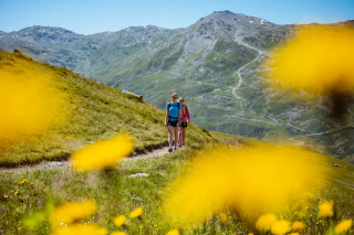
This exceptional territory is home to remarkable biodiversity : over 1,000 species of flowers , approximately 2,000 ibex , 5,000 chamois , not to mention the large alpine birds of prey such as the golden eagle and the bearded vulture . Each hike offers an immersive experience close to this unique flora and fauna.
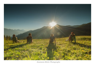
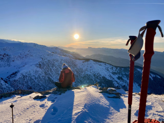
From Aussois , the route crosses the iconic valleys of Savoie , Maurienne , and Tarentaise . From viewpoints to panoramic vistas of snow-capped peaks, each stage offers breathtaking views of glaciers and the Alpine landscape. An authentic journey, punctuated by the daily discovery of a pristine mountain environment.
The highlights
-
Exceptional flora and fauna: ibex, chamois, and unique alpine biodiversity
-
Simplified logistics: A guide takes care of everything, you only carry the essentials.
-
Nights in mountain huts: Mountain atmosphere and local meals for total immersion
Photos


Sport
Level
Hiking / Trekking
The expert's opinion
Level :
- hike of sustained difficulty
- positive elevation gain between 700 and 1000 meters per day
- distance between 10 and 15 km, equivalent to an average of 7 to 8 hours of walking per day
- This route requires excellent physical fitness.
- Prior experience of multi-day mountain hiking is required.
Mountain trails are generally well maintained, although sometimes the route may take off-trail sections.
In figures
Hiking
- Average distance/day: 14 km
- Average daily elevation gain: 750 m
- Average daily descent: 850 m
Management
French
English
Qualified professionals with a passion for the mountains, they will guide you safely . Expert and attentive, they share their knowledge of nature, adapt the pace to your group, and ensure your comfort.
Objective : To provide you with a unique experience, combining the discovery of landscapes, local anecdotes and total disconnection.
Conditions of participation :
- Maximum 6 to 12 participants for optimal supervision.
- Registration is possible from the age of 16 , accompanied by a parent.
These standards guarantee a quality stay .
Program
-
From Aussois to the Refuge de l'Orgère – An alpine getaway between forests and peaks
- Activity Hiking
- Distance 9 km
- Positive elevation gain 850 m
- Negative elevation 500 m
- Accommodation Refuge
- Breakfast not included
- Lunch included
- Dinner included
This hike takes you from the picturesque village of Aussois to the Refuge de l'Orgère, via the Col du Barbier. The route begins with a gradual climb through shady forests, where winding paths lead you to open alpine pastures, offering increasingly expansive views of the surrounding mountains. Upon reaching the Col du Barbier, you'll be rewarded with a 360° panorama, featuring majestic peaks and verdant valleys stretching as far as the eye can see.
The descent to the Refuge de l'Orgère, located at the entrance to the Vanoise National Park, is equally captivating. This refuge, nestled in a pristine natural setting, is the ideal place for a night in the mountains, offering both conviviality and serenity. There, you can enjoy delicious local cuisine, chat with other hikers, and soak up the warm atmosphere before drifting off to sleep under a starry sky.
This stage is an invitation to discover the wild beauty of the Alps, between physical effort and moments of contemplation, for an unforgettable experience in the heart of nature.
Day 1 -
From the Orgère Refuge to the Roc de la Pêche Refuge – A crossing between forests and peaks
- Activity Hiking
- Distance 14 km
- Positive elevation gain 900 m
- Negative elevation 900 m
- Accommodation Refuge
- Breakfast included
- Lunch included
- Dinner included
This stage takes you from the Refuge de l'Orgère to the Refuge du Roc de la Pêche, passing through varied and unspoiled landscapes. The trail initially climbs in switchbacks through a Swiss pine forest before reaching the chalets of L'Estiva, where alpine meadows shelter marmots. The ascent continues towards the Col de Chavière (2,796 m), crossing rocky areas and offering breathtaking views of the surrounding peaks.
The descent then begins on the Tarentaise side, through a scree slope where ptarmigans can be spotted. The path, bordered by the Lauzes stream and then the Doron de Valpremont river, gently guides you towards the Roc de la Pêche Refuge. A night in the mountains, in a natural and welcoming setting, for an authentic experience in the heart of the Alps.
Day 2 -
From the Refuge du Roc de la Pêche to Pralognan-la-Vanoise – Magnificent panoramas
- Activity Hiking
- Distance 14 km
- Positive elevation gain 900 m
- Negative elevation 1400 m
- Accommodation 3-star hotel
- Breakfast included
- Lunch included
- Dinner included
This stage takes you from the Refuge du Roc de la Pêche to Pralognan-la-Vanoise , traversing magnificent alpine landscapes. Shortly after the Pont de la Pêche bridge, the trail climbs steadily towards the Col du Mône pass, before tackling the steeper ascent of the Petit Mont-Blanc (2,677 m) . This summit, marked by gypsum outcrops, offers a unique mineral atmosphere and exceptional panoramic views of the Vanoise glaciers and surrounding peaks.
For the descent, you have two options:
- Via the Col des Saulces , for a gentler and more accessible descent.
- Via the west face of the Aiguille de Mey and the Col de la Grande Pierre , for hikers seeking adventure and technical challenges.
Arriving in Pralognan-la-Vanoise at the end of the day marks the end of this intense stage, between physical effort, breathtaking landscapes and total immersion in alpine nature .
Day 3 -
From Pralognan-la-Vanoise to the Entre Deux Eaux Refuge – Alpine switchbacks and high-altitude lakes
- Activity Hiking
- Distance 13 km
- Positive elevation gain 750 m
- Negative elevation 600 m
- Accommodation Refuge
- Breakfast included
- Lunch included
- Dinner included
This stage begins with a cable car ride up Mont Bochor (2,010 m) , offering breathtaking views of the alpine landscape right from the start. Once at altitude, the trail climbs gradually towards the Col de la Vanoise (2,517 m) , passing alongside the Lac des Vaches and Lac Long . These high-altitude lakes, with their turquoise waters and surrounded by stark, mineral landscapes, create a unique atmosphere, typical of the high peaks.
Upon reaching the pass, the descent begins gently, traversing open and unspoiled landscapes. The route passes by Lac Rond and Lac du Col de la Vanoise , where the reflections of the mountains mingle with the calm waters. The view then opens onto the Leisse valley , a wild and pristine setting, before crossing the stream of the same name.
A final climb leads to the Refuge d'Entre Deux Eaux , where you'll spend the night in a warm and welcoming atmosphere. This refuge, nestled in the heart of the Alps, is the ideal place to rest after a day of hiking, surrounded by breathtaking scenery and tranquility.
Day 4 -
From the Entre Deux Eaux Refuge to the Arpont Refuge – A crossing between lakes and ibex
- Activity Hiking
- Distance 12 km
- Positive elevation gain 600 m
- Negative elevation 400 m
- Accommodation Refuge
- Breakfast included
- Lunch included
- Dinner included
This stage begins with a return along the trail taken the previous day, before branching off towards the Lozières lakes , a site of particularly remarkable geology. The mineral landscapes and rock faces offer a spectacular setting, while the ibex , often seen nearby, add a touch of wildlife to this alpine crossing.
We then begin the two-day trek back to our starting point. The afternoon is punctuated by short ascents and descents , traversing scree slopes, moraines, and streams, for a varied and dynamic experience. A final descent through rocky scree leads us to the Refuge de l'Arpont , where we will spend one last night in the mountains.
This refuge, located in a preserved setting and surrounded by magnificent landscapes, is the ideal place to rest after a day full of emotions and discoveries.
Day 5 -
From the Arpont Refuge to Aussois – A beautiful finale between peaks and valleys
- Activity Hiking
- Distance 17 km
- Positive elevation gain 500 m
- Negative elevation 1300 m
- Accommodation Refuge
- Breakfast included
- Lunch included
- Dinner not included
For this final stage, the Dent Parrachée invites us to skirt around it, offering a varied and spectacular route. After passing near the Saint-Laurent Chapel , we cross the Combe d'Enfer , a place steeped in history and characterized by its stark, mineral landscapes. The balcony path, clinging to the slopes of the Dent Parrachée, reveals breathtaking views of the Maurienne Valley and the Thabor massif. On the horizon, the iconic silhouettes of La Meije, the Écrins, and the Albaron come into view, adding a touch of wonder to this final day.
The descent from La Turra is gentle, traversing open and unspoiled landscapes. In the late afternoon, we reach the heights of Aussois , where civilization welcomes us after this alpine adventure. This stage marks the end of the trek, a time of exertion, contemplation, and satisfaction , with our heads full of memories and magnificent landscapes etched in our minds.
Day 6
Note
The route may be adapted at any time by the instructor, depending on the weather or the technical and physical level of the participants.
Accommodation
Access
At the end of the trip, the return to the village of Aussois is scheduled for late afternoon. The return time is approximate : if you have a train or plane to catch, please allow extra time.
Go to the starting point
By train 🚆
- Modane SNCF station (~8 km from Aussois) → served by TGV & international trains (Paris, Lyon, Turin) .
- From Paris to Modane by TGV: ~4 h.
🚌 Bus to finish the journey to Aussois
- From Modane train station, take the S52 regional bus to Aussois (frequent stops),
- or taxi / ride-hailing service (~10–15 min drive).
✈️ Lyon Saint-Exupéry (LYS)
- Then :
- 🚆 Train Lyon Part-Dieu → Modane (~2h)
- 🚌 Bus Modane → Aussois (~20 min)
- or 🚗 Car rental (~2.5 hours)
✈️ Geneva (GVA)
- Many international flights
- Then by car (~2h30) or train via Chambéry → Modane
By car 🚗
- A43 motorway towards Turin → take exit no. 30 (Modane/Haute Maurienne Vanoise) .
- Then follow the D1006 departmental road to Modane .
- In Modane, turn onto the D215 towards Aussois (~7 km).
This is the most direct access from Lyon/Chambéry/Turin.
The Parking Pied de Pistes is free all year round.
Alternative parking options:
- The Croix parking lot is also free.
Price details
The price includes
- The logistical organization of the stay
- The stay will be supervised by a mountain guide specializing in mid-mountain activities.
- Nights in mountain huts with half-board (mixed dormitory)
- Meals from lunchtime on Day 1 to lunchtime on Day 6
The price does not include
- The route to get to the starting point of the hike
- Drinks and personal expenses (bring cash)
- Anything not listed under "Price includes"
Options
- Flex fare and insurance
Practical information
Specific formalities
Specifics
During the hike, you must have the following documents in your possession:
• Valid identity card or passport.
• Health insurance card.
• Your travel insurance leaflet received upon registration (if you purchased this insurance through our offices) or your personal insurance (contract number + telephone number).
Equipment
Equipment to bring
⚠️ Importance of choice : Your equipment directly influences the success of your stay.
Weight = key criterion : Find the right compromise between weight and comfort .
👟 High-top hiking boots :
- Suitable for trekking: good ankle support .
- New? → Wear them first to break them in .
- Blisters? → Talcum powder on dry feet + shoes in the morning.
🎒 Backpack :
- Volume 40L (allow space for a picnic).
- Rain tip : Protect your belongings with a plastic bag (like a garbage bag) inside the bag.
Bag weight :
- Optimize each item : "Will I use it every day?"
- Tips :
- Pack it down as much as possible.
- Smaller bag = better balance → reduced feeling of weight.
Others :
- Telescopic poles
- Minimum 2L water bottle
- Pocket knife and spork-type fork
- Flashlight or headlamp
Clothing to bring
🔹 Weather conditions :
Conditions can be changeable → Opt for thin, layerable garments rather than one thick garment.
Stay dry in all circumstances.
Preferred textiles :
- Avoid cotton (heavy, cold, slow to dry).
- Prefer :
- Synthetic technical textiles.
- Merino wool (warm, quick-drying, odorless).
Clothing & Accessories :
- Breathable T-shirts (long and short sleeves)
- Lightweight fleece-type jacket
- Warm down-type jacket
- Gore-tex type waterproof jacket
- Rain cape
- Hiking pants
- Gore-tex type waterproof trousers
- Shorts
- Hiking socks
- Hat or cap
- Cap
- Pair of gloves
- Change of clothes at your convenience
- Sunglasses (minimum category 3), sunscreen, lip balm
- Optional : camera, binoculars, etc.
- Bag sheet
- Toiletries bag, earplugs and toilet paper
- Limited personal pharmacy (Compeed-type second-skin plasters, medications for common ailments: diarrhea, constipation, sore throat, headache, pain, allergies)
- A little laundry soap
⚠️ Note : The guide has a first aid kit .