Alpine hiking in the Chartreuse mountains: between ridges and exposed passages
In summary
-
Sports
-
Duration6 days
-
LevelAdvance
-
DestinationChartreuse Mountains / Isère
-
AgeFrom the age of 18
-
CO₂-Emissions79.32 kg CO2
-
Type of stayIn a group
-
Languages
 French
In a few words
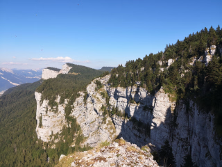
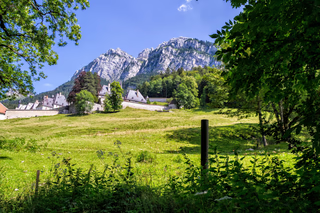
Embark on a journey to conquer the vertiginous trails and wild ridges of the Chartreuse Mountains during an active holiday in the heart of a protected environment. This territory of steep limestone cliffs offers an ideal playground for lovers of challenging hikes , alternating between exposed sections and less-traveled routes. Between iconic peaks and hidden paths, this adventure immerses you in the soul of an authentic mountain, far from the hustle and bustle. Immersed in the nature reserve , you will discover a raw and unspoiled landscape, shaped by time and the elements. A unique trip for mountain enthusiasts seeking thrills and breathtaking scenery .
The highlights
-
Discover the Chartreuse Natural Park, with its most beautiful sites
-
The wild atmosphere of the Hauts de Chartreuse Nature Reserve
-
Professional supervision: Trip accompanied by an experienced guide
Photos


Sport
Level
Hiking / Trekking
In figures
Hiking
- Average duration/day: 5h
- Average distance/day: 12 km
- Average daily elevation gain: 1055 m
- Average daily descent: 962 m
Management
French
State-certified mountain guide, specialist in the Chartreuse mountains.
As a mountain professional, he is committed to:
- Manage the progress of your hike in the best possible way and in complete safety: choice of route, pace of progression, logistics, health, adaptation to weather hazards and snow conditions.
- To ensure the dynamics and cohesion of the group.
- To make it easier for you to approach the mountain environment and to passionately share its knowledge of nature with you.
- To be available and attentive to your needs.
Program
-
Welcome
- Activity Hiking
- Duration of the activity 4h
- Distance 9 km
- Positive elevation gain 780 m
- Negative elevation 720 m
- Accommodation Cottage
- Breakfast not included
- Lunch included
- Dinner included
Meet at Chambéry Challes Les Eaux station (main exit) at 10:45 am if you are coming by train (transfer on reservation at registration) or directly at the parking lot of the town centre of Entremont le Vieux (73) at 11:30 am if you are coming by car.
Equipped with your hiking gear , we head to the hamlet of Grand Carroz , the starting point of our adventure.
For our first group picnic, in addition to our own preparations, we would appreciate it if each participant brought a specialty from their home region, so we can begin the hike with some fruitful cultural exchanges. It's time to start our first hike, which will take us towards the Crêtes de la Drière.
Back to our first accommodation in the Entremont valley (group gîte accommodation).
Elevation gain: +780 m, -720 m
Length: 9 km
Time: 4:00 AM
Day 1 -
At the summit of Granier
- Activity Hiking
- Duration of the activity 6h
- Distance 13 km
- Positive elevation gain 1000 m
- Negative elevation 1000 m
- Accommodation Cottage
- Breakfast included
- Lunch included
- Dinner included
The second hike takes us to the summit of Granier. It's a scenic route that forms a loop to reach the summit and offers a 360° panoramic view.
During the hike, you will discover this magnificent and wild world.
Return to group accommodation.
Elevation gain: +1000 m, -1000 m
Length: 13 km
Time: 6 a.m.
Day 2 -
Le Pinet
- Transportation Minibus - 00h20 - 15km
- Activity Hiking
- Duration of the activity 5h
- Distance 17 km
- Positive elevation gain 1300 m
- Negative elevation 1300 m
- Accommodation Cottage
- Breakfast included
- Lunch included
- Dinner included
For this new hike, we're heading towards one of the more secluded peaks of the Chartreuse: Le Pinet.
Via the Alpette pass we reach the summit and cross the plateau of the nature reserve and complete a beautiful loop in the high-altitude pastures shaped by man and nature.
A beautiful and challenging hike in a unique and still unspoiled setting.
Short transfer to the gîte in St Pierre de Chartreuse.
Elevation gain: +1300 m, -1300 m
Length: 17 km
Time: 6 a.m.
Day 3 -
The Great Summit
- Transportation Minibus - 00h15 - 10km
- Activity Hiking
- Duration of the activity 6h
- Distance 15 km
- Positive elevation gain 1500 m
- Negative elevation 1000 m
- Accommodation Cottage
- Breakfast included
- Lunch included
- Dinner included
Starting from St. Pierre de Chartreuse, after a short minibus transfer, the day revolves around the ascent of an iconic peak in the Chartreuse massif: Le Grand Som via the Pas du Loup. Depending on the group's fitness level, your guide can easily adapt and suggest reaching the summit of Le Petit Som. Enjoy magnificent panoramic views before descending back to St. Pierre de Chartreuse.
Accommodation in a gîte d'étape (stopover hostel).
Elevation gain: from +1000 m to +1500 m depending on the summit reached -1000 m
Length: 15 km
Time: 6 a.m.
Day 4 -
The Dent de Crolles
- Transportation Minibus - 00h30 - 20km
- Activity Hiking
- Duration of the activity 5h
- Distance 10 km
- Positive elevation gain 950 m
- Negative elevation 950 m
- Accommodation Cottage
- Breakfast included
- Lunch included
- Dinner included
From St Pierre de Chartreuse, we reach the Col du Coq for an unusual hike towards the Dent de Crolles and the Bellefont mountain range. A wild and exposed route on the southern edge of the Hauts de Chartreuse nature reserve. A beautiful loop allowing us to return to the starting point.
Short transfer to the Col de Porte for accommodation in a gîte or hotel.
Elevation gain/loss: +950 m, -950 m Length: 10 km Time: 5 hours
Day 5 -
Chamechaude
- Transportation Minibus - 00h30 - 15km
- Activity Hiking
- Duration of the activity 4h
- Distance 7 km
- Positive elevation gain 800 m
- Negative elevation 800 m
- Accommodation Cottage
- Breakfast included
- Lunch included
- Dinner included
You must climb to the iconic summit of the Chartreuse mountains: Chamechaude, reaching 2082 meters to admire the extraordinary view to the south, the Belledonne range, and the Vercors. This round trip loop offers a beautiful and accessible hike. The hikes of the last two days may differ from the stages described, depending in particular on the weather conditions, but their appeal remains undiminished.
In the late afternoon, return to your home or to Chambéry train station by 6 p.m.
Elevation gain: +800 m, -800 m
Length: 7 km
Time: 4 a.m.
Day 6
Note
The times were calculated based on a pace of 300 meters of elevation gain per hour uphill, 500 meters of elevation loss per hour downhill, and 4 km per hour on flat terrain, in order to allow for a comparison of the different hikes on the same basis. They only include actual walking time; all meal breaks, rest stops, or periods of quiet contemplation must be added.
We may sometimes need to slightly modify the indicated itinerary: either due to organizational issues (overbooked accommodations, splitting groups, changes in trail conditions, etc.) or directly at the guide's discretion (weather, group level, etc.). Rest assured, these modifications are always made in your best interest, for your safety and comfort!
Access
Day 07 around 5:00 PM at the Entremont le Vieux parking lot, or at 6:00 PM at the Chambéry Challes Les Eaux train station with minibus transfer, to be booked at registration.
You can possibly reach Grenoble train station by bus from Col de Porte with line 62.
Return train: Chambéry Challes Les Eaux train station
Return by car: If you came by car, a minibus will take you back to the car park in the village of Entremont le Vieux.
Go to the starting point
Train access: Chambéry Challes Les Eaux train station
Access by car: parking lot in the centre of the village of Entremont le Vieux (73)
Route: www.viamichelin.fr
Price details
The price includes
- Organization and supervision costs
- Full board
- Shared dormitory accommodation
- The transfers planned in the program
- Luggage transport at each stage
The price does not include
- Drinks and personal expenses
- Personal equipment
- The journeys to and from the reception location.
Options
- Round-trip transfer from Chambéry train station : CHF27.44 / person
- Flex fare and insurance
Practical information
Specific formalities
Specifics
During the hike, you must have the following documents in your possession:
- Valid identity card or passport
- Your travel insurance leaflet received upon registration (if you purchased the insurance we offer) or your personal insurance (contract number + telephone number)
- Health insurance card
Equipment
Equipment to bring
- 1 backpack of 35/40 litres with a flexible frame, equipped with a waist belt
- 1 large plastic bag to protect the inside of the backpack
- 1 pair of sunglasses
- 1 water bottle (1.5 liters minimum)
- 1 Opinel-type pocket knife
- 1 small pouch (preferably waterproof) to hold your money, ID card, health insurance card and assistance contract
- Sunscreen + lip balm
- A pair of poles is recommended.
For the evening at the accommodation:
- 1 sleeping bag liner
- 1 pair of comfortable trousers
- 1 pair of lightweight casual shoes
- 1 headlamp or flashlight
Clothing to bring
For the upper body, the 3-layer principle allows you to manage almost all situations:
- A long-sleeved undershirt made of breathable material (hollow fiber)
- A warm fleece jacket
- A windproof, waterproof, and breathable jacket
The ideal list: (to be adapted according to the hike and the season)
- 1 sun hat or cap
- 1 scarf or neck warmer
- Short-sleeved T-shirts made of breathable material are preferable.
- 1 long-sleeved base layer in breathable material or a shirt
- 1 fleece jacket
- 1 windproof, waterproof and breathable Gore-Tex type jacket with hood
- 1 rain cape or a bivvy bag if you own the jacket above
- 1 pair of loose-fitting trekking trousers
- 1 pair of shorts or bermudas
- 1 pair of high-top hiking boots that provide good ankle support and are waterproof. We do not recommend low-cut shoes.