The Grand Tour of Chartreuse at Your Own Pace
In summary
-
Sports
-
Duration7 days
-
LevelConfirmed
-
DestinationChartreuse Mountains / Isère
-
AgeFrom 12 - 90 years
-
CO₂-Emissions82.14 kg CO2
-
Type of stayIndependent traveler
In a few words
The Grand Tour of Chartreuse at Your Own Pace: an alpine adventure at your own pace
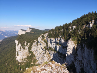
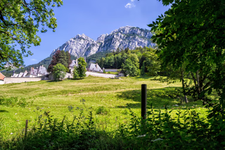
Discover the Chartreuse massif, a true haven of nature in the heart of the Alps! Between deep forests, verdant alpine pastures and breathtaking panoramas, this independent stay promises an unforgettable immersion in the Chartreuse Regional Natural Park.
A hike tailored to your preferences
Explore the mountains at your own pace with itineraries that can be adapted to your fitness level, preferences, and the weather. With an average of 4 to 5 hours of walking per day, enjoy accessible hikes without any particular technical difficulty, while discovering exceptional landscapes. Each stage offers alternative routes to customize your trip. At lunchtime, take a break surrounded by nature and savor the picnic prepared by your host, overlooking the magnificent Chartreuse scenery.
Comfort and relaxation guaranteed.
After a beautiful day of hiking, return to the comfort of your accommodation to rest and enjoy the tranquility of the mountains.
An adventure in complete freedom!
Whether you're a couple, a group of friends, or a family, enjoy an authentic experience combining discovery, relaxation, and the pleasure of hiking. The Grand Tour of Chartreuse invites you to explore a pristine mountain range at your own pace and in close contact with nature.
The highlights
-
The freedom to choose your route every day.
-
Easy access from Chambéry train station.
-
The discovery of the unsuspected Chartreuse mountain range.
Photos


Sport
Level
Hiking / Trekking
The expert's opinion
The walking pace is slow and steady, with a focus on discovery rather than physical exertion. In case of minor difficulties, it will always be possible to join the group in the evening using the support vehicle that transfers luggage (the cost of this transfer is your responsibility).
You are able to navigate using a map and simple directions. An easy-to-use app with tracks will be provided.
This route is undertaken at your own risk, without a guide. It is important to monitor the weather forecast by calling 08.99.71.02.73 for Savoie and 08.99.71.02.38 for Isère.
Average elevation gain: 640 m Maximum elevation gain: 830 m
Average length: 13 km Maximum length: 17 km
Average time: 5 hours Maximum: 6 hours
In figures
Hiking
- Average duration/day: 5h
- Average distance/day: 14 km
- Average daily elevation gain: 642 m
- Average daily descent: 682 m
- Maximum altitude: 2082 m
Management
Program
-
Welcome
- Accommodation 2-star hotel
- Breakfast not included
- Lunch not included
- Dinner included
This trip is a self-guided, independent hiking tour. You will discover the Chartreuse mountain range stage by stage. You will arrive at your first accommodation in St Pierre d'Entremont (38) in the late afternoon.
You will be greeted by your host who will give you the travel documents.
Check-in and dinner.
Day 1 -
The Saint-Même circus
- Activity Hiking
- Duration of the activity 4h
- Distance 12 km
- Positive elevation gain 550 m
- Negative elevation 550 m
- Maximum altitude 1210 m
- Accommodation 2-star hotel
- Breakfast included
- Lunch included
- Dinner included
Depending on your accommodation, enjoy a beautiful day of hiking around the famous waterfalls of the Cirque de Saint-Même, a unique and unspoiled spot in the Chartreuse mountains. The waterfalls mark the natural border between Savoie and Isère, the former province of Dauphiné.
Route 1:
From Saint-Pierre-d'Entremont, a beautiful hike leads to the famous waterfalls, with a loop trail to reach the upper falls and discover this exceptionally scenic spot up close. The descent follows the other side of the stream back to the village. Visit the Natural Park visitor center, with its relief map of the massif and its exhibition of crafts by local artisans from the Chartreuse region. A free visit not to be missed!
Route 2:
From the Cirque de Saint-Même, embark on a nature adventure through the villages of the valley. Pass through the hamlet of Teppaz, home to Peterpan, the last woodturner in the massif. If he's open, discover his treasure trove and his creations made from local wood. Descend along the mule track to Saint-Pierre-d'Entremont, then climb back up to your accommodation. Don't miss the chance to try the local bread in Saint-Même-d'en-Haut!
Note: Saint-Pierre-d'Entremont, straddling the Savoie and Isère departments, offers a beautiful mountain atmosphere. Discover its artisans, charcuterie, cheese affineur, and renowned pastry shop. A wonderful opportunity to extend your exploration with a tasting!
12 km, + 550m / - 550m, 4 hours of walking
Day 2 -
The Ruchère pass and the Grande Chartreuse monastery
- Transportation Minibus - 00h20 - 12km
- Activity Hiking
- Duration of the activity 5h
- Distance 13 km
- Positive elevation gain 600 m
- Negative elevation 750 m
- Maximum altitude 1235 m
- Accommodation 2-star hotel
- Breakfast included
- Lunch included
- Dinner included
For this day, three routes allow you to discover the Great Chartreuse Forest and the world of the Carthusians, who have been settled in the massif for over 900 years.
After a short transfer by minibus to La Ruchère, organised by the team, meet at 9am in front of your accommodation or in the parking lot of the village school.
Route 1:
From La Ruchère, cross the pass of the same name, then descend via the Habert de Billon, the monks' summer pasture, high above the Grande Chartreuse Monastery. Continue to La Correrie to visit the museum, then reach your accommodation in Saint-Pierre-de-Chartreuse via the GR de Pays hiking trail.
13 km, + 600m / - 750m, 5 hours of walking
Route 2:
From La Ruchère, reach the summit of Petit Som via the Col de Leschaux. A beautiful climb offering exceptional panoramic views of the monastery. Descend via the chapel circuit, the site where the monks settled in 1084, then visit the museum before returning to your accommodation.
14 km, + 800m / - 950m, 5h30 walk
Route 3:
From La Ruchère, cross the Col de la Ruchère, gateway to the Carthusian monastery's silent zone. Continue through the Grande Forêt to the chapels of Notre-Dame-de-Casalibus and explore the monastery. Visit the museum before reaching Saint-Pierre-de-Chartreuse. This is the easiest route.
12 km, +550m / -750m, 4h30 walking time
Day 3 -
The Porte pass
- Activity Hiking
- Duration of the activity 5h
- Distance 13 km
- Positive elevation gain 650 m
- Negative elevation 100 m
- Maximum altitude 1523 m
- Accommodation 2-star hotel
- Breakfast included
- Lunch included
- Dinner included
Your hike allows you to discover the large village of Saint-Pierre-de-Chartreuse, then the church of Saint-Hugues. This collection of contemporary sacred art is unique, since it was entirely decorated and furnished by the same artist.
The route takes you through the vast forest, past the Emeindras chalets, at the foot of the Chamechaude summit. You then reach the Col de Porte, where you will be welcomed at a mountain inn.
Please note: the Museum of Contemporary Sacred Art is closed on Tuesdays.
13 km, + 650m / - 100m, 5 hours of walking
Day 4 -
The summit of Chamechaude
- Activity Hiking
- Duration of the activity 5h
- Distance 11 km
- Positive elevation gain 800 m
- Negative elevation 800 m
- Maximum altitude 2082 m
- Accommodation 2-star hotel
- Breakfast included
- Lunch included
- Dinner included
Your day allows you to discover the southern part of the Chartreuse massif and to fly towards the ascent of its highest peak, the Pointe de Chamechaude.
Even today, several hiking options are available to you, depending on your desires and your level.
Route 1: The ascent of Chamechaude
From your accommodation, embark on a beautiful and challenging hike to the highest peak in the massif. Part of the route is an out-and-back, but the effort is more than rewarded with an exceptional 360° view encompassing the Alps, the Vercors, Mont Blanc, and even the Jura Mountains. A truly breathtaking panorama!
11 km, + 800m / - 800m, 5 hours of walking
Route 2: Hike on the Montfromage ridges
From your accommodation, immerse yourself in the heart of the Great Chartreuse Forest, a designated Exceptional Forest, with its remarkable trees. You'll quickly reach the ridge and continue your hike between two valleys, enjoying beautiful panoramic views of the massif's landscapes. At the Orgeval oratory, descend gently towards the Col de Porte pass, following forest paths and the old access road to the Charmant Som peak.
12 km, + 600m / - 600m, 4 hours of walking
Optional: The ascent of Charmant Som
To extend this day, you can reach the summit of Charmant Som by continuing route 2 from the Orgeval oratory to the parking lot, then making an additional loop (4 km, +250 m / -250 m, 2 additional hours).
Day 5 -
Return to Saint-Pierre-de-Chartreuse
- Activity Hiking
- Duration of the activity 6h
- Distance 16 km
- Positive elevation gain 650 m
- Negative elevation 1090 m
- Maximum altitude 1230 m
- Accommodation 2-star hotel
- Breakfast included
- Lunch included
- Dinner included
From the Col de Porte, the return to Saint-Pierre-de-Chartreuse is via a wild path, passing through the slabs of the Charmant Som, up to the village of Saint-Pierre-de-Chartreuse.
16 km, +650m / -1090m, 6 hours of walking
Day 6 -
The Cucheron pass and the Saint-Philibert valley
- Activity Hiking
- Duration of the activity 5h
- Distance 14 km
- Positive elevation gain 600 m
- Negative elevation 800 m
- Maximum altitude 1327 m
- Breakfast included
- Lunch included
- Dinner not included
This final stage allows you to return to your starting point via the pretty Cucheron pass and to reach, via a gentle slope, the village of Saint-Pierre-d'Entremont.
Your luggage will be available in the village, at the Tourist Office, or at your first accommodation. The trip ends in the afternoon.
If you wish to stay an extra night in the mountain range, please contact us so that we can offer you suitable accommodation.
14 km, + 600m / - 800m, 5 hours of walking
Day 7
Note
The times were calculated based on a pace of 300 meters of elevation gain per hour uphill, 500 meters of elevation loss per hour downhill, and 4 km per hour on flat terrain, in order to allow for a comparison of the different hikes on the same basis. They only include actual walking time; all meal breaks, rest stops, or periods of quiet contemplation must be added.
We may sometimes need to slightly modify the indicated itinerary: either due to organizational issues (overbooked accommodations, splitting groups, changes in trail conditions, etc.). Rest assured, these modifications are always made in your best interest, for your safety and comfort!
A transfer to the village of La Ruchère will take place on day 03 in the morning at 9 a.m. in front of your accommodation to reach the start of your hike.
All other journeys are made on foot.
Luggage transported by us via vehicle.
You only carry one bag containing your belongings for the day and the provided lunch, which is divided among everyone.
During the week, we ask that you have one piece of luggage per person, not too bulky (10 kg maximum).
We absolutely disclaim all responsibility in the event of damage to any fragile item (laptop, for example).
- Bring a pair of very light shoes for the evening (sandals).
- For your toiletry bag, prioritize the essentials, small sizes, samples and travel kits.
- Plan for a hiker.
Accommodation
You will be accommodated in comfortable guest rooms or in a 2-star mountain hotel.
The contact details for the accommodations will be provided with your hiking pack.
In order to respect the rest time of the hosts, the rooms are accessible from 4 p.m.
Dogs are not allowed.
The stay is offered on a full board basis, including dinner, overnight stay, breakfast and picnic lunch.
Access
Welcome :
Day 1, late afternoon at your first accommodation in St Pierre d'Entremont (38).
Accommodations are available for check-in between 5pm and 7pm.
If you are arriving late: On the day itself, in case of a last-minute delay, please contact us.
Dispersion:
Day 07 around 5pm in St Pierre d'Entremont.
Go to the starting point
Chambéry Challes Les Eaux train station
A regular S04 bus line departs from Chambéry bus station towards St Pierre d'Entremont (1 hour journey). Find out more at www.cars-region-savoie.fr or by calling 09.70.83.90.73.
For taxi transfers, contact TARDY Taxis at 06.60.36.05.59
Entremont Valley Tourist Office.
Route: www.viamichelin.fr
To go from Chambéry to St Pierre d'Entremont: From the A41 motorway north of Chambéry, take the direction "Massif de la Chartreuse" via the D912. Cross the Col du Granier and descend to St Pierre d'Entremont.
To get from Lyon to St Pierre d'Entremont: Leave the A43 motorway (Lyon-Chambéry), exit 10 (Les Abrets). Follow signs for Massif de Chartreuse via Pont de Beauvoisin (D82) and Les Echelles (D1006). Then take the road to St Pierre d'Entremont (D520c).
You can park your vehicle without worry in one of the village car parks, with the exception of the one at the Tourist Office (market on Saturdays).
Price details
The price includes
- Organization and logistics costs.
- Full board food and accommodation.
- The transfers planned in the program.
- Luggage transport at each stage.
- A visit to the Correrie Museum (Monastery of the Grande Chartreuse).
- Picnics.
- Tourist taxes.
The price does not include
- Drinks and personal expenses.
- Personal equipment.
- The journeys to and from the reception location.
- The different types of insurance
- Anything not mentioned under "Price includes".
Options
- Single room supplement : CHF219.55 / unit
- Additional night with half-board, in a double room, in Saint-Pierre-d'Entremont : CHF90.57 / person
- Additional night with half-board, in a single room, in Saint-Pierre-d'Entremont : CHF136.31 / unit
- Single traveler supplement : CHF54.89 / person
- Flex fare and insurance
Practical information
Specific formalities
Specifics
During the hike, you must have the following documents in your possession:
- Valid identity card or passport.
- Your travel insurance leaflet received upon registration (if you purchased the insurance we offer) or your personal insurance (contract number + telephone number).
- Health insurance card.
Equipment
Equipment provided on site
- Travel file
- Application with GPS tracking
- We recommend that you equip yourself with an additional battery for GPS navigation, which consumes a lot of battery power.
Equipment to bring
Equipment :
- 1 backpack of 35/40 litres with a flexible frame, equipped with a waist belt.
- A large plastic bag to protect the inside of the backpack.
- 1 pair of excellent quality sunglasses with side protection.
- a water bottle (1.5 liters minimum).
- 1 Opinel-type pocket knife.
- 1 small pouch (preferably waterproof) to put your money, identity card, health insurance card and assistance contract in.
- Sunscreen + lip balm.
- Camera, binoculars (optional).
- A pair of poles is recommended.
For the evening at the accommodation:
- 1 swimsuit (optional).
- 1 pair of comfortable trousers.
- 1 pair of lightweight casual shoes.
- Toiletries (opt for the essentials, small sizes, samples and travel kits).
- 1 quick-drying bath towel.
- Earplugs or ear pads (optional).
- 1 headlamp or flashlight.
Personal pharmacy:
- A tick remover.
- Your usual medications.
- Elastic adhesive strip, Elastoplast type, 8 cm wide.
- Sets of adhesive bandages + disinfectant compresses.
- Double skin (like Compeed or SOS blisters).
- 1 pair of tweezers.
Clothing to bring
The principles:
For the upper body, the 3-layer principle allows you to manage almost all situations:
- A long-sleeved undershirt made of breathable material (hollow fiber).
- A warm fleece fur jacket.
- A windproof, waterproof and breathable Gore-Tex type jacket.
When hiking in calm, sunny weather, a base layer may be sufficient. In rain, snow, or wind, simply add a waterproof jacket. In very cold weather or during breaks, a fleece jacket is an essential addition.
Choose quick-drying clothes, so avoid cotton. Opt for wool (merino wool underwear is comfortable and doesn't develop unpleasant odors), silk, and synthetic fibers that will keep you dry and warm for as long as possible.
The ideal list: (to be adapted according to the hike and the season)
- 1 sun hat or cap.
- 1 scarf or neck warmer.
- Short-sleeved T-shirts made of breathable material are preferable.
- 1 long-sleeved undershirt in breathable material or a shirt.
- 1 fleece jacket.
- 1 windproof, waterproof and breathable Gore-Tex type jacket with hood.
- 1 rain cape or a sleeping bag liner
- 1 pair of loose-fitting trekking trousers.
- 1 pair of shorts or bermudas.
- 1 pair of high-top hiking boots with good ankle support and waterproof soles (Vibram type). Remember to test new shoes and those that haven't been used for a long time beforehand.