Trekking through the Vanoise glaciers, between peaks and valleys
In summary
-
Sports
-
Duration7 days
-
LevelAdvance
-
DestinationModane / French Alps
-
AgeFrom the age of 18
-
CO₂-Emissions50.49 kg CO2
-
Type of stayIndependent traveler
In a few words
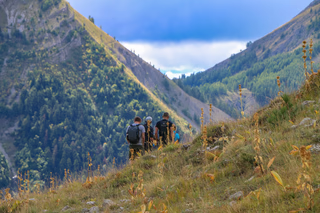
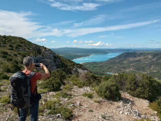
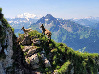
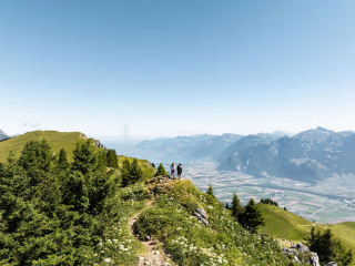
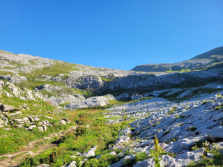
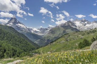
Between pristine valleys and spectacular peaks , embark on a unique immersion in the heart of Vanoise National Park , France's first national park. This circuit invites you to explore the Vanoise Glaciers , a majestic ice cap in the Alps, and to admire the impressive landscapes of the Grande Casse Massif ( 3855 m ), an iconic summit in Savoie.
On accessible and well-marked trails, you'll pass through the charming villages of Pralognan-la-Vanoise and Champagny-le-Haut before reaching the lively resort of Tignes . Thanks to excellent organization, you'll travel light , carrying only a daypack, and find your luggage waiting for you each evening in comfortable and welcoming mountain huts.
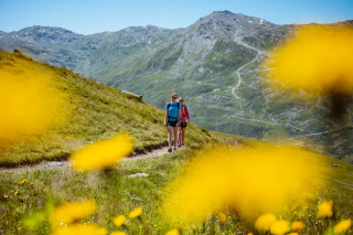
From the Maurienne Valley , the route takes you along more secluded paths to offer you an immersive experience in one of the most beautiful Alpine massifs. Between sparkling glaciers , flowering alpine pastures and breathtaking panoramas , experience an authentic adventure where effort rhymes with wonder .
The highlights
-
The Vanoise National Park in one week
-
An exclusive multi-day hiking tour that truly circumnavigates the Vanoise
-
A lighter version of the Vanoise tour
Photos


Sport
Level
Hiking / Trekking
In figures
Hiking
- Average duration/day: 6h30
- Average distance/day: 20 km
- Average daily elevation gain: 1009 m
- Average daily descent: 1115 m
- Exposed Passages: Yes
Management
Program
-
Welcome
- Accommodation Refuge
- Breakfast not included
- Lunch not included
- Dinner included
Arrive at your accommodation in the late afternoon, where your host will give you a warm welcome.
If you are staying at the Refuge de l'Orgère , you can reach the site by taking the shuttle from the Modane bus station (journey at your own expense, timetable available in your file ).
If your accommodation is planned in Modane , you will spend the night there before taking the shuttle the next morning, always departing from the Modane bus station , towards Porte de l'Orgère ( timetable also provided in your file ).
Day 1 -
Porte de l'Orgère (1935 m) - Pralognan La Vanoise (1418 m)
- Activity Hiking
- Duration of the activity 6h45
- Distance 22 km
- Positive elevation gain 920 m
- Negative elevation 1440 m
- Exposed passages Yes
- Accommodation Refuge
- Breakfast included
- Lunch included
- Dinner included
At the start of the season, it's important to be well-equipped and set off at the right time to cross the softened snow on the north face of the Col de Chavière . After a 15-minute walk, you enter the Vanoise National Park , which has its own specific regulations. The initial climb is steep, then the terrain becomes gentler until you reach Lac de la Partie (2502m), an ideal spot for a break. The ascent then resumes to the Col de Chavière (2796m), the highest point of the day, from where the valley opens up towards Pralognan . The steep descent down the north face requires caution, especially in snowy conditions, before reaching Plan des Cairns . After passing the Refuge de Péclet Polset (2430m), the long descent continues via the Refuge du Roc de la Pêche (1903m) and Les Prioux (1711m), where you reach the valley floor. It then remains a 1 hour 15 minute walk to reach Pralognan-la-Vanoise .
Elevation gain/loss : +920m / -1440m — Distance : 22km — Duration : 6h45
Depending on your chosen accommodation, you can stay overnight in Les Prioux , thus shortening the stage. A free shuttle also connects to Pralognan (timetable in your travel documents).
Day 2 -
Pralognan La Vanoise (1418 m) – Champagny Le Haut (1468 m)
- Activity Hiking
- Duration of the activity 5h45
- Distance 17 km
- Positive elevation gain 1120 m
- Negative elevation 1060 m
- Exposed passages Yes
- Accommodation Refuge
- Breakfast included
- Lunch not included
- Dinner included
Today's stage unfolds in a forest setting quite different from the previous days. You'll progress in the shade, along beautiful old paths connecting several hamlets, far from the hustle and bustle of the classic routes. After a gentle start, the switchback climb through the Ravin de Leschaux and then the Couloir des Rossets leads you to Mont Chevrier (2000m), an ideal plateau for a break. The change in atmosphere is striking: after the hot, dry south-facing slope, the descent plunges into the cool, damp north-facing slope , punctuated by the magnificent Cascades de la Vuzelle . You'll then continue with a series of ascents and descents to traverse the valleys flowing from the Grand Bec to the Mollard (1570m). A final climb takes you to the foot of the Tour du Merle (1941m) before descending into the Champagny en Vanoise valley . The descent via the Enclos du Seil (1690m) and then the traverse above the Gorges de la Pontille gently leads you to the valley floor. From there, a pleasant path leads to Champagny le Haut (1468m).
Day 3 -
Champagny Le Haut (1468 m) – Porte de Rosuel (1555 m)
- Activity Hiking
- Duration of the activity 6h45
- Distance 19 km
- Positive elevation gain 1150 m
- Negative elevation 1060 m
- Exposed passages Yes
- Accommodation Refuge
- Breakfast included
- Lunch not included
- Dinner included
The day begins with a gentle climb along the Doron de Champagny river to the hamlet of Laisonnay d'en Haut (1580m). The real ascent then begins at the foot of the Cascade du Py waterfall , before the trail levels out to reach the Refuge de Plaisance (2176m). You then traverse the vast, peaceful landscapes of the Montagne de Vallaisonnay , up to the Col de Plan Séry pass (2609m). The view opens up to the other side of the mountain with a remarkable vista of Mont Pourri . A steady descent then leads you to the Refuge Entre le Lac (2151m), nestled beside the vast Lac de la Plagne . The path becomes almost level, runs alongside the lake, then crosses the Plan des Eaux to the Pertes du Ponthurin (2068m), where the stream briefly disappears under scree before reappearing further down. All that remains is to descend gently towards the upper Peisey-Nancroix valley to reach the Porte de Rosuel (1555m).
Day 4 -
Porte de Rosuel (1555 m) – Tignes (2107 m)
- Activity Hiking
- Duration of the activity 5h30
- Distance 15 km
- Positive elevation gain 1110 m
- Negative elevation 550 m
- Exposed passages Yes
- Accommodation Refuge
- Breakfast included
- Lunch not included
- Dinner included
Today you ascend the valley you traversed yesterday, but on the opposite bank, via a more rugged route. After crossing the Ponthurin stream , you continue in the sunshine, at the foot of the Nant Putors waterfalls . The climb gradually eases before briefly rejoining yesterday's route to reach the Pertes du Ponthurin (2068m), where you definitively cross to the other side of the valley. The path becomes gentler, traversing small climbs and large plateaus. You cross the Plan de La Plagne , then reach the Cabane des Mindières (2224m), which overlooks Lac de La Plagne on the opposite side. You then continue via the Plan de la Grassaz , the Plan de Janin , and then along the shores of Lac du Grattaleu before arriving at the Refuge du Col du Palet (2590m). One last effort takes you to the Col du Palet (2652m), before a crossing of the ski slopes which leads you to Tignes (2107m).
Day 5 -
Tignes (2107 m) – Bellecombe (2335 m)
- Activity Hiking
- Duration of the activity 6h30
- Distance 22 km
- Positive elevation gain 1030 m
- Negative elevation 800 m
- Exposed passages Yes
- Accommodation Refuge
- Breakfast included
- Lunch included
- Dinner included
Even starting from a large resort, the atmosphere can quickly become more natural as you move away from the center. You soon enter the Vanoise National Park and make gentle progress to the Col de la Leisse (2758m), facing the Grande Motte Glacier , in the heart of vast open spaces. The descent begins at Lac des Nettes , Plan des Nettes , and the Refuge de la Leisse (2590m). The Vallon de la Leisse , dominated by the cliffs of the Grande Casse , sometimes still bears the marks of winter avalanches in summer. You reach Entre Deux Eaux (2043m), at the confluence of the Leisse and Femma rivers. At the end of the day, a final effort is needed to climb to Plan du Lac (2375m) and then to Bellecombe (2335m). Along the way, you gradually discover the Vanoise ice cap , the backdrop for your next stage.
Day 6 -
Bellecombe (2335 m) – Termignon (1290 m)
- Transportation Minibus - 00h20 - 17km
- Activity Hiking
- Duration of the activity 7h30
- Distance 24 km
- Positive elevation gain 720 m
- Negative elevation 1780 m
- Exposed passages Yes
- Breakfast included
- Lunch not included
- Dinner not included
The return to Entre Deux Eaux (2043m) offers a breathtaking view with the Grande Casse reflected in the Lac du Plan du Lac . After crossing the confluence, a single climb takes you to 2400m to join a superb balcony route beneath the Vanoise glaciers and the Dôme de Chasseforêt (3586m). You then cross the Lacs des Lozières (2418m) before a series of short climbs and long traverses above the Doron de Termignon gorges , reaching a high point close to 2500m. The descent begins with a tricky traverse on a steep slope, leading to the Refuge de l'Arpont (2309m). After a more rolling section, you descend into the valley to the Pont du Châtelard (1347m), then follow a flat path to Termignon (1290m). An appointment with your taxi is scheduled for 6pm for your transfer to Modane .
Day 7
Note
Arrive at your accommodation in the late afternoon where you will be greeted by your host.
If you are staying at the Refuge de l'Orgère : you will need to take the shuttle ( at your own expense ) from the Modane bus station . Timetables are included in your information packet.
If you are staying in Modane : you will take the shuttle ( at your own expense ) the following day from the Modane bus station to Porte de l'Orgère . Timetable attached to your file.
Accommodation
5 nights in mountain huts, with showers.
1 night in a hotel.
Out of respect for the daily rest period of the hosts (available early in the morning and late in the evening), the rooms are not available before 4 p.m.
The contact details for the accommodations will be provided with your hiking pack.
Dogs are not allowed.
The basic package for this self-guided hike is dormitory-style accommodation with half-board (dinner + night + breakfast).
Some hotel nights may be offered as a bed and breakfast package . In this case , dinner will be at your own expense .
The beds are equipped with duvets or blankets.
If you choose the extension with 2 nights in Pralognan you will be accommodated in a hotel in a room for 2 or 3 people (2 nights).
Access
Go to the starting point
Arrival is possible by train to Modane station. We advise you to check the SNCF train schedules. Please note that train services can be more complicated on weekends and public holidays, so it is best to plan your trip for a weekday for greater ease.
Maurienne A43 motorway, Modane exit.
Price details
The price includes
- Organization fees
- Food and accommodation on a half-board basis (except day 5 which is B&B)
- The provision of a complete hiking file
- Taxi transfer on the last day between Termignon and Modane
The price does not include
- Lunch (except for full board)
- Dinner of day 5
- Luggage transfer
- Drinks and personal expenses
- The shuttle to reach the Porte de l'Orgère on the first day
- Possible shuttle services to shorten the stages
- Possible visits
- Personal equipment
- The journeys to and from the reception location.
- The different types of insurance: Cancellation and/or Search and Rescue Costs - Assistance - Repatriation - Trip Interruption
Options
- Luggage transfer - 2 people : CHF535.16 / person
- Luggage transfer - 3 people : CHF356.77 / person
- Luggage transfer - 4 people : CHF251.57 / person
- 5 picnics : CHF59.46 / person
- 6 picnics : CHF71.35 / person
- Extra day : CHF86.91 / unit
- Supplement for departures from September 1st to 13th, 2026 : CHF22.87 / person
- Flex fare and insurance
Practical information
Specific formalities
Specifics
During the hike, you must have the following documents in your possession:
- Valid identity card or passport
- Your travel insurance leaflet received upon registration (if you purchased the insurance we offer) or your personal insurance (contract number + telephone number)
- Health insurance card
- Membership card of the FFME or the CAF (if you are a member)
For security reasons, we will ask for the mobile phone number you have with you during the hike.
Equipment
Equipment to bring
- 1 backpack of 35/40 litres with a flexible frame, equipped with a waist belt
- A large plastic bag to protect the inside of the backpack
- 1 pair of excellent quality sunglasses with side protection
- a water bottle (1.5 liters minimum)
- 1 Opinel-type pocket knife
- 1 small pouch (preferably waterproof) to hold your money, ID card, health insurance card and assistance contract
- Toilet paper + garbage bag
- Sunscreen + lip balm
- Airtight plastic container (minimum capacity 0.5 L) + cup + cutlery
- 1 survival blanket
- Camera, binoculars (optional)
- A pair of poles is recommended.
For the evening at the accommodation:
- Your pocket-sized hand sanitizer and disinfectant wipes
- Your masks in sufficient quantity
- A sleeping bag liner is sufficient; duvets are unnecessary.
- 1 swimsuit (optional)
- 1 pair of comfortable trousers
- 1 pair of lightweight casual shoes
- Toiletries (opt for the essentials, small sizes, samples and travel kits)
- 1 quick-drying bath towel
- Earplugs or earplugs (optional)
- 1 headlamp or flashlight
Clothing to bring
- 1 sun hat or cap
- 1 scarf or neck warmer
- Short-sleeved T-shirts in breathable material preferred (1 for 2 to 3 days of walking)
- 1 long-sleeved base layer in breathable material or a shirt
- 1 fleece fur jacket
- 1 waterproof and breathable windproof jacket (gore-tex type) with hood
- 1 rain poncho or a sleeping bag cover if you own the jacket above
- 1 pair of loose-fitting trekking trousers
- 1 pair of shorts or bermudas
- Hiking socks (1 pair for 2 to 3 days of hiking). Opt for wool or hiking-specific socks. Be careful with cotton as it can cause blisters.
- One pair of high-top hiking boots with good ankle support and waterproof soles (Vibram type). Remember to test new boots and those that haven't been worn for a long time beforehand.
- Underwear
- At the beginning and end of the season (July and September), it can be useful to also have gaiters, gloves and a hat.