Tour of the Obiou at your own pace: a self-guided hiking tour in the Dévoluy
In summary
-
Sports
-
Duration4 days
-
LevelAdvance
-
DestinationÉcrins Massif / Isère
-
AgeFrom 18 - 90 years
-
CO₂-Emissions31.73 kg CO2
-
Type of stayIndependent traveler
In a few words
Rising proudly at the border of the Trièves, Matheysine, and Dévoluy regions, the Grande Tête de l'Obiou is the highlight of an exceptional 4-day trek . This hiking route traces a complete loop around this limestone giant, winding through the heart of one of the most secluded and unspoiled areas of the Alpine arc.
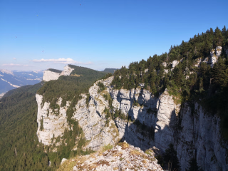
Designed for hikers seeking wide open spaces, this challenging circuit alternates between verdant alpine pastures, hanging mineral valleys , and panoramic mountain passes . The trails, laid out at the foot of spectacular cliffs, reveal an authentic mountain landscape shaped by two millennia of pastoralism .
Far from the beaten track and the crowds of the major mountain ranges, each stage of this trek promises a wild immersion. In the evening, you disconnect completely amidst unspoiled nature, where physical exertion is magnificently rewarded by breathtaking 360-degree panoramas . A true alpine adventure, ideal for recharging your batteries and experiencing genuine freedom at altitude.
The highlights
-
The complete circuit of the Obiou, an iconic peak and one of the wildest in the Alps
-
Magnificent panoramas between alpine pastures, high mountain passes, cliffs and mineral landscapes
-
An immersion in an authentic mountain, marked by more than 2,000 years of pastoralism
Photos


Sport
Level
Hiking / Trekking
The expert's opinion
This trip is perfect for you if you're already an experienced hiker in good physical condition and able to endure long periods of exertion! The hikes take place on mountain trails with elevation gains and losses of 700 to 1200 meters, without any particular technical difficulties. Expect to hike for approximately 6 to 7 hours per day.
The difficulty level corresponds to the average cumulative elevation gain over the entire week. We also use other factors such as luggage carrying, commitment, network availability, and terrain to refine the level. During peak season, an inter-village shuttle service can save you some time and elevation gain on the stages, making them a little easier.
Regarding the calculation of elevation gain, this is either based on a field survey or a calculation using a computer model. The calculation takes into account all variations in terrain, both uphill and downhill, and not just the difference in altitude between two points! Thus, on a stage where the profile appears to be entirely uphill, the cumulative effect of small slopes could result in a negative elevation gain of around one hundred meters.
If you take your own measurements, it is not uncommon to find discrepancies with our description.
In figures
Hiking
- Average distance/day: 16 km
- Average daily elevation gain: 873 m
- Average daily descent: 878 m
Management
Program
-
From Pellafol to Bachilianne
- Activity Hiking
- Distance 11 km
- Positive elevation gain 870 m
- Negative elevation 172 m
- Accommodation Cottage
- Breakfast not included
- Lunch not included
- Dinner included
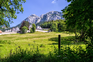
The hike begins in Pellafol, the gateway village to the Dévoluy massif. The trail climbs gradually, initially skirting meadows before winding through mixed deciduous and coniferous forests. The ascent remains gentle, providing a welcome warm-up for hikers. As the altitude increases, the vegetation becomes sparser, and the Bachilianne alpine pastures open onto a breathtaking panorama: the Obiou mountain rises before you for the first time, imposing and majestic.
Night in a mountain refuge.
Day 1 -
From Bachilianne to Tréminis
- Activity Hiking
- Distance 15 km
- Positive elevation gain 500 m
- Negative elevation 1300 m
- Accommodation Cottage
- Breakfast included
- Lunch not included
- Dinner included
The day begins with the ascent of the Col de l'Aiguille, which offers a sweeping panorama of the surrounding landscapes – the Trièves, the Matheysin plateau, the Vercors, and the Écrins massif. From this natural viewpoint, the route heads due south along a magnificent balcony path, alternating between pastures and rocky valleys. (Beware of late-lying snow patches on this slope.) The descent then winds through beautiful clearings before reaching the banks of the Ébron River, which guides the final kilometers to the village of Tréminis.
Overnight stay in a gîte (holiday cottage).
Day 2 -
From Tréminis to Lachaup
- Activity Hiking
- Distance 17 km
- Positive elevation gain 1290 m
- Negative elevation 817 m
- Accommodation Cottage
- Breakfast included
- Lunch not included
- Dinner included
The most challenging stage of the tour. Leaving Tréminis, the route winds through fields and forests to reach the Col de la Croix, before climbing eastward to the Col de Charnier – the gateway to the Hautes-Alpes. Here, the landscape transforms into a stark, rocky scene: a descent into the Charnier valley, a passage at the foot of spectacular curved rock cliffs, and then along the Chourum Clot, an impressive chasm plunging deep into the heart of the massif. The stage concludes in the hamlet of Lachaup, nestled peacefully in this remote, remote setting.
Overnight stay in a gîte (holiday cottage).
Day 3 -
From Lachaup to Pellafol
- Activity Hiking
- Distance 19 km
- Positive elevation gain 830 m
- Negative elevation 1220 m
- Breakfast included
- Lunch not included
- Dinner not included
The final day offers a beautiful walk along the edge of the alpine pastures and forests. At times, the path opens onto the wild valleys of the Ferrand and Obiou mountain ranges – views that reward the effort of the previous days. The route crosses several valleys before reaching the Col des Faïsses pass, where the Obiou rises one last time. The final descent is through the forest, gently leading the hiker back to the village of Pellafol, thus completing the loop.
Transfer to Corps if you arrived by train.
Day 4
Note
Discover our day hikes, perfectly suited for hiking enthusiasts! Follow well-maintained, marked trails for a worry-free experience. Rest assured, we'll be there for you every step of the way, guiding and assisting you in any situation. Your adventure is our top priority! Each individual is responsible for their own skill level, the weather conditions, and the effort required. We make it a point to provide you with clear and precise information so you can plan your hike with confidence. Please note that once you have started your hike, you must follow the indicated itinerary, and no changes to your accommodation can be made. At the beginning of the season, the itinerary may be adapted to the current snow conditions. We can offer alternative routes to ensure you can hike safely.
Accommodation
The base price for this stay is based on shared rooms in a gîte and mountain refuge. You will sleep in rooms accommodating 4 to 12 people, depending on the gîte. Towels and sheets are not included, so please bring a sleeping bag liner. Blankets or duvets are provided. Bathroom facilities are located on the landing.
Our hosts take care of meals and breakfast. The food in the accommodations is balanced, varied, and suitable for hikers. Lunch is at your own expense. Please note that you will only be able to buy groceries in Tremini.
If you prefer, you can choose the picnic option now or book it with the accommodation providers.
Access
Go to the starting point
The nearest train stations are Grenoble (north access) and Gap (south access), from where you can reach Corps by bus. From each station, a bus service will take you to Corps – the journey takes approximately 2 hours from Grenoble and 1 hour from Gap (lines T90/T91). Check the timetables on SNCF Connect. Corps is your arrival point on day 1.
From Body:
- Taxi transfer available, duration 15 min
- Hiking to Pellafol is possible, duration: 2 hours
From the north (Grenoble): Take the N85 towards Corps. Allow approximately 1 hour 15 minutes from Grenoble.
From the south (Gap): Reach Corps via the N85. Allow approximately 1 hour from Gap.
Then head to the Sautet Lake Dam, then the hamlet of Les Payas. There is free, unguarded outdoor parking in the village.
Price details
The price includes
- Accommodation in guesthouses and mountain huts
- Half-board accommodation (dinner + breakfast)
- The provision of the digital hiking file
- Access to the travel log app on your phone
- Organization fees
The price does not include
- Transportation to the place of stay
- Luggage transport (not available on this tour)
- Lunch (optional)
- The customized IGN map (optional)
- Personal equipment
- Drinks and personal expenses
- Anything not listed under "Price includes"
Options
- Custom IGN map : CHF22.87 / person
- Picnic pack : CHF35.68 / person
- Flex fare and insurance
Practical information
Specific formalities
Specifics
Before your departure, check with the embassy or consulate regarding the entry and stay requirements for your destination country. You can also find this information on the France Diplomatie website ( https://www.diplomatie.gouv.fr/fr/dossiers-pays/ ).
In the case of flights with stopovers operated by different airlines, also check the entry requirements of the countries you are transiting through.
It is your responsibility to ensure you are in compliance, particularly regarding the validity of your identity documents (for example, some countries require your passport to be valid for at least six months after your return) , visa requirements, necessary vaccinations, and health recommendations. And don't forget to consider any customs restrictions and other potential requirements of your destination or transit country.
ℹ️ Information may change up to the departure date, remember to regularly check official websites.
Equipment
Equipment to bring
Your bag's bottom
- 30/35 litre backpack with waist belt.
- 2 telescopic poles (recommended) for better stability.
- Waterproof hiking boots with good ankle support and Vibram soles are essential. Be sure to test them before setting off, especially if they are new or haven't been used for a long time. Low-cut shoes are not recommended for trips of level 3 or higher.
- Thermos, water bottle or water bladder with a drinking tube with a capacity of at least 1.5 liters per person.
- Small airtight plastic container, cup, knife and fork for picnics.
- Race supplies to replenish energy along the way.
- A small waterproof pouch for your valuables such as: cash, ID card, bank card, health insurance card, and assistance contract. You can leave the rest of your documents and car keys at the hotel during your stay.
- Emergency survival blanket.
- Toilet paper with a sealed bag to wrap it up and throw it in the first available bin.
Important : At the beginning of the season, depending on snow conditions, small hiking crampons may be necessary. The area in question is mainly along the Italian border, before and after the Agnel refuge.
For the evening at the accommodation
- Simplify your life by packing only the essentials. For a week of hiking, a few changes of clothes are more than enough. As for toiletries, opt for the essentials, choosing compact sizes, samples, and travel kits, especially if you have to carry your backpack.
- Remember that a sleeping bag liner is mandatory as the beds are already equipped with duvets or blankets. Make sure your luggage doesn't exceed 8 kg to facilitate transfers and ensure your comfort throughout your adventure.
Personal pharmacy
- Your first aid kit should be kept to a minimum. In your backpack, only carry your essential personal medications, compresses, elastic bandages, disinfectant, etc.
Attention! Sleeping bag liners are mandatory in guesthouses and mountain huts (beds are equipped with duvets or blankets).
Clothing to bring
Recommended clothing for hiking:
When hiking, adhering to the three-layer principle is essential to guarantee your comfort and safety throughout your journey:
- Breathable short-sleeved T-shirt: Choose a breathable hollow fiber T-shirt to wick away sweat when you are active.
- Fleece jacket: This fleece jacket keeps you warm in cool weather by providing extra thermal insulation.
- Waterproof and breathable windproof jacket (like Gore-Tex or equivalent): This outer layer effectively protects you against inclement weather such as rain, snow or wind, keeping your body dry and sheltered from the elements.
Adapt your clothing according to the weather and activity level. For example, in pleasant weather, a base layer may be sufficient. In bad weather, add a waterproof jacket. In cold weather or at altitude, wear a fleece jacket under your windproof jacket.
Choose clothes that dry quickly, avoid cotton which retains moisture, and favor materials like wool, silk and synthetic fibers to stay dry and warm.
Remember that you are in the mountains, where the sun is intense and the UV index is high. Temperatures can change rapidly depending on altitude and season. It is therefore essential to equip yourself with appropriate protection such as sunglasses, a neck warmer, and sunscreen for your comfort and safety.