In summary
-
Sports
-
Duration7 days
-
LevelConfirmed
-
DestinationGrand Est / Vosges
-
AgeFrom 14 - 90 years
-
CO₂-Emissions85.08 kg CO2
-
Type of stayIndependent traveler
In a few words
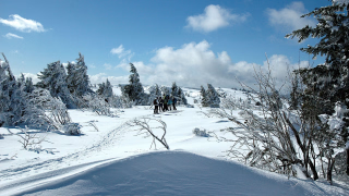
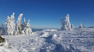
Venture into the Vosges Mountains on this magnificent route ! Starting from Munster, you'll traverse the High Vosges and discover breathtaking landscapes along the way. Forests blanket rolling hills as far as the eye can see, rocky peaks and ridges offer incredible views of this unspoiled natural environment . In the evenings, stay in comfortable hotels, allowing you to rest and be in top form for the next day! It's the perfect opportunity to immerse yourself in Vosges and Alsatian cuisine : discover the famous Alsatian wines, Munster cheese, a distinctive Vosges cheese, and many other regional specialties. Embarking on this Vosges crossing means enjoying a comfortable yet fully self-sufficient physical challenge!
The highlights
-
The great ridge of the Vosges, the most iconic site of the Massif
-
Contrasting landscapes, between Alsatian villages and Vosges mountains
-
Enjoy a comfortable journey with a choice of ideally located family hotels
Photos


Sport
Level
Hiking / Trekking
In figures
Hiking
- Average duration/day: 6h
- Average distance/day: 19 km
- Average daily elevation gain: 790 m
- Average daily descent: 789 m
- Maximum altitude: 1363 m
Management
Your travel guide to take everywhere with you. 🗺️
Digital Hiking Guide:
- The provision of our assisted navigation app "Roadbook" for all participants, including route, map background, real-time location, points of interest, and alternative routes. It installs easily on your phone.
- Your travel journal will be printed in PDF format , including extracts of 1:25,000 scale maps of your route.
- Provision in PDF format of: the list of accommodations with access details, the list of restaurants in Munster, the vouchers to be presented to the accommodations.
Luggage tags will be available at the first accommodation.
Program
-
Munster
- Accommodation 2-star hotel
- Breakfast not included
- Lunch not included
- Dinner not included
You will be welcomed around 6:00 PM at the hotel located in the Munster Valley (at an altitude of 370m, famous for its distinctive cheese...), one of the largest and most beautiful valleys on the Alsatian side of the High Vosges Mountains. You will settle in for the night. Dinner will be at your leisure.
Day 1 -
Munster (370 m) - Schratzmaennele (1045 m) - Orbey (531 m)
- Activity Hiking
- Duration of the activity 5h
- Distance 14 km
- Positive elevation gain 720 m
- Negative elevation 610 m
- Maximum altitude 1045 m
- Accommodation 2-star hotel
- Breakfast included
- Lunch not included
- Dinner included
Your stay will take on a magnificent climax. You will discover very varied landscapes thanks to a gentle progression through the different vegetation zones.
You will have the opportunity to visit World War I heritage sites, such as the Linge Memorial (at 987m, with the possibility of visiting the museum) and the German military cemetery of Baerenstall (at 975m), as well as the scattered farms of the Welche region.
You will complete your ascent to the summit of Schratzmaennele before descending to the Alsatian mountain village of Orbey, where you will settle for two nights.
Day 2 -
Orbey - Tête des Faux (1219 m) - Lac Blanc (1058 m) - Orbey (531 m)
- Activity Hiking
- Duration of the activity 6h30
- Distance 21 km
- Positive elevation gain 930 m
- Negative elevation 930 m
- Maximum altitude 1219 m
- Accommodation 2-star hotel
- Breakfast included
- Lunch not included
- Dinner included
This beautiful hike offers a perfect blend of nature and history. From the hotel, you'll first reach the unusual peat bog of the Etang du Devin. Then, the winding path will lead you to the Roche du Corbeau (at 1122m altitude, offering a beautiful panorama), the former arrival station of the cable car.
You will continue with the ascent to the summit of Tête des Faux, the highest point of the day and a listed historical monument, overlooking the villages of Bonhomme, Lapoutroie and Orbey, as well as the Col du Bonhomme, considered strategic by the French in 1914.
Next, you will descend towards the Duschesne Cemetery to discover the Lac Blanc (a lake of glacial origin), before finishing the descent on Orbey.
Day 3 -
Orbey (531 m) - Lac des Truites (1065 m) - Col de la Schlucht (1139 m)
- Activity Hiking
- Duration of the activity 6h30
- Distance 19 km
- Positive elevation gain 1050 m
- Negative elevation 430 m
- Maximum altitude 1139 m
- Breakfast included
- Lunch not included
- Dinner included
This stage will be one of the most beautiful of your Vosges crossing, with the proximity of three magnificent glacial lakes and the ridge trail (GR5) offering splendid panoramas of the Alsatian and Vosges valleys, as well as the Black Forest and the Alps in the distance. You will pass through the Schlucht Pass before reaching our mountain chalet hotel, located at an altitude of 1100m, where you will stay for two nights.
Day 4 -
Col de la Schlucht - le Hohneck (1363 m) - Col de la Schlucht (1139 m)
- Activity Hiking
- Duration of the activity 5h30
- Distance 17 km
- Positive elevation gain 820 m
- Negative elevation 820 m
- Maximum altitude 1363 m
- Breakfast included
- Lunch not included
- Dinner included
You will ascend towards the Hohneck massif to the Falimont pass to join the "Snowfield Trail." This panoramic path runs alongside the immense Wormsa glacial cirque, one of the prime locations for spotting chamois. You will leave the trail at the Kastelbergwasen Farm Inn to explore in depth the two glacial cirques of Wormsa and Wormspel, home to two magnificent mountain lakes: Fischboedle and Schiessrothried.
Next, you will climb the Hohneck (the 3rd highest peak in the massif) before returning to the hotel.
Day 5 -
Schlucht Pass - Kastelberg (1350 m) - Markstein (1200 m)
- Activity Hiking
- Duration of the activity 6h
- Distance 19 km
- Positive elevation gain 560 m
- Negative elevation 480 m
- Maximum altitude 1350 m
- Breakfast included
- Lunch not included
- Dinner included
You'll embark on a high-altitude trek, traversing ridges and summits between 1200 and 1316 meters, offering breathtaking panoramic views of the entire Vosges Mountains: simply sublime! After climbing the Hohneck (1363 m), you'll follow the summit ridge of the massif that separates the Vosges from the Alsace plain. Along the way, numerous smaller peaks will dot this ridge, such as the Kastelberg (1350 m), the Rothenbackhopf (1316 m), and others.
But you won't need to climb them all! Below, glacial lakes shimmer amidst the coniferous forest.
Day 6 -
Markstein - Langenfeldkopf (1290 m) - Petit Ballon (1272 m) - Munster (370 m)
- Transportation Minibus - 00h20 - 14km
- Activity Hiking
- Duration of the activity 6h
- Distance 21 km
- Positive elevation gain 660 m
- Negative elevation 1460 m
- Maximum altitude 1290 m
- Breakfast included
- Lunch not included
- Dinner not included
This will be the wildest stage, with captivating landscapes and diverse vegetation including pines, heather, and juniper. You will be transferred to Le Markstein. You will cross the old pastures of Le Markstein and then those of Steinlebach before reaching the Oberlauchen pass (1211m). The path will follow the ridge to the Petit Ballon, then you will begin the descent to Munster, which is absolutely stunning!
The hike will end around 4 p.m. in Munster, with the possibility of visiting the village: abbey, church, the Albert Schweitzer and Fecht parks, as well as an exhibition in the premises of the Ballons Park.
Day 7
Note
We may need to modify your itinerary if the planned accommodations are unavailable during your travel dates. The alternative accommodations offered will be of a similar category and their location will have minimal impact on your route. Rest assured, these changes are always made in your best interest, for your safety and comfort!
SUPPLEMENTARY PROGRAMME
Extension: If you wish to climb the Grand Ballon, it is possible to add a night at Markstein to do a loop hike that passes by the summit.
The program will then be as follows:
Day 07: Markstein - Grand Ballon (1424 m) - Markstein (1200 m)
Stage of 5 hours 30 minutes walking - Elevation gain: 526 m - Elevation loss: 526 m - Length: 18 km
Day 08: Markstein - Langenfeldkopf (1290 m) - Petit Ballon (1272 m) - Munster (370 m)
Stage of 6 hours of walking - Elevation gain: 660 m - Elevation loss: 1460 m - Length: 21 km
Accommodation
Accommodation is provided in 2* or 3* hotels in a double room (or single room with supplement):
- Munster : One night in a hotel ideally located near the city center or a little further away depending on availability, with rooms equipped with shower or bath, toilet, flat-screen TV, and access to a garden
- Orbey : Two nights in a hotel in the heart of the Alsatian village, offering rooms with shower or bath, toilet, flat-screen satellite TV, safe and high-speed internet
- Schlucht Pass : Two nights in a comfortable, family-run chalet-hotel, either at the pass in a peaceful setting or at the foot of the Hohneck massif, with rooms equipped with shower or bath, toilet, and flat-screen TV.
- Markstein Pass : One night in a mountain hotel with rooms including shower or bath, toilet, and flat-screen TV. If this hotel is full, a night in a farm inn is offered (rooms for 2 or 4 with duvets, shared bathrooms like in a mountain refuge, and a €22 discount per person).
Access
The last day around 5:00 PM in Munster.
Additional night before or after the hike
Overnight stay and breakfast at Munster hotel **: see section “dates and prices”.
Go to the starting point
Train access: SNCF station in Munster via SNCF station in Colmar (19 km - Timetables to be consulted with SNCF).
TGV from Paris > Strasbourg > Colmar then TER line Colmar > Munster (SNCF line No. 23 Colmar > Metzeral).
Paris Gare de l'Est: 2:55 PM, 2 changes; Munster: 5:53 PM
Lyon Part Dieu: 12:04 15:27 Colmar: 17:27 Munster: 17:53
Marseille: 10:00 a.m. 2 changes Munster Badischhof: 5:50 p.m.
The hotel is 200m from Munster train station.
Air access: Basel-Mulhouse Airport (EuroAirport Basel Mulhouse Freiburg) is 80km away. Strasbourg-Entzheim International Airport is 80km away.
Air access: Basel-Mulhouse Airport (EuroAirport Basel Mulhouse Freiburg) is 80km away. Strasbourg-Entzheim International Airport is 80km away.
Access by car: Munster (370m - Haut-Rhin - 68) is located on the D 417 about 20km east of Colmar towards Col de la Schlucht/ Géradmer/ Epinal.
Price details
The price includes
- Half-board accommodation in a double room
- Breakfasts
- Dinners (except on Day 1)
- The Freedom File (in digital format)
The price does not include
- Drinks
- Personal expenses
- Luggage transport
- The means of transport to the meeting place
- Personal equipment*
- The Freedom File in paper format
- Access to the SPA (if staying at Le Collet, subject to availability at the time of booking)
- Lunch
- Dinner on Day 1
- The “solo supplement” if you are travelling alone
- All options not included in the price
Options
- Luggage transfer (based on 1 person) : CHF288.16 / person
- Luggage transfer based on 2 to 3 people : CHF164.66 / person
- Luggage transfer for groups of 4 to 5 people : CHF96.05 / person
- Luggage transfer for 6 people or more : CHF54.89 / person
- Option for an extra night before departure in a double room : CHF68.61 / person
- Option for an extra night before departure in a 1-room room : CHF91.48 / person
- Extension to Markstein on day 3 with half-board - Double room : CHF91.48 / person
- Extension to Markstein on day 3 with half-board - Single room : CHF118.92 / person
- Option for an additional night after your stay in a double room : CHF68.61 / person
- Option for an additional night after your stay in a 1-room room : CHF91.48 / person
- Hiking guide : CHF32.02 / person
- Supplement for departures on Monday, Tuesday, Thursday and Saturday : CHF22.87 / reservation
- Flex fare and insurance
Practical information
Specific formalities
Specifics
Before your departure, check with the embassy or consulate regarding the entry and stay requirements for your destination country. You can also find this information on the France Diplomatie website ( https://www.diplomatie.gouv.fr/fr/dossiers-pays/ ).
In the case of flights with stopovers operated by different airlines, also check the entry requirements of the countries you are transiting through.
It is your responsibility to ensure you are in compliance, particularly regarding the validity of your identity documents (for example, some countries require your passport to be valid for at least six months after your return) , visa requirements, necessary vaccinations, and health recommendations. And don't forget to consider any customs restrictions and other potential requirements of your destination or transit country.
ℹ️ Information may change up to the departure date, remember to regularly check official websites.
Equipment
Equipment provided on site
Digital hiking guide (included):
- Access to the "Roadbook" navigation app with route, maps, real-time location, points of interest and alternative routes.
- PDF travelogue with detailed description and map extracts at 1:25,000 scale
- PDF of accommodation and restaurant lists, as well as vouchers for accommodations.
- Luggage tags available at the first accommodation
Paper hiking guide (optional, with supplement):
- Paper road book detailing the route day by day with information on nature and heritage
- Two IGN maps at 1:25,000 scale with the route highlighted
- Exchange vouchers and luggage tags included
- Application sent by post 2 weeks before departure
Mobile navigation app :
- Detailed maps, route, points of interest and real-time geolocation
- Works offline after downloading, to save battery
- An external battery is recommended, especially in mountain huts where recharging can be difficult.
Equipment to bring
- Walking shoes
- Lightweight shoes
- Walking sticks
- Sunglasses
- Gourd
- Headlamp
- Camera
Clothing to bring
- Change of clothes
- Warm sweater
- Windproof jacket
- Swimsuit
- Hat
They traveled with us