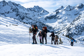
GR10 stage 7: Mérens les Vals to Vernet les Bains
In summary
-
Sports
-
Duration7 days
-
LevelAdvance
-
DestinationPyrénées-Orientales / Pyrenees
-
AgeAccessible to all ages
-
CO₂-Emissions69.68 kg CO2
-
Type of stayIn a group
-
Languages
 French
 English
In a few words
Embark on a magnificent week-long trek along the famous GR10 trail ! This seventh leg of the Pyrenees Crossing takes you from Ariège to the sunny, high-altitude plateaus typical of the Eastern Pyrenees . Starting from Mérens-les-Vals, you'll hike towards the Besines refuge before a beautiful mountain and lakeside stage around Puig Carlit , which rises to 2,921 meters. After passing by Lac des Bouillouses , you'll traverse the vast Cerdagne plateau . Located in the heart of the Catalan Pyrenees Natural Park, it's known for its famous yellow train and is home to magnificent mountain villages. Then you'll leave the Cerdagne plateau to continue your trek towards the Conflent region , with its more Mediterranean atmosphere. After the charming Carança refuge , nestled in a beautiful valley, you'll explore the Mantet and Py Nature Reserves . The landscapes will give way to high desert plateaus similar to the altiplanos of the Andes Mountains, up to the Pic du Canigou , overlooking the spa town of Vernet-les-Bains , which is the end point of your journey.
The highlights
-
The GR10 as the central theme of your trek
-
Part of the route lies within the Catalan Pyrenees Natural Park
-
Discovering the Bouillouses site and its many lakes
Photos


Sport
Level
Hiking / Trekking
The expert's opinion
Hikes on good trails, the terrain is varied but often rocky.
For regular walkers, in good physical condition, with prior experience of mountain hiking.
In figures
Hiking
- Average duration/day: 5h30
- Average distance/day: 15 km
- Average daily elevation gain: 784 m
- Average daily descent: 859 m
Management
French
English
Program
-
From Mérens les Vals to the Bésines refuge
- Activity Hiking
- Duration of the activity 4h45
- Distance 9 km
- Positive elevation gain 1300 m
- Negative elevation 300 m
- Accommodation Refuge
- Breakfast not included
- Lunch included
- Dinner included
Meet your guide at 8:30 am in Mérens-les-Vals at the start of the hike. From Mérens, you will gradually leave the Haute-Ariège region and head towards the Capcir. This is a classic Pyrenean stage that takes you through deep valleys and over mountain passes. A long climb along the valley and the Nabre stream will lead you to the Porteille des Bésines pass, at 2,333 meters altitude. Then you will descend towards the Etang des Bésines lake and its staffed mountain refuge. Take some time to admire the superb view of the lake and the nearby Pic Pédros from the refuge's terrace!
Day 1 -
From the Bésines refuge to Lake Bouillouses
- Activity Hiking
- Duration of the activity 5h45
- Distance 16 km
- Positive elevation gain 650 m
- Negative elevation 700 m
- Accommodation Refuge
- Breakfast included
- Lunch included
- Dinner included
From the Besines refuge, the route crosses the Coume d'Anyell pass and leaves Ariège for the Pyrénées-Orientales. Below the pass lies the Lanoux lake, the largest lake in the French Pyrenees, with a surface area of 1.71 km². After skirting the lake, the path climbs towards the Porteille de la Grave and descends onto the Cerdagne plateau. You then begin a pleasant descent to Pla and the source of the Têt river at 2050m altitude, which flows into the vast Bouillouses lake.
Day 2 -
From Lake Bouillouses to Planès
- Activity Hiking
- Duration of the activity 6h
- Distance 20 km
- Positive elevation gain 250 m
- Negative elevation 750 m
- Accommodation Cottage
- Breakfast included
- Lunch included
- Dinner included
Starting from Les Bouillouses, a hiker's paradise and a little corner of Canada in the Pyrenees, this pleasant transitional stage winds its way between plateaus, mountain lakes, and national forests. After reaching Bolquère, near the renowned Font-Romeu resort, you'll cross the vast high plateau of Cerdagne. You'll enjoy landscapes found nowhere else in the Pyrenees. Next, you'll arrive in Planès, a magnificent village with its Romanesque church, unique in Europe for its trefoil plan.
Day 3 -
From Planès to the Carança refuge
- Activity Hiking
- Duration of the activity 6h30
- Distance 15 km
- Positive elevation gain 1200 m
- Negative elevation 900 m
- Accommodation Refuge
- Breakfast included
- Lunch included
- Dinner included
The topography of this stage is reminiscent of a rollercoaster: every descent is often followed by a climb over a mountain pass or high plateau! The ascent to Pla de Cédeilles offers a beautiful traverse through the Planès forest. The descent along the balcony trail towards the Riberola valley is equally superb. This is followed by a climb to the wide Mitja pass (2367m), a remarkable viewpoint overlooking the Cerdagne plateau, as well as the Capcir region and the iconic Pic du Carlit. Finally, a last descent will take you to the Carança refuge located in Fontpédrouse.
Day 4 -
From the Carança refuge to Mantet
- Activity Hiking
- Duration of the activity 4h45
- Distance 10 km
- Positive elevation gain 650 m
- Negative elevation 950 m
- Accommodation Cottage
- Breakfast included
- Lunch included
- Dinner included
From the charming Carança refuge, a pleasant traverse followed by a wooded climb leads to the Col del Pal pass, from which the view opens up, notably to the Canigou massif to the east. You then enter the heart of the Mantet Nature Reserve, part of the network of Catalan Nature Reserves (7 in total). Next, you descend into the Alemany valley before climbing back up to the village of Mantet, characterized by its beautiful stone buildings.
Day 5 -
From Mantet to Vernet-les-Bains
- Activity Hiking
- Duration of the activity 6h
- Distance 15 km
- Positive elevation gain 650 m
- Negative elevation 1550 m
- Accommodation 3-star hotel
- Breakfast included
- Lunch included
- Dinner included
Today, you'll quickly reach the Col de Mantet pass, offering a stunning view of the Py Nature Reserve. The Mediterranean atmosphere becomes increasingly pronounced, particularly in the vegetation. A descent along the Campelles stream then leads to the village of Py. From there, a trail with panoramic views over the Rotja valley leads to the Goa tower, situated on a small natural platform offering a beautiful vista of the Canigou peak and the Haut Conflent region. A ridge path followed by a descent through the forest then leads to Vernet-les-Bains.
Day 6 -
End of stay in Vernet les Bains
- Breakfast included
- Lunch not included
- Dinner not included
After your breakfast, your stay ends.
Day 7
Note
The programs were established based on the latest information available at the time of writing; however, unforeseen circumstances are always possible, and situations beyond our control may alter the itinerary. Our guides are the best judges on site and may modify the route depending on the weather or if the safety of the group requires it.
Accommodation
Access
Separation on day 7 in Vernet les Bains, after breakfast.
It is strongly recommended that you travel by train for your trip to avoid returning to your starting point to retrieve your vehicle, as journeys can be very long and poorly served, or expensive if you choose to return by taxi. However, if you do choose to come by car, we advise you to leave your vehicle at your arrival point on the first day and drive to your starting point for your trip. This will give you time to make the journey and you won't be tired from your week of hiking.
Option to book a return shuttle to Mérens les Vals: €90/person
Go to the starting point
Numerous trains depart from major cities towards Mérens les Vals (with connections): https://www.sncf-connect.com
How to leave Vernet-les-Bains by public transport:
Bus from Vernet-les-Bains to Villefranche-de-Conflent (Pyrénées-Orientales - Line 521 – Casteil > Perpignan): https://www.lio-occitanie.fr/horaires-et-plans/
From Villefranche de Conflent, trains run to major cities (with connections): https://www.sncf-connect.com
How to get to Mérens les Vals from Vernet-les-Bains by public transport:
Bus from Vernet-les-Bains to Villefranche de Conflent (Pyrénées Orientales - Line 521 – Casteil > Perpignan): https://www.lio-occitanie.fr/horaires-et-plans/
Train from Villefranche de Conflent to Mérens les Vals (with a connection at Latour de Carol): https://www.sncf-connect.com
Vehicle parking in Mérens les Vals: Parking in the village: at the train station or at the Auberge du Nabre (free and unguarded/unsupervised)
Vehicle parking in Vernet-les-Bains: Parking at the thermal center (free and unguarded/unsupervised)
If you are leaving your vehicle for the entire duration of your stay, please check with the tourist office to find out if any events (festivals, markets, etc.) will be organized at your parking location.
Price details
The price includes
- Accommodation in 2-star hotels, mountain inns, guesthouses and mountain refuges
- Full board from picnic lunch on Day 1 to breakfast on Day 7
- Luggage transport between accommodations except for 2 nights in mountain huts on days 1 and 4.
- The transfers mentioned in the program
- Supervision by a BE AMM specialist in the region
The price does not include
- Transfers not included in the program
- The visits
- Drinks
Options
- Transfer from Vernet les Bains to Mérens les Vals by minibus : CHF82.33 / person
- Flex fare and insurance
Practical information
Specific formalities
Specifics
Before your departure, check with the embassy or consulate regarding the entry and stay requirements for your destination country. You can also find this information on the France Diplomatie website ( https://www.diplomatie.gouv.fr/fr/dossiers-pays/ ).
In the case of flights with stopovers operated by different airlines, also check the entry requirements of the countries you are transiting through.
It is your responsibility to ensure you are in compliance, particularly regarding the validity of your identity documents (for example, some countries require your passport to be valid for at least six months after your return) , visa requirements, necessary vaccinations, and health recommendations. And don't forget to consider any customs restrictions and other potential requirements of your destination or transit country.
ℹ️ Information may change up to the departure date, remember to regularly check official websites.
Equipment
Equipment provided on site
- Walking sticks (on request)
Equipment to bring
- Your personal luggage: Only one piece of personal luggage per person is permitted. For logistical reasons, we ask that you limit the weight of your personal luggage to a maximum of 15kg and avoid rigid suitcases: our logistics team and transport partners have to load and unload dozens of these suitcases every day, sometimes involving many stairs. The transport company may charge you an additional fee at the end of the hike if your luggage is too heavy or too numerous.
- Hiking shoes
- Backpack
- Sunglasses
- Sunscreen
- Picnic kit
- Minimum 1.5 litre water bottle
- A sleeping bag sheet
- A pair of sneakers, or sandals for the evening
- A pair of telescopic poles (optional)
- A flashlight or headlamp
Clothing to bring
- A waterproof windproof jacket (Gore-Tex type)
- A fleece jacket or sweater
- Trousers for walking
- A short
- T-shirts (preferably made of breathable materials)
- Change of clothes
- Personal linen
- A swimsuit and a towel
- For the beginning and end of the season, bring thin gloves and a hat.